All posts by Matteo Luccio
Geodetic Control over Time and Space in California
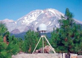
Interview with Scott Martin, Chief of Geodetic Control and GNSS Surveys, California DoT Above: UNAVCO/PBO station P655 with Mt. Shasta in the background. Matteo Luccio: Scott, what is your relevant background and what is your current role? Scott Martin: I’m a state employee with the California Department of Transportation (Caltrans), in the Office of Land...
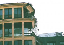
Shifting Ground: USGS on Earth Movement after an Earthquake
Ken Hudnut, science advisor for risk reduction, US Geological Survey, talks GPS and earthquakes. Editor’s note: In many ways, we are all participants in a grand scientific endeavor that’s on the cusp of helping humankind prepare for some of the most destructive natural hazards–earthquakes and volcanic eruptions. The fields of seismology, geodesy, and surveying have...
The iCon build: Adding Adaptable Options for Layout Automation
Leica’s “iCon build” solves a common layout automation conundrum for vertical construction firms, large and small. Editor’s note: The benefits of automation for vertical construction are not limited to projects that have implemented full-on, single-environment BIM. Many firms and projects can now use a realistic and practical mix of old and new workflows and technologies during...
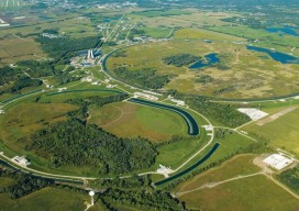
Neutrino Beam! Scanning a Ring Tunnel
The surveying challenges for construction related to a particle accelerator are exacting—but surprisingly familiar. By Matteo Luccio Trillions of neutrinos from the sun and other celestial objects pass harmlessly and unnoticed through our bodies each second. These tiny particles are among the most abundant in the universe–a billion times more abundant than those that make...

Cadasta: Mapping Land Rights from the Bottom Up
Above: Staff of the Kenya Land Alliance review a sketch map with community members while mapping water resources in Tana River County, Kenya. Credit: Hilary Ogina, Kenya Land Alliance. Cadasta helps put people on the map with a cloud-based platform for land-ownership data. By Matteo Luccio In advanced industrial countries we take much infrastructure for...
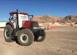
Project Management, Collaboration, the Cloud, and Robots!
Above: An autonomous farm tractor drives on a demonstration course at Trimble Dimensions. In addition to following predefined paths and instructions, the on-board tractor systems can sense and react to obstacles. Trimble launches a new solution for construction project management– and takes a futuristic leap into autonomous construction vehicles. by Matteo Luccio and John Stenmark Editor’s...