All posts by Matteo Luccio

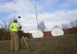
GNSS Mission: Accomplished
Above: Interviewed during our visit to Hemisphere GNSS’s headquarters, left to right: Jos Briceo, senior VP of business development; Rodrigo Leandro, senior director of engineering, and Randy Noland, VP, global sales and marketing. How a revitalized Hemisphere GNSS hit “reboot” and developed a new family of RTK and L-band positioning solutions for surveying. By Matteo...
Championing GNSS for Surveyors
Lonnie Sears co-founded and runs Champion with dedication to training, quality, and cost. Editor’s note: The theme of this month’s issue is surveying innovation, so we felt it fitting to present the story of Champion Instruments. This firm was started by an American surveyor who responded to what surveyors were asking for and who has...
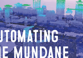
Automating the Mundane: AI Geospatial Analysis
Customized geospatial exploitation services provide solutions for the defense, homeland security, and aerospace markets. You don’t have to work for huge organizations, such as the U.S. Air Force or the U.S. Forest Service, to appreciate the benefits of customized geospatial exploitation services or capabilities. Even small companies and public agencies are increasingly challenged with extracting...

Custom, Portable Maps — Via App!
Software company Avenza has evolved its map products into an app that lets people upload their own map—or download a map of their choice—to their mobile devices, and customize it. Whether for fighting a wildland fire, delivering packages, or exploring tourist sites, using a map should be easy and quick. Well, especially when you’re fighting...

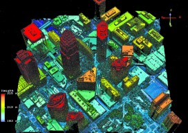
3D Software, Not Really Like CAD at All
Above: InfraWorks 360 uses engineering rules to ensure that vertical and horizontal curves in infrastructure elements have the proper radii. Take a close look at Autodesk’s InfraWork’s 360, an unusual 3D modeling software. Editor’s note: For many firms and practitioners of surveying, photogrammetry, mapping, and remote sensing, traditional deliverables to AEC clients have focused on...
A Lidar That Oversamples: Geiger Lidar Imaging
Harris Corporation’s Geiger-mode lidar reaches new markets. Typical linear lidar systems repeatedly fire a single beam, each time measuring a single location on the ground. They collect data at a given resolution, which is also the processing resolution. By contrast, a Geiger-mode system is an array that illuminates a large area on the ground, capturing...