All posts by Matteo Luccio

Freeing the Data
A Canadian software company is making it easy for the geospatial community (and beyond) to work with, exchange, and extract value from data. Many GIS professionals—and others in the geospatial community and beyond—use Safe Software’s FME daily to convert, extract, and analyze data. Yet, few of them know much, if anything, about the Canadian company that...
Radiant Earth
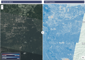
Connecting the global development community to Earth imagery and primary analytical tools. Nonprofits working on global development issues have had great difficulty acquiring and using a staple source of geospatial data in the form of Earth observation imagery collected by satellites. Anne Miglarese, the founder, and CEO of Radiant.Earth is working to change this. Miglarese...

Easing the 3D Workflow
For 30 years, an Alaska-based company has been producing digital mapping and photogrammetic software to help automate the complex work of data interpretation. Photogrammetry, long the foundation of mapping, has evolved much since 1987 when DAT/EM Systems International was founded. Despite all the advances in both hardware and software, however, the latter cannot yet reliably...
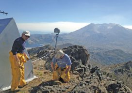
Shifting Ground: GNSS for Earthquakes
Glen Mattioli, Director of Geodestic Infrastructure, UNAVCO This is the third article in our series introducing you to scientists and technologists who work in pursuit of early-warning capabilities for earthquakes and volcanoes—in the increasingly aligning fields of seismology, geodesy, and surveying. You can access this series on our website by searching the author’s name. Glen...
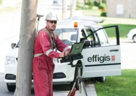
Managing Canada’s Data
From mapping utility poles to mapping radio frequency signal leaks, this company collects and manages much of the country’s utilities and oil and gas data. Effigis is an interesting Canadian firm that offers a range of GIS solutions for utilities and the oil and gas industry—as well as its own GNSS positioning solution for asset inventory/mapping and utility/energy...

Recording, Registration, and Cadastres
Comparing systems for real-property management in the Netherlands and the United States Editor’s Note: the most valuable fiscal investment for many in their lifetime is in real-property; and quite understandably matters of legal and spatial certainty is of utmost importance to property owners, financial institutions, and public entities (for taxation, planning, and land management purposes)....