
Blog

Weekly xyHt News Links: 06/08/2018
Shenzhen JTT Technology Released a Foolproof Industrial Drone – Spider C85 Pointfuse Showcases New Point Cloud Software at SPAR 3D Trimble RealWorks Announces Performance and UI Enhancements Topcon announces new data controller with advanced speed and power functionality Harxon launches smart eRadio for RTK applications SXblue offers Toolbox application for GNSS receivers
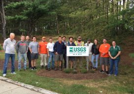
Surveying Scientists: The USGS Does It Right
As is often the case in our tightly networked profession, one thing leads to another. In early 2017 I was contacted by the US Geological Survey (USGS) hydrologist, Brenda Densmore, from the USGS Nebraska Water Science Center. Brenda had found me through the NGS State Geodetic Coordinator web page and reached out to me for...

An Interview with Charles Kennelly – CTO Esri UK
Charles Kennelly became CTO of Esri UK in 2008, and, unlike many people in similar positions, he takes time to listen to “the little man.” I fondly remember giving a talk at FOSS4G UK a few years back and seeing Charles there front and center in the audience. After I finished he immediately told me...
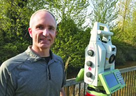
Keith Belsham Branch Manager at Spatial Technologies
Spatial Technologies was started by two partners in Calgary in 2000, and we expanded first to Edmonton, then to Vancouver, BC in 2009. We are the only full-line Leica distributor in Western Canada, supporting everything from handheld Disto laser distance meters to iCON 3D machine control systems, robotic total stations, and GNSS equipment. We also...

Laser Scanning for GIS and FM
On the surface, rich laser- scan data seems like a natural, valuable addition to GIS and facility management (FM) solutions—and to related operations and maintenance and asset-management capabilities. Much as the emergence of GPS in the 1990s helped drive GIS adoption and growth, the emergence of laser scanning also feels ready to aid GIS, FM,...
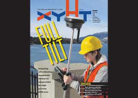
xyHt Magazine June 2018 Issue
Click on the cover below to view the June 2018 issue of xyHt magazine. Articles in the issue include (links will turn live throughout June): Full Tilt – Beyond the electronic bubble: Integrating self-calibrating, magnetically immune tilt compensation in a high-precision GNSS rover. Surveying Beyond the Water’s Edge – A remotely controlled unmanned survey vessel gives a land survey...
Advertisement