
Blog
Cadasta: Mapping Land Rights from the Bottom Up
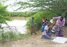
Above: Staff of the Kenya Land Alliance review a sketch map with community members while mapping water resources in Tana River County, Kenya. Credit: Hilary Ogina, Kenya Land Alliance. Cadasta helps put people on the map with a cloud-based platform for land-ownership data. By Matteo Luccio In advanced industrial countries we take much infrastructure for...
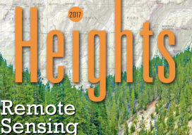
Remote Sensing in Yellowstone Park
A consortium demonstrates the value of integrated remote-sensing technologies for studying and monitoring the impacts of climate change using the northern range of Yellowstone National Park as a testing area. By Dr. Olaf Niemann, Dr. Robert Crabtree, and David Brown In 2014, a consortium between environmental scientists and an airborne remote-sensing company was awarded funding...

Geospatial on the Big (and Little) Screen
I get excited anytime I see the tools and technology of the geospatial profession in the media. Positive media exposure to the general public of all things geospatial can be a powerful tool to help build awareness for the profession. Additionally, it helps “build the brand” for the next generation, getting them interested in the...
Your Local Knowledge Is King
Although the adage, “Your local knowledge is king,” could apply to other professions or even trades, I think it is especially true in our profession. When a surveyor practices in a given area or region, or possibly an entire state, knowledge is gained and lessons learned about many things that determine one’s ability to remain competitive,...
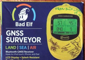
First Stop for Wandering Elf STEM Education
Franklin Community High School, Indiana First Stop: Franklin Community High School, Indiana xyHt, in conjunction with GNSS solutions provider Bad Elf, has kicked off an interesting STEM project that seeks to promote the physics and geodetic science behind GNSS. A Bad Elf GNSS Surveyor (a Bluetooth peripheral receiver for smartphones and tablets) has begun its...

Sensing Improvements? The Future of Lidar & UAVs
By Neil Sandler What does the future of lidar and UAVs look like in our world? We’re preparing this issue of xyHt just as we return from the important International LiDAR and Mapping Forum (ILMF) in Denver. Coincidentally, this issue will be widely distributed at the SPAR 3D conference and expo in Houston this April...
Advertisement