
Blog
State of: UAS
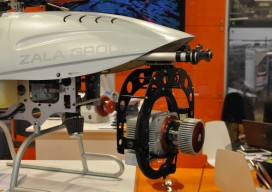
Multiple names and acronyms are used for this technology: UAS, UAV, and the sadly ubiquitous “drone.” The mapping industry avoids the military connotation of “drone” and prefers UAS (unmanned aerial system) to UAV (unmanned aerial vehicle). UAS encompasses the entire system: the unmanned aircraft and sensor package, the ground control system, the control link, a...
State of: Technology in Oil and Gas
Perhaps more so now than when Bob Dylan first penned the lyrics to The Times They Are A-Changing, this title line carries a sense of urgency, and it continues to reverberate with a significance that transcends any specific moment in time. We now live in an age where nothing is more constant than change, and...
State of: Surveying
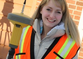
Surveying is the timeless science and profession of geographic measurement and boundary determination that has evolved over the centuries, constantly improving with advancements in technology to keep pace with the world around it. One aspect, however, has not and should not change: the fact that surveying is a profession. Per professional licensure and supporting laws,...
State of: Precision Agriculture
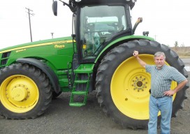
One of the fastest growing areas of application for geospatial technologies, precision agriculture is a way to optimize agricultural production through the application of crop information, advanced technologies, and management practices. Precision farmers map in detail variations in soil chemistry, moisture, and other site-specific conditions, use this information to produce “prescription maps,” then use these...
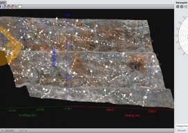
State of: Close-Range Photogrammetry
By definition, close-range photogrammetry (CRP) is simply photogrammetric data collection and processing where the subject is less than 1,000 feet away. Collection methods can be both ground- or aerial-based, and the final output can be rendered either two- or three-dimensionally. Several factors have made this a powerful tool for geospatial professionals. The strongest of these...

State of: Aerial
Demand for aerial mapping and its products is higher than ever. While several factors drive the market, the internet is by far the most significant. Nearly everyone has access to the internet and thus access to aerial photography in many formats and resolutions. Thank Google and Microsoft for that visibility and resulting demand. The problem...
Advertisement