Category Archives: GNSS/Location Tech
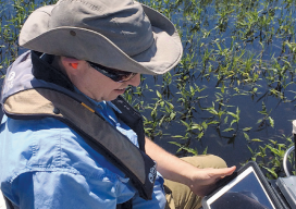
Fluid Data: GNSS and iPads
Lawrence Spencer puts the Trimble R1 GNSS receiver and iPad to work on the Kissimmee River. Pairing GNSS with iPads opens seamless data flows for a water management district in Florida facing wetlands complexity. Lawrence Spencer first joined the South Florida Water Management District’s (SFWMD) lake and river ecosystems section in 2006 as a...

UAS: It’s Unstoppable and Headed Your Way
From time to time I like to stop and think about the mission of Pangaea and explain that mission to you. My task is exposing you to new, emerging geospatial technologies. But why bother? Here’s a little analogy I thought of to help explain why keeping abreast of new geospatial tech is critical. Imagine emerging...
Advancing GNSS: Full Interview with Jan Van Hees & Bruno Bougard
Jan Van Hees, Septentrio’s Business Development Manager, and R&D Director Bruno Bougard Click here for the truncated version of this interview that appeared in the February 2016 print issue of xyHt. Septentrio was started as a spin-off of IMEC and attracts talent from KULeuven University as well as from around the world. What is the current...

Ongoing Adventure
Mini-hydro surveying is wet, wild, and wonder-filled in the Scottish Highlands. When Scottish surveyor Stuart Ross heads to the Highlands to survey for one of the region’s many small-scale hydro schemes (mini-hydro), he always packs his camera. When the rain stops and the sky clears, he wants to capture the view, not just the data. ...
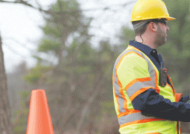
Keeping Workers Safe in the Field
Above: Users in the field can pair the inReach wirelessly via Bluetooth with a smartphone or tablet to provide a dashboard control panel for the unit and facilitate easier typing and messaging. Credit: DeLorme Satellite communication technology provides a critical lifeline for teams working off the grid. Editor’s note: Cellular coverage is not as ubiquitous...
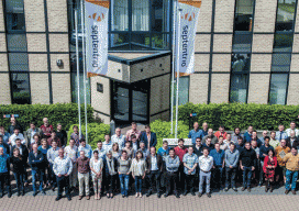
Advancing GNSS
A Profile of Septentrio Editor’s note: The name Septentrio may not be familiar to you, but after their formal acquisition of Altus (with which Septentrio has collaborated for a decade) you may be hearing more about this internationally recognized, high-precision GNSS developer. A leader in GNSS research and development since 1999, Septentrio has a...