Category Archives: Lidar/Imaging
The Value of 360º Digital Panoramic Images
The GeoDude tells us that rich, new deliverables are changing client expectations for the better. One of the biggest impacts that 3D laser scanning has had on the market is a set of new client deliverables that it has spawned. One deliverable in particular (360° panoramic digital images) has profoundly raised the bar of client expectations, yet...
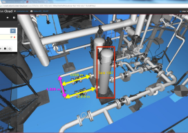
BIM and Reality Modeling
Working examples of BIM workflow optimization using reality capture techniques. Editor’s note: Until recent years, BIM has been a difficult subject to consider; many AEC practitioners had not yet been involved in a BIM-executed project. But today, globally, BIM advancements have become prevalent for many large-scale infrastructure projects. We at xyHt emphasize two aspects of...
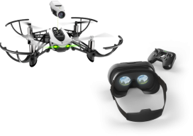
Geospatial Holiday Gift Guide
Here’s what xyHt’s Located contributors want for the holidays and their suggestions for great geospatial gifts. Kevin Lidtka Wants a VR Booth For Christmas I would like a special booth that I can sit in. Inside will be VR glasses and a controller so I can walk or fly around my point clouds or 3D...
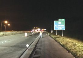
Finding Flat Spots: Better Weighing (WIM) for Better Trucking
Laser scanning helps in building and troubleshooting weigh-in-motion stations for commercial trucks. With advances in automated traffic systems and improvements to traffic flows now common along many interstate highways, virtual weigh stations (also known as weigh-in-motion stations, or WIM) for commercial truck traffic are a logical development. This new type of station is an automated...
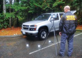
Building a Solid Case: Forensic Mapping (and Ghost Clouds)
A Washington State Patrol officer improves the use of laser scanning for investigations by integrating field and office processes. Rod Green has been doing accident and crime scene reconstructions for 14 years. In addition to collecting and analyzing information, Green is working to improve the reconstruction process on-scene and in the office. His work is drawing...

BLK360 + ReCap Pro: Collaboration for Reality Capture
Autodesk and Leica Geosystems collaborate on a highly anticipated scanning solution, the BLK360: practical, high-precision reality capture for everyone. We see so much written about 3D, BIM, and virtual and augmented worlds; it is easy to wax poetically about the potential for spatial analysis, automated feature recognition, space planning, and 3D design. There is much to...