Category Archives: Spatial IT/GIS
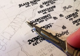
Back to the Future
An Interview with the hand-drawn map creator, Kevin Sheehan There isn’t much you can’t do with digital media nowadays, from effective maps using shadows and drop effects to using graphic-design packages to make the map “pop”—except for one thing—capturing that hand-drawn style, the way that the pen line moves in and out from the pressure...
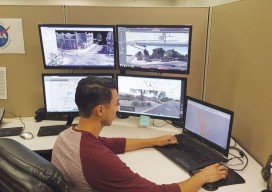
Orbit GT & Integration in the Mapping Business
A new software integration tool attacks what I call “workplace technology interplay denial.” Above: At BPG Designs, plenty of screens are filled with integration software. Through our smartphones, we are now integrated with all the people we know (and don’t know); we have integrated our work spaces with our home lives; and we can even...
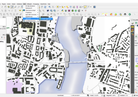
Webmapping 3.5: A Recommendation for your First Step Into Web Mapping
It’s been almost a year since the web mapping series I did. Hopefully, by now, you’ve had a chance to have a little play with some of the options. If not, don’t worry, I have a sneaky confession to make… I held back on one option, QGIS2WEB, which is a wysiwyg plugin for QGIS. Why...

Automating the Mundane: AI Geospatial Analysis
Customized geospatial exploitation services provide solutions for the defense, homeland security, and aerospace markets. You don’t have to work for huge organizations, such as the U.S. Air Force or the U.S. Forest Service, to appreciate the benefits of customized geospatial exploitation services or capabilities. Even small companies and public agencies are increasingly challenged with extracting...

40 Under 40, 2017: Danielle Smilovsky
REMOTE SENSING SCIENTIST AND GIS ANALYST AT AMEC FOSTER WHEELER ARIZONA, USA WITH A BS IN ECOSYSTEM SUSTAINABILITY AND AN MS IN GEOGRAPHIC INFORMATION SYSTEMS, Danielle Smilovsky uses GIS and remote-sensing applications to study and analyze ground deformation around the world. She specializes in performing geotechnical land subsidence investigations using InSAR, SAR, lidar, and water...
40 Under 40, 2017: Biplov Banda
RESEARCH ASSOCIATE AT THE GEOINFORMATICS CENTER IN THE SCHOOL OF ENGINEERING AND TECHNOLOGY, ASIAN INSTITUTE OF TECHNOLOGY THAILAND MEMBER AND SOFTWARE DEVELOPER FOR SAHANA SOFTWARE FOUNDATION CALIFORNIA, USA BIPLOV BHANDARI EARNED HIS BS IN GEOMATICS ENGINEERING from Kathmandu University, Nepal, in 2014, and now he applies GIS to humanitarian efforts. As soon as he graduated,...