Category Archives: Surveying
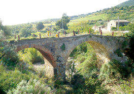
Sicilian Survey of the Norman Bridge
Standing at 10,970 feet tall, Italy’s Mount Etna dominates the eastern coast of Sicily and is the highest volcano on the European continent. At the foot of “the mountain,” as it is referred to by Sicilians, stretches a vast area of cultivated fields interlaced with a dense network of narrow streets bordered by the dry lava...

Visual Intelligence Takes Top MAPPS Honors
By xyHt Visual Intelligence captured the Grand Award at the 8th annual MAPPS Geospatial Products and Services Excellence Awards ceremony. The award was presented at the 2014 Geospatial and Engineering International Marketing Conference in Alexandria, Virginia on September 25, 2014. A software and sensor technology company based in Houston, Texas Visual Intelligence won with their...
My Dad the Solo Surveyor
Dislocated My dad’s been acting pretty suspicious lately. He comes home after long hours with bruises, bug bites, and scratches. He invites strangers into our den. He also leaves to have these “lunch” meetings. I’m pretty sure that he’s not a superhero or a therapist, so I finally decided to ask what the heck’s going on....
Field Hazards: A Two-Copperhead Tuesday
It’s hot, dang hot here in Georgia. It’s so hot, you wish somebody would hit you in the head with a wet squirrel and cool you off! As a 56-year-old registered surveyor/party chief/instrument man/rodman/cad tech and office cleaner, I’m tired, hot, mosquito bit, chigger infested, and Grand-Central-Station for all of the ticks trying to get...
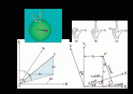
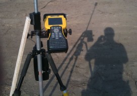
Transformation of Observations
Educate: Where Theory Meets Practice In previous articles I’ve discussed the reduction of conventional surveying observations to their geodetic equivalents. This article presents how these observations can be reduced to simple vector components that match GNSS surveyed baseline vectors. Unfortunately this transformation of conventional observations to GNSS baseline vectors involves three-dimensional rotations, so the mathematics will increase....
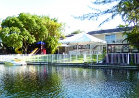
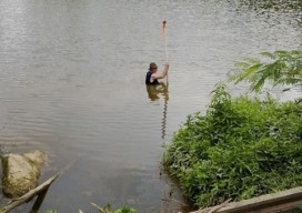
Imaging Rover on the Canal
A Florida surveying company puts a new technology to the test on an historic canal fronted by 21 subdivisions. Editor’s note: The announcement of the Trimble V10 imaging rover in late 2013 was greeted with a mix of excitement and questions (“what is it?”). With close-range photogrammetry just beginning to reach the toolboxes of surveyors...