Category Archives: Surveying
Future of Determining Elevation
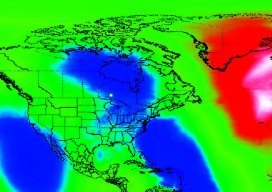
A frank discussion of the different heights used in surveying, what’s inside a geoid model, and how geoid model data is used within GNSS software to produce elevations. Certainly most geospatial professionals who have used Global Navigation Satellite Systems (GNSS) within their surveying workflows have come across the term “geoid model” before. But who actually knows...
A Post-licensing World for Surveying?
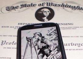
One geospatial professional’s suggestions on increasing the professional aspect and relevancy of the surveying profession. Editor’s note: The subject of licensure for surveyors, photogrammetrists, and other geospatial professionals has heated up of late. This has been as a result of efforts in a number of states, including Tennessee and Washington, to redefine the definition of...
The Lot Corner
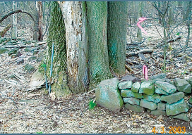
A large survey-engineering firm had developed a subdivision, bounded by a section line on the north side and a 1950 subdivision and 1/16 line on the east side. By doing so they had exposed a five-foot overlap between the section line as run with GPS and the 1950 subdivision. They sought advice from the county...
Critical Issues for GIS/Survey Cooperation
State Plane Coordinates in Legal Descriptions The time is now to have State Plane Coordinates (SPC) attached to key monuments that should be part of just about any legal description, in the proper context.* This has been discussed since the early 1980s and has been accomplished only on a piecemeal basis. With coordinate inclusion, a...
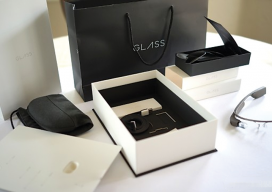
Google Glass
The box a Glass arrives in is pretty impressive in and of itself—it reminded me more of Apple packaging for iPads than of typical Android products (top right). A little card underneath the Glass holder tells you that you are special for spending so much money (middle right). There are really very few operating instructions...
Dr. Mark Monmonier on Modern Cartography
“I’ve heard people say that cartography is dead. Where might that kind of thinking be coming from?” I asked Dr. Monmonier, distinguished author and professor of geography at Syracuse University. His response was, “Why would anyone in his or her right mind think cartography is, or might be, dead?” This initiated a discussion about people...