Category Archives: Surveying
Bilby Tower Dedication Honoring Jasper Sherman Bilby
June 14, 2014 was a perfect sunny Saturday in Osgood, Indiana, where many people gathered to dedicate the last known complete survey tower and honor Jasper Bilby, the USC&GS reconnaissance man who had designed it. They included surveyors from more than a dozen states, current and retired employees of the United States Coast and Geodetic...
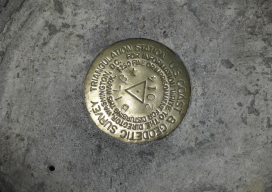
Geodetic Observations, Part 3
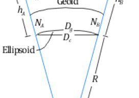
Types of Distances for Geodetic Observations This article explores the various types of distances that are often listed on GNSS adjustment reports; for related articles on the difference between geodetic and observed azimuths and angles, see “Where Theory Meets Practice” in Professional Surveyor’s March and May 2014, issues. Slope (slant) distances (S) observed on the...
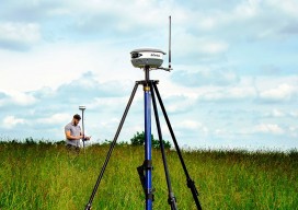
Bucking Conventional Approaches With Carlson’s New BRx5 GNSS Rover
There is a bit of unique angle to the launch of Carlson’s new Brx5 GNSS Rover… Carlson Software, the Kentucky based engineering, construction and surveying software company has been challenging conventional approaches for decades, and has developed a substantial and loyal international user community. Whereas a lot of companies start as hardware “box makers” and...

Encouraging Industry and Professions to Get Smart
What started as a simple Q and A turned into a primer on how, in a very short amount of time, a small, flailing, Swedish company challenged conventional wisdom and grew into a global powerhouse. Familiar to our readers mainly from their Leica Geosystems business (in its ninth year as a division of the parent...

Kennemerland: Repositioning a Dutch East Indiaman
The Kennemerland is now designated as a Historic Marine Protected Area on account of the national importance of the wreck. Recently I was part of a team of archaeological divers sent to Out Skerries by Cotswold Archaeology on behalf of Historic Scotland. We were tasked with checking, updating, and geo-referencing the existing plans of the...
NC PLS Grandfathering Provision for GIS Professionals
In order to adapt to a whole new contingent (GIS), NCBELS formalized GIS Inclusion/Exclusion Guidelines for what GIS work fits under the definition of surveying in 2008 and created the Mapping Sciences Exam in 2009 as an alternative exam that focuses on areas of the surveying profession that GIS professionals would work with.