
Looking past an unfamiliar form factor reveals hidden strengths of a unique and capable high-precision GNSS field system.
I’ll cut straight to the punchline: this little unit performed as well as many of the high-end (and pricier) GNSS rovers I’ve tried, both as a base-rover pair and as a network rover. And I had way too much fun test driving it.
The Sokkia GCX3, nicknamed “the Bullet,” was released in March of 2017, the second generation of the receiver family of this unique form factor (a multi-constellation update to the earlier-released GCX2). Why so long for a test drive? I’ll have to be frank: the form factor was so alien to the typical “bucket“ or” burger“ or “box-on-a-pole” survey rovers we all use that many folks were wary of that “funny looking thing.”
But I started seeing Bullets more and more in use. Especially overseas. In fact, I heard of a European forestry organization from Charles Teng (Topcon’s product marketing manager and an xyHt 40 under 40 honoree) that has 200 of them, and they’ve even built a nifty bracket for the receiver and tablet for field mapping. After conversations with fellow surveyors and inquiries from readers, the question of how well that little thing works needed to be answered.
We do not typically do straight-up product reviews and would never do head-to-head comparisons, (we are not Consumer Reports or JD Powers), but when something is that unique it piques my interest. I borrowed a pair of GCX3s with a tablet and field software and set out to try it. As it turned out, that odd shape proved to be one of its big pluses, along with a few other surprises.
The Basics
It is, foremost, smaller than typical GNSS rovers: it weighs 440g, about the same as a can of soda (or can of “pop” as my PA cousins say). But it’s narrower, more like a beer bottle (47mm x 47mm x 197mm, or 2” x 2” x 7-3/4”). I had to chuckle that I didn’t give a second thought to putting the rover in my back pocket while I was breaking down the pole, something I could never do with one of those bucket/burger/box rovers.
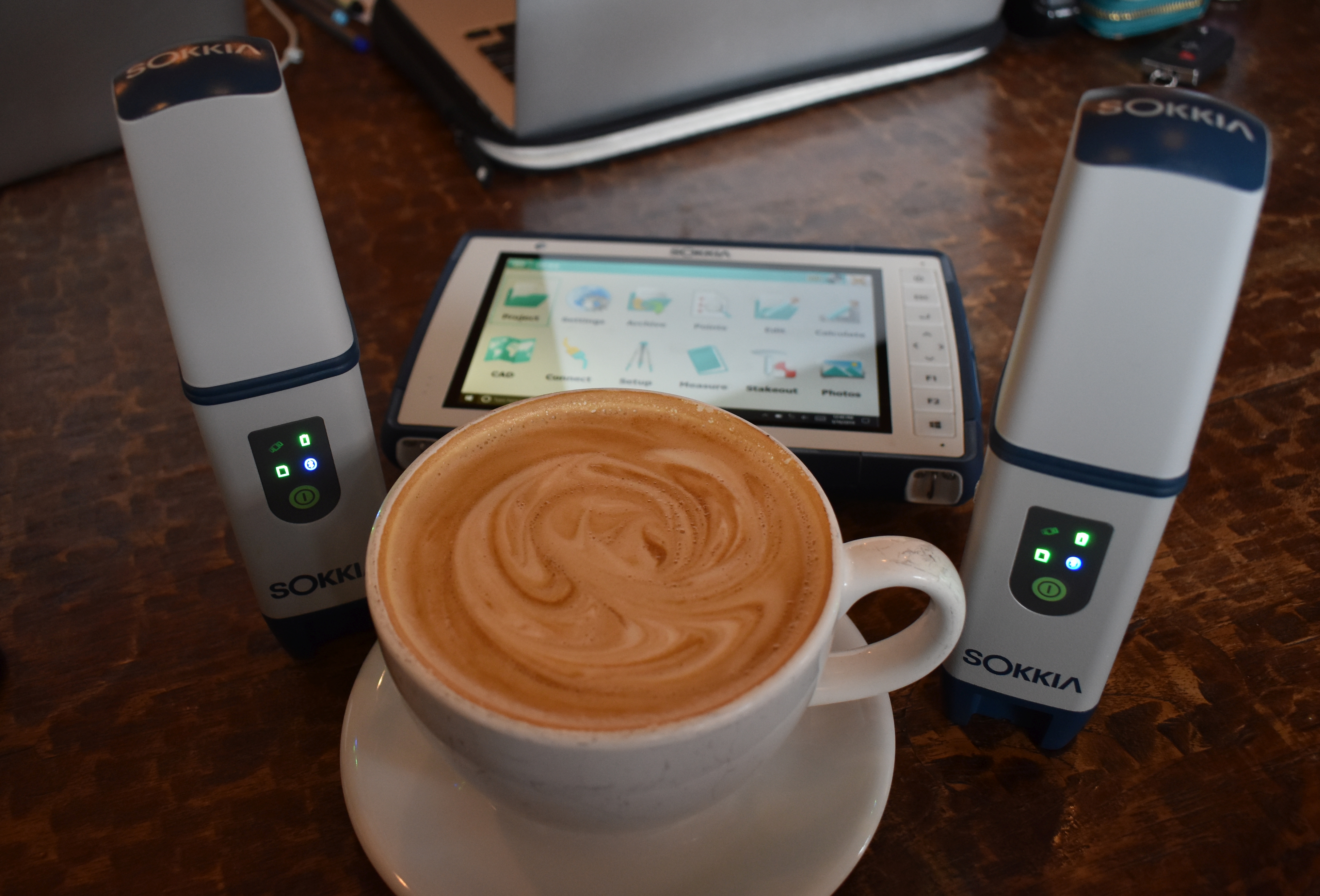
Time for some post-test-drive coffee. I liked that the Bullet is small but solid. It weighs much the same as a can of soda and easily fits in my vest pockets. For the test drive I borrowed a tablet (which I like, but in some field applications folks might prefer something else). It works with standard data controllers and smaller mapping handhelds.
It tracks and uses all the visible constellations: GPS, Glonass, Beidou (B1+B2), Galileo (E1), QZSS, and various regional SBAS. I do not see L5 in the current specs, but there are 226 channels, so there is some room for other signals at some point (e.g. L5 is not quite ready for prime time yet anyhow).
The max data rate is 10Hz; you can broadcast and update at 10Hz, either in an epoch-by-epoch match mode or extrapolated. Note that my tests at different rates did not yield any significant differences in results (same with any rover I’ve tried), but there are a handful of applications where high-rates actually make sense and can come in handy (e.g .moving base, marine applications, mobile mapping, certain stakeout functions).
Real-time data formats include standard RTCM3 and RTCM3-MSM (multi-signal message) and CMR/CMR+. These formats are applicable to use as a base or rover and as a network rover (on a network that broadcasts such formats, as most do at least RTCM). There is 8GB of internal memory, plenty for project files and static observations. Static stores in the native TPS format, but files can be easily converted to Rinex.
Connecting to external devices is by standard Bluetooth or USB2.0. In fact, charging the units is as easy as plugging into any charger with a USB-micro.
Communications between base and rover can be via external UHF radios (Sokkia R4S-BT) that you can add on, but most users would find that, on a small site, the built-in radio system (no license needed) will do just fine. Sokkia calls this short-range radio technology “SiteComm,” and Topcon calls it “LongLink” on their respective models, but both are essentially a type of long-range Bluetooth and are spec’d out at 300m.
The battery life is stated to be 10 hours. I set up a pair (one transmitting and one receiving) and I ran it a full 8 hours (before I tuned them off, worried a raccoon might steal them off my back porch), so 10 seems realistic. Plus, with that simple USB-micro charging/data port you could connect any simple portable battery like you might have for your cell phone.
It is one tough little receiver. It feels quite solid, is IP67 rated, and can operate from -20°C to 63°C (-4°F to 145°F).
One surveyor asked me about that tall antenna: Did that equate to a particularly big offset from the ARP (antenna reference point) and the phase center? The concern is that a large offset might make for larger errors if the pole is not as plumb as it should be.
But a quick look at the ANTEX data (most models are listed on the National Geodetic Survey antenna data page) revealed that while it had a larger vertical offset than some, its phase-center-to-ARP offset actually shorter than just as many of the bucket/burger/box-style rovers. So, let’s look a little deeper at that odd tall antenna.
POST
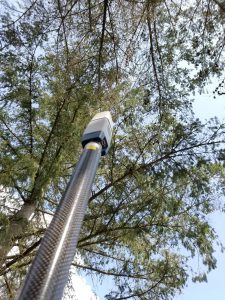
The antenna is called the POST (POST2 for the GCX3) antenna element, which describes its shape but also stands for Precision Orbital Satellite Technology. This is unique among the standard rovers.
When I first saw it years ago, I thought it was a helical antenna. Helical antennas are often used for satellite communications, and indeed the antennas on GPS satellites include spiral wound antennas that, among other things, produce the right-hand bias for the signals.
For survey receivers, they are mostly patch style, with or without ground planes, and with variations like pinwheels and fences. For other applications, you might also see patches or helical, like the quadrifilar helix (quad helix) you might find on some recreational GPS devices. But I was wrong; it is not exactly a helix antenna.
I asked Vishu Suvarna, product manager for GNSS at Topcon Positioning Group, about the antenna and other elements of the GCX3. He said that the antenna is a novel and unique design that the engineering team had worked on. They had wanted to come up with something completely new that would be compact and lightweight. This was along the same lines as design goals for the SiteComm/LongLink radios: not straight-up Bluetooth, but with their own innovation taking the technology just a bit further.
Again, seeing the non-traditional shape of that antenna and being so used to the notion that the “bigger the ground plan, the better,” I was bit skeptical of performance. But the test drive proved me wrong on that count, as well.
Test Drive
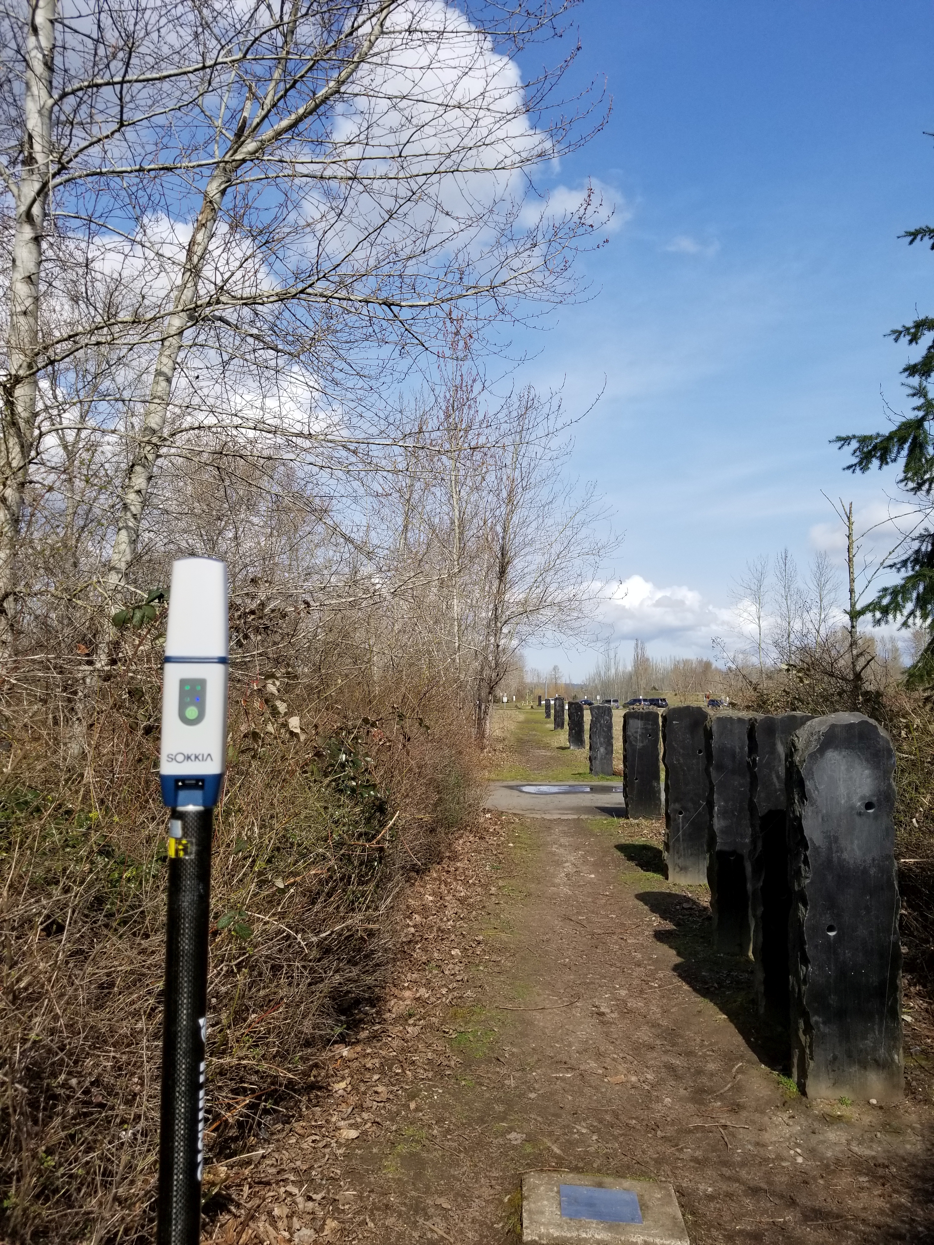
I did a series of observation on a National Geodetic Survey calibration baseline and checked inverses against the published values. It performed very well. Incidentally, the large stones along the baseline are an interesting story: a surveying-inspired art installation created to preserve the baseline.. Read more at: bit.ly/2KQ7zdo
I do a lot of gear testing that I use for day-to-day surveying (be it optical, laser, or GNSS) at a nearby National Geodetic Survey calibration baseline. No one quibbles with published distances between the marks. Over the years, I’ve also set out marks in varied canopy nearby, and we have derived solid geodetic values on the baseline marks. I was one of many local surveyors who volunteered to help with the weeks of observations used by the NGS in the most recent re-certification of the baseline (we trust the published values for sure).
Over two weekends I took multiple sets (e.g. ten shots, re-initialize, repeat many times) with the base/rover configuration and via NTRIP (network solution and single base to a station 5km away). I brought two late-model high-end rovers of different makes/models, as well. I’m not going to say which, but I’ve run a lot of makes and models on my test marks over the years and have found that most newer ones perform much that same as any others.
I did observations with each, one at a time, to gauge respective precision performance, and on a crossbar for canopy and multipath tests. (the crossbar was rotated, and the post positions changed over repeated sessions) to try to evaluate under equitable conditions.
On the first day I was joined by a local surveyor, and we set out to try to use the system without looking at the manual, using survey software neither of us had ever seen. While the GCX3 can be used with Topcon’s Magnet on the data controller, we had fun using the Sokkia GeoPro field software on the SHC5000 tablet that came with the borrowed kit.
I like working on a tablet, but many people do not, so the GCX3 will work with any of the Topcon or Sokkia controllers such as the SHC500, Allegro 2, and T1-8 controllers. Suvarna said that the T-18 was a popular combination with users who like the compact and lightweight aspects of the GCX3. Even with the larger tablet, I could still put the whole kit in my vest pockets.
We did not go deeply into the other features of the GeoPro software, but in poking around the menus it appears to do everything we would expect in good survey field controller software, for both GNSS and total-station instruments and integrated surveying. Connecting one GCX3 as a base and one as a rover and then linking them with the SiteComm radio was a snap.
The Bullet performed as well under all-but-the-thickest canopy as several high-end rovers I tested.
We set up one on a fixed-height rod on one of the baseline marks, then moved to another mark 150m away for multiple sets, then to another in the opposite direction, 280m from the base. At 280m the SiteComm was working (as the 300m spec had promised). I stood between them to see if it would disrupt and stepped into some woods, but it was fine. It was only on another day when I tried a 430m separation that it started to drop.
For these tests I checked inverses against the published NGS distances. I used a simple combined grid factor (minimal expected distortion as the site is very flat). The observed inverses for the GCX3 pair did not exceed more than 0.05’ (15mm) and mostly fell in the 0.02’-0.04’ (6mm-12mm) range.
While the NGS has not published high-order verticals for the marks, level runs were performed during the re-certification. The highest difference vertically was 0.11’ (33mm) but most fell within the 0.05’-0.07’ (15mm-21mm) range.
I later did observations with the other rovers (using the nearby base station) and found the same results, within a hundredth of a foot here or there. Initially, the GCX3 base-rover pair appeared slightly better, but when doing GCX3 observations connected to the nearby base (via NTRIP), the results were effectively the same. Network solution (VRS) for each were comparable to single-base, but at that location amid a fairly dense network it was like the RTK equivalent of shooting fish in a rain barrel.
Static tests of 15 minutes and two hours for post processing yielded identical answers to the other gear for respective length sessions, as did 25-minute and two-hour OPUS-RS and OPUS (standard) solutions (via the National Geodetic Survey online post-processing service).
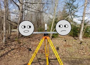
For multipath and canopy tests (under equitable conditions), the Bullet was put on a crossbar with some other common rovers. Post positions were switched and the crossbar rotated in multiple tests. All performed much the same.
I also liked the feature on the GCX3 to start (or stop) a static session (without the data controller) by simply pressing the power button three times in quick succession and stopping it with the same motion.
As it was too early in the year for a full leaf-on test under deciduous trees, I chose marks under increasingly dense evergreens. All gear could fix pretty much the same under each location. Only under very thick (though hard to put a metric to that) canopy did any of them have difficulties, with the GCX3 only then beginning to show slightly higher outliers than one of the others.
In subsequent multipath tests (I hold up a sheet of metal at different distances and put the tripod up next to a truck), all performed admirably. It was only when I put the sheet up at a ridiculously close two feet that any of them started to misbehave—a testament to modern antennas and multipath mitigation. Again, it was only in the extreme that the GCX3 began to show only slightly higher outliers. I tried to break it, but that is one tough and capable little device.
Where It Counts
To see how it would work under day-to-day conditions, I set out to do topo in the tangled mess of vegetation and creek bed behind my house. I have topo’d it several times with a total station, and it is under the largest native maple for miles around. There are stakes and marks on rocks I compare to when trying out different rovers. I stuffed the two GCX3s into my vest, put two poles and a bipod in a bag, broke out the sunflowers seeds, and trudged out into the wilds.
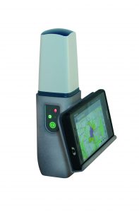
One adaptation for the Bullet for some asset mapping users is this bracket for holding a standard-size cell phone.
I set up the base on a mark in the open and started shooting points. I didn’t use the bracket to attach the tablet to the pole: in the thick scrub, that would catch on things, so most surveyors prefer a smaller data controller for those conditions.
I slung the tablet in front of my chest, and that didn’t get in the way. The tiny receiver didn’t get hung up on anything, and the light weight was a welcome relief from my usual bucket/burger rover. With the maple only starting to sprout spring foliage, this would be moderate canopy at most, and I fixed just fine and hit the marks within the same ranges as I observed on the baseline on most points.
Sokkia resellers sometimes refer to this rover as entry-level, but most of that has to do with price and extras. High-end units of any brand are differentiated often by added features like tilt or extra signals, but in terms of the basics of real-time GNSS and performance under equitable conditions, mid-level units are certainly quite capable. And when a little digging around the web reveals that one can buy a new pair of these Bullets for less than the price of a single top-tier rover (of many models/makes), such a unit seems even more attractive.
My test drive was by no means a tightly controlled scientific study. But even that minimal data has me convinced that this is a serious and viable system, one that surveyors should consider and test drive themselves (as with any gear). So, that funny looking rover really is the real deal!