I had seen the name Tersus GNSS in geospatial social media for several years before our xyHt team stopped by their booth at the INTERGEO exhibition in Berlin in 2017. For a startup, launching in 2014, the company appeared to be making a lot of the right moves.
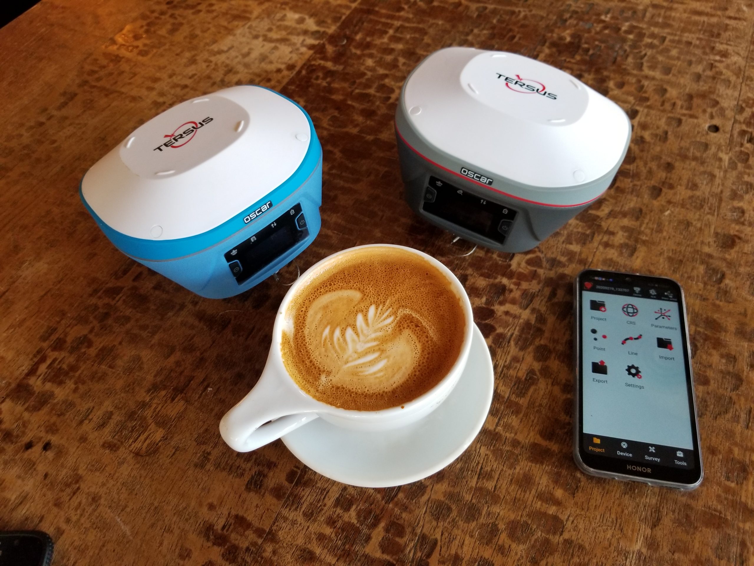
Two models of Tersus Oscar we test drove using the companion NUWA software on a standard Android phone.
As high precision GNSS was entering what we call a 4th wave of development for surveying and mapping, I thought it would be an interesting exercise to track this company. A little over two years later, I would visit Tersus headquarters, and test drive some of their gear. It has been quite impressive to see how they have grown into a viable international player.
xyHt has published a number of articles on the 4th Wave of surveying instruments, profiled several of the up-and-coming firms, and had the opportunity to test drive a lot of surprisingly capable and affordable gear. GNSS development has been anything but static: new entrants moving past being OEM integrators into developing their own boards, and imitators becoming developers.
There has also been a commoditization of GNSS, with receivers serving essentially as peripherals for surveying, mapping, autonomy, robotics, and more. Tersus (which in Latin can mean “accurate”) has been doing all of the above.
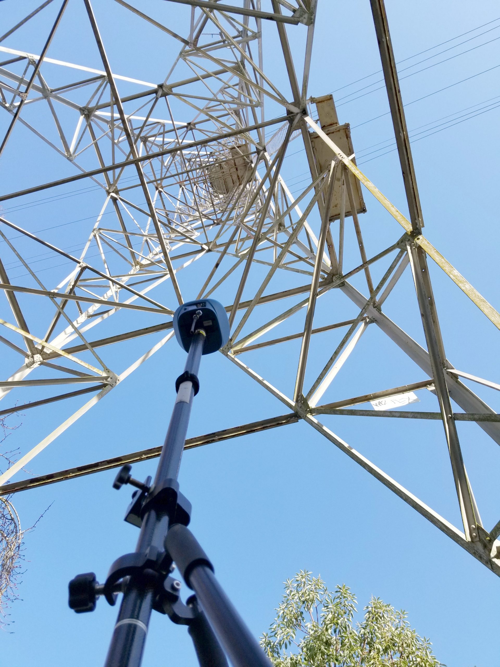
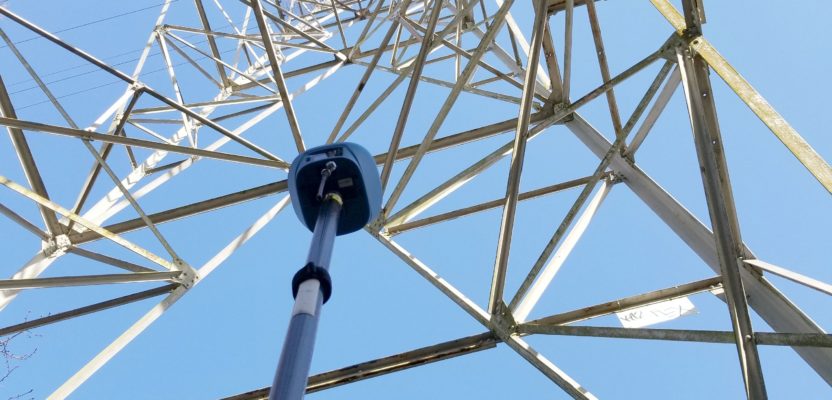
In a multi-path test, the Oscar is one of only a handful of rovers we’ve tried that fi xed in this test location under a power-line tower. It checked into a conventionally established surveyed mark under the tower as well as the others.
First Fix
As I noted in the August 2019 article “New (GNSS) Kids on the Block,” I was eager to test drive some of the Tersus gear. And to find out if, as some readers asked: “Can a $3,000 rover really deliver?” In, short, the answer is yes. Is there room for improvement? Absolutely, but I was taken aback by how much the results have me questioning my perceptions of what some call “third-party manufacturers.”
The system I test drove at the time was based on the David modular receiver. It came in a kit with and external antenna, radios, poles, more-than-a-few cables, and a bracket to hold the components—including slots for my mobile hotspot and a standard battery bank. Testing took place on an NGS calibration baseline (that I use for all my test drives) and some locations with varied tree canopy and multipath conditions. The results were well with in the two centimeters to three centimeters (3D) I am used to seeing with some other (more familiar named) high-end GNSS rovers.
While Tersus had already released its newer integrated rover system, the Oscar, I started with the David as it represents an entry-level rover system. That it is a modular receiver, only a little larger than a deck of cards, is a deliberate design decision; handy for developers and integrators to use for many uses besides surveying. These include precision agriculture, machine control, mapping, UAS, marine, and more. I have since had an opportunity to do multiple test drives of two models of the Oscar survey rover (which I will cover later in the article).
My conclusions from testing the David and Oscar, as well as some other newer brands models, is that legacy assumptions about unfamiliar brands are becoming moot. Like the idea that gear from certain places are simply copies, or “cheap-n-cheesy.” No longer, and we now have access so many more options in capable and affordable gear. While such test results are not universal to all new “third-party” gear, quite a few are up to the mark; enough so to prompt a trip to visit half a dozen of these GNSS developers—and do more test drives.
Starting Up
“We are a GNSS technology solution provider, and integrated solutions provider,” said Caroline Huang, communications manager at Tersus GNSS, during introductions at their headquarters in Shanghai. “We were established in 2014, with facilities also in Melbourne, Australia, and Silicon Valley. As of April 2019, we have over 150 dealers and distributions in 70 countries.”
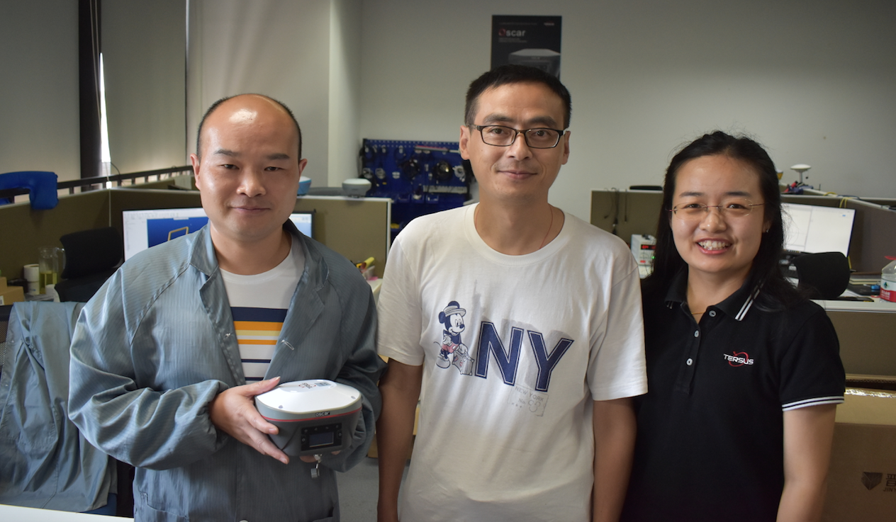
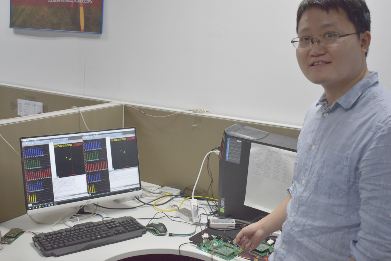
Tersus team members Zhonghai Zou, production engineer, Sen Liu, vice general manager, and Cathy Liu, product document engineer.
Huang explained that the founding goal and vision was to form an agile team, embrace new ideas, and place a heavy emphasis in R&D. By 2016, Huang said the company had developed its own RTK technology and produced its first RTK devices for surveying applications by 2017, along with several other devices for non-surveying applications. David arrived in 2018, and the Oscar survey rover, with no-calibration tilt compensation, in 2019.
“That is our superstar product right now” said Huang. “And as for what is next…stay tuned.”
Once the official timeline was presented, we were joined by Nick Zhu, sales director who is one of xyHt’s 2020 “40 Outstanding Young Geospatial Professionals Under 40. I wanted to dig deeper than the official statements, meet more of the team, see how the company ticks. Zhu and Huang were happy to accommodate. There was something about the enthusiasm that they, and others in the company, displayed that hints at the keys to their rapid success.
Huang had studied electronic information engineering and came to Tersus right after graduation. She was attracted to Tersus because she felt that applications for high-quality GNSS were about to boom, and the company atmosphere was about creating something that could benefit society.
“Our motto is ‘Global Accuracy Easier.’ Very precise, but also affordable to help make a better world,” said Huang. I could tell I was not just getting the corporate spin. “We faced many difficulties, but we over came them. We spent two years developing our RTK, and then the products. Oscar has very quickly been QC’d and is shipping all over the world.”
And from seeing the photos in their large volume of social media posts (IMHO one of the best at leveraging this new digital media world among geo companies) I see surveyors on six continents smiling with their new rovers.
Zhu who studied geodesy at the University of Nottingham, concurred. “I like working here, I can apply my background in geodesy to development. We have so many colleagues from all over, and we collaborate online,” said Zhu. “We are not yet a large company, we all feel connected, and can see directly how we are contributing to the innovation. It is a good phenomenon.”
A lot of the company spirit, they said, comes from the original goals of founder and CEO Xiaohua Wen. The official goal is “providing high-quality, affordable and centimeter-accuracy GNSS RTK modules and systems that solve positioning and navigation challenges.” But the practical, and underlying goal is to make an agile team that is not burdened by corporate legacies or trying to serve too many lateral markets, as that can drive up costs.
Wen had done this before. Prior to starting Tersus, he had overseen the roll out of one of the largest cell networks in China. A sought-after innovator, why did he choose high-precision positioning as his next venture? Zhu explained that he saw high precision as being high-growth opportunity, as well as being essential for so many emerging needs.
“He learned the geodesy very quickly,” Zhu says of Wen. “In turn, he showed us how to make agile teams, to choose the right people, and how to prioritize.” Wen is quite hands-on with the equipment and does a lot of his own testing. I remember when I was doing my test drives, we were exchanging (time-zone-challenged) messages comparing our procedures and results.”
Wen is based in Melbourne. He chose to establish a strong presence in Australia as it has become one of the global centers of GNSS and geospatial development, and there is a lot of growth in all the fields of application. Another of Wen’s goals, and one that everyone I talked to at Tersus is excited to be part of, is that from day one, they sought to serve international markets, and not just the domestic markets. With that comes challenges, but as Wen once told me: “Getting things done is in our DNA.”
Growing Up Together
I wanted to look inside the manufacturing process, see what QA/QC measures are implemented, and see just how tough these units are. The HQ, at the time of my visit was a few floors of some office park buildings (they are expanding to new manufacturing facilities in the near future). But I saw all of the same kinds of equipment and test stations at bigger factories I’ve visited. What seemed different though was the energy of folks working there. It seemed more like those pumped-up techies in Silicon Valley than a typical factory. And though many of the people there, like Huang a Zhu, are young, there were also many seasoned hands—yet just as cheerful and enthusiastic as the youngsters.
I met Zhonghai Zou, a production engineer. He said that previously he worked for many years for an electronics manufacturer that produced consumer products, like wireless cards, in a factory with over 4,000 employees. He wanted to work at Tersus because he sees a bright future for positioning, and that GNSS manufacturing is much more sophisticated. He likes the flexibility of management and the opportunity to learn so many new things.
The head of product development is Sen Liu, the vice general manager. He spent many years at large international electronics firms, like ATI/AMD and Maxlinear. His specialty is radio frequency engineering and integrated circuits (IC) electronics. He joined Tersus in 2016 and oversees teams doing hardware, software, manufacturing, engineering, and testing.
He introduced me to the team designing the rover housings; these are very solid and, if anything, a bit heavy. It was explained that the housing is slightly larger than some other rovers to accommodate the tilt components, all-day battery, and to withstand rough conditions.
Liu chose Terus as GNSS was a field he was quite interested in. It is a welcome change from the large firms he previously worked for, and he likes the way the company is structured to provide a good path to development.
Have you ever read an equipment manual and thought: “Who wrote this?” I got to meet Cathy Liu, who is a product documentation engineer for Tersus. She began her career as an electronics engineer, working for a manufacturer in Singapore. But she wanted to have options beyond the very competitive grind of electronics engineering. So, she went for her Master of Finance at the University of Surrey in England. Like her colleagues, she sees a bright future for GNSS, and appreciates the close teams.
“Everyone has a chance to use the equipment,” Liu said. “I use the equipment and that is part of my process of writing the manuals and other documents.” I relied on the manuals when I test drove the equipment and I commended Liu on not only her multilingual skills, but also how easy the manuals were to follow.
And finally, I got to geek out and talk to Cheden Huang, director of R&D at Tersus. His team’s R&D work involves development of boards, RTK engines, integrating constellations and signals. And they are also involved in development of the no-calibration tilt solution as GNSS is a key component (magnetic-oriented tilt compensation is fading into the past).
I was a bit in awe and had geek envy of his workspace, with many screens displaying feeds from antennas and rovers on the roof. That was the first time I’d seen more than 50 navigation satellites in a single view. Cheden said the 576-channel boards (at the time, new boards have just been released) include 12 signals: GPS L1, L2, L5, Glonass L1, L2, Galileo E1, E5a/E5b, and Beidou B1. B2. B3, and B2C (much like L5). This is not just tracking the satellites and signals but using them in solutions.
“We also work on the tilt system, integrating the GNSS and IMU data,” said Cheden, “something we have developed entirely in-house.” Cheden was also the author of a general overview and status of triple frequency constellations, which appeared in xyHt’s January 2020 Outlook issue.
There are GNSS engineers on his team as well as those specializing in geodesy. I related to him my experience with their office software (Tersus Geomatics Office) and that it was user friendly, but also let me drill down to the geodetic equations.
Cheden said he joined Tersus “to make the best of my abilities, and to do R&D on applications for many fields, like autonomous vehicles.” He explained that a young company in a growth industry that is in its heavy R&D stage, is a very good place for him and his fellow eager engineers.
Caroline Huang summed it up: “The company is growing up, we are growing our careers, GNSS is growing up. We are all growing up together.”
The Gear
We reviewed the Tersus product lines. For survey there is the flagship Oscar, in three models. The Basic (without a screen), the Advance (with a screen), and the Ultimate, which has the new no-calibration tilt compensation. There is the modular David, which is used in many other applications, and now comes in a two-antenna version (for heading).
Tersus also develops inertial systems, radios, and now sell its own boards as OEM products to other integrators. In their early development days, Tersus used OEM boards from others, but only until its own boards were engineered and produced.
Another interesting product, the GeoBee, is an NTRIP modem. It can be connected to a David and has WiFi, Ethernet, and cellular to act as an NTRIP server or client, relaying corrections via the Tersus NTRIP caster service, or your own caster. This is a low-cost solution for surveyors who want to run their own reference station and deliver corrections via NTRIP.
Current choices might involve a complex setup, with many potential points of failure. Or some of the high-end reference station systems. This solution, including receiver, comes in at nearly one-third the cost of those. And they have been broadly deployed in Asia, Africa, Russia, etc.
Another option Tersus is promoting for bases, is a security feature known as PAS. It utilizes a block-chain-like distributed ledger for security in RTCM corrections casting. Tersus has implemented this for some customers using its GeoBee solution. There is lot of chatter in the industry about such solution—we will have to revisit this subject.
I spoke with Rudy Enns, the principal at 720i, an equipment reseller in Canada (that is now also a Tersus reseller). Enns has just deployed a David+GeoBee reference station for a municipal client (see “Sidebar: A North American Reseller” below).
The Oscar Goes to…
My opportunity to test drive the flagship rover, the Oscar, came when David Yan, a sales engineer with Tersus, attended a nearby surveying conference. We spent a day running the Tersus Oscar Ultimate through my standard test courses.
If you’ve read any of my rover test drives, I do inverse checks on a national Geodetic Survey Calibration Baseline. On these same marks, over many years I have used conventional methods and long static GNSS to keep coordinates and elevations current. Nearby I have marks under various canopy densities, and I have some favorite “multipath hell” locations.
The Ultimate is the top-end of line of the three Oscar models. Full constellation, it has a four-centimeter (1.5”) OLED screen for configuration, status, running static sessions, and it has calibration-free tilt compensation. The Advance model is the same, but without the tilt compensation. The Basic also does not have the OLED screen or tilt.
Screen or not, we did nearly all operations from an Android phone (iOS is not currently available) using the free Nuwa software. Nuwa (named after the mother goddess of Chinese mythology) is a quite simple and easy to use software. It is not as complete as the packages we might be familiar with, but Tersus is adding to it all the time, and soon there will be some roads functions. Nuwa has all the standard global and U.S. projections (e.g. SPC zones), and I was able to apply a geoid difference model.
For many positioning tasks, I can see the appeal of something free that you can run on your phone (or more ruggedized Android devices). If you need a more complete field software, the units are compatible with Microsurvey’s Field Genius, and recently MicroSurvey added support for the tilt compensation. (MicroSurvey’s Ubiquity, xyHt December 2019)
I did not try the base/rover option while Yan was visiting, but instead we used corrections (RTCM3.2-MSM) via NTRIP from a base five kilometers away, and in VRS mode from a regional cooperative network. The inverses and checks with established coordinates at 150 meters (492 feet) and 430 meters (1,410 feet) all came in under two centimeters in both horizontal and vertical. I took about 60 shots on the 150-meter course, and the horizontal came in at 11 millimeters (0.04 feet) 2σ. This is typically what I have seen with other high-end rovers, including the one I brought along that day. But I did notice how fast the Oscar was, and at the other marks under canopy it fixed where I have struggled with other (high-end multi-constellation) rovers.
The no-calibration tilt compensation had only just been released, and with a little experimentation we were able to use it with no difficulties. I wish I had several days of data to work with, but it appears to maintain a good position up to about 15 degrees and loses about two centimeters or more when at 30 degrees of tilt. I have since compared notes with Wen who provided a spreadsheet of extensive data from their own tests. Overall, position results from the tilt were quite workable, but I lacked good procedures—there is a bit of nuance to getting the best out of the tilt.
Tersus director of R&D Cheden Huang
Cheden later explained to me that when in RTK mode, the GNSS-determined velocity is the key to providing both the attitude and orientation, and it is a good failback for the integration filter. The first initialization takes a bit more movement, about 10 seconds, and after that it is almost instantaneous. The conventional wisdom in the industry is that tilt at 30 degrees or more becomes a challenge, due in part to the loss of satellites in good geometry due to the angle of the antenna.
Tersus has since prepared a document with tips on how to get the most out of the tilt function. Wen summed it up: “The Oscar likes movement.” The guide contains advice like keeping it moving before and between observations. Wave it around like a flag (e.g. like a foot), but do not spin, it helps remove outliers if you try to avoid suddenly changing the direction it is facing.
In looking at my own results, it appears my outliers were when I was either holding it still too long or going crazy on motion. The results were decent, and better than with any magnetic oriented unit I’ve tried. This is only the first round—they are continuing to work on the tilt function.
Under various canopy densities, the Oscar Ultimate performed as good if not better than nearly every rover I’ve tried. Including other late-model multi-constellation rovers. Then came the real fun: my ultimate (no pun intended) “multipath hell” test spot, a benchmark directly underneath a power line tower. It is only the third of any rover I’ve tried that fixed in that spot, and it hit the value I’d established on the mark (by conventional methods) within the three centimeters 3D range.
Of course, I’m not going to use a position shot under a tower, but I think it shows power of multi-constellation in dealing with tough situations. We had a lot of fun seeing where we could try it out to break it. While xyHt would not endorse any specific surveying gear, this one was impressive. There is a lot of great gear out there.
I wanted to see how consistent the results might be on more than just that single day, so for the past month I’ve conducted many more tests with an Oscar Advanced and used it on a few real-world projects.
Access to my test course was closed due to recent events, so I set up an antenna farm on the roof of my condo—how’s that for working from home? I set marks around the roof, shot these with total station, and did many days of long static to establish control for the RTK testing. Results reinforced those from the earlier baseline tests. Yep, it’s a good rover.
Value Proposition
GNSS rover heads are not robotic total stations: there are not a lot of moving parts, they do not require calibration, and mostly they act like a peripheral component. There are now decades of GNSS engineering graduates globally, doing parallel development, and innovating. Many are not held back by legacy conventions, assumptions, and corporate machinations. The secret sauce of high precision is no longer held by an exclusive club.
I could make a long list of reasons why one would want to choose from the top tier of any instrument type, and much of the givens would relate to track record, support, service, and peer user communities. But then again, if rover heads are becoming more reliable, nearing plug-and-play, the learning curve is almost all about the field software, and in this age of online live support and next-day shipping for repair/replacements, could those givens be challenged?
Choosing surveying equipment is never just about price, but with a David system coming in at less than one-quarter of a top end rover, and the Oscar Ultimate at nearly one-third, it does make one reconsider long held views. Tersus is not alone in challenging the status quo, but they are a very passionate and capable team—one worth watching.
***
Sidebar: A North American Reseller
Rudy Enns is the president and owner of 720i, a surveying equipment reseller in British Columbia (BC). “As a used survey equipment dealer, we’ve become familiar with most models from the [big 3] manufacturers. As such, we have tested, updated, refurbished, and repaired all of them,” said Enns.
“When Tersus approached us approximately a year ago, we agreed to look at an Oscar Advanced receiver and tested it beside our best canopy-savvy receiver. We were shocked as the Tersus Oscar walked right past it, holding initialization, and recording good shots.”
Enns said that when a fix was lost The Oscar reinitialized sooner than the other—he was quite surprised. For his tests, both receivers were receiving multi-constellation corrections via UHF from the same base.
“All right, this dog can hunt,” said Enns. “The price is very attractive, but where does it fit in a market that is dominated by three well-entrenched manufacturers, as well as several recognizable tier-two brands fighting for remaining market share?” The possible answer? When looking at things from a new point of view – what about a role as a base receiver?
“A $20,000-plus high-end rover does no more for an RTK system as a base than a Tersus David or Oscar receiver,” said Enns. “Not glamorous perhaps but represents good value to the surveyor considering the low price of the David receiver, or that an Oscar does not need to connect to data collection software in order to be configured as a base using the 4 line display on the receiver. Here lies the possibility of entering the longstanding incumbent barrier to entry for new products – by complementing the big 3, rather than going head-to-head against them. If users see the value of the base, they will eventually see its strengths as a rover.”
Next we looked at Tersus’ innovative network solution. After years of working for a regional real-time network provider before starting 720i, Enns has become quite intrigued by Tersus’ NTRIP modem, the GeoBee. It is a small device that contains the communications options (Ethernet, WiFi, or cellular) to relay corrections to and from a David with a caster (the Tersus NTRIP service, or your own).
“Just add a SIM card, hook up to base and you have your own corrections,” said Enns, “an [under] US$5,000 hardware solution. We purchased a system and have been running it since last fall.”
Now the reality check – Recently a BC municipality had posted an RFQ (request for quotation) where the spec was simply a networked Rover with an annual subscription. “We sent in two quote options,” said Enns. “One that met the spec exactly and the second with the GeoBee+David hardware base solution in place of the network subscription, and an Oscar rover with MicroSurvey’s Field Genius on a Mesa 3 Windows 10 tablet for data collection. Every supplier quoted as well, of course, but our Tersus GeoBee solution won the tender.”
Looking at the evolution of high-precision GNSS, Enns says he is reminded of the early days of cell phones. “The early days involved two-way radio dealers installing them into vehicles. Fast forward to the present and today you can’t walk through a mall without bumping into three or four cell phone kiosks,“ said Enns. “Motorola, Nokia, and Panasonic were the hardware name brands. Now Apple, Samsung and LG own it. It is all plug and play. Turns out it’s all about content and ease of use in the end.”
“Are we at an RTK plug-and-play stage today?” asked Enns. “Maybe not just yet, but not far from it, and the Tersus approach to GNSS solutions shows that evolutionary potential. After configuring our first several Tersus receivers, our technicians’ comments go along the lines of wishing all receivers could be this easy to set up. The only remaining question – are surveyors ready for this?”