A modern hydrospatial organization adapting to today’s challenges
The Hydrographic Society of America (THSOA) as it is commonly known in the hydrographic world, is a non-profit organization committed to promoting education in hydrography, inshore surveying, inland waters surveying, offshore surveying, positioning, and mapping/charting, including related earth sciences. Our organization is divided into seven regional chapters: Houston, Mid-Atlantic, Midwest, New England, Southeast, and West Coast, covering the entire United States, and Latin America.
I have had the privilege of being a member for several years and one of the founding members of the Latin American Chapter in 2015 in an effort to integrate our colleagues in the continent to our large North American community and the reason for the parenthesis in the title of this article. Around three years ago, the Latin American Chapter gave me the opportunity to serve as a chair, a position I held until recently when I took over as president June 1, 2021.
For those who don’t know me, I’m a hydrographer, a former Mexican Navy Hydrographic Office representative, and a retired captain after 25 years of service. Then I went to private industry when I joined Esri almost 14 years ago, doing hydrography and maritime, something I like to call “hydrospatial.”
Our growing hydrographic community, which includes government, academia, and industry, has in THSOA a hub and a conduit to meet colleagues and develop their professional careers, share their knowledge and experience and learn from each other to stay up to date on the latest advancements in hydrographic matters. THSOA also supports future professionals in hydrographic related sciences providing scholarships and facilitating networking with its members.
Each chapter conducts its regional meetings and activities at its own pace according to its needs, and we have regular “All-Hands” meetings roughly every quarter. Every other year, alternating with the Canadian Hydrographic Society (and their Canadian Hydrographic Conference), we organize the US Hydro Conference, our one-week, in-person (normally) main plenary event where we have technical seminars, workshops, paper presentations, lightningtalks, and poster sessions. During this week we hold our members plenary meeting and vote to select who, from proposed inductees, will be inducted into the Hydrographer Hall of Fame (HOF), a tradition we started in 2012. The HOF honors hydrographers who have made significant advances in the science of hydrographic surveying, with distinguished careers and who have made contributions in the education of hydrographers, or who have provided exemplary service to the society.
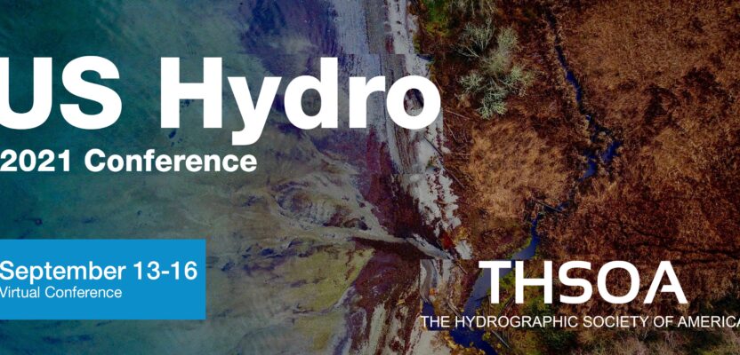
This year, due to the COVID pandemic and the uncertainty that this situation causes, we are organizing for the first time a fully virtual US Hydro ‘21 Conference, from September 13 to 16, utilizing an innovative platform that we expect will get participants as engaged and productive as if it were an in-person event (www.us-hydro.org). We will also organize social events, networking sessions and fun activities to make this a memorable US Hydro ‘21 Conference.
I could not let pass the opportunity to mention with a special feeling, the loss of our friend, colleague, and THSOA president RDML Rick Brennan. His sudden passing impacted us all. At the time I was recently appointed as president-elect, a new position created with the goal of having some experience and familiarity with THSOA affairs before assuming the position’s responsibilities next year. That would have given me time to learn and give some continuity to the organization’s activities. That unfortunately couldn’t happen, I took the helm much earlier under difficult circumstances. My commitment is to honor Rick’s legacy and to continue with his vision for our organization.
Rick was a passionate advocate of ocean and coastal mapping. For that reason, and to honor his memory, NOAA’s Office of Coast Survey and National Geodetic Survey jointly have announced the NOAA Richard T. Brennan Ocean Mapping Matching Fund program (FY2023) to identify and 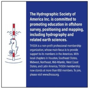 match funds with partners on ocean and coastal hydrographic surveys and mapping. The priorities of the FY23 Brennan Matching Fund include mapping of the US EEZ, expanding the Alaska Coastal Data Collection to deliver the priority geospatial products required by stakeholders, and mapping the full extent of US waters to modern standards. At our US Hydro ‘21 Conference we will have a special mention for Rick and this fund.
THSOA is expanding its horizons, reaching out to as many professionals with common interests as possible, listening, and attending to its needs, such as the certification process for hydrographic surveyors, supporting students, facilitating knowledge transfer, and collaboration with other organizations with mutual interests, elevating our society to the “hydrospatial” dimension.