A look at innovation in hardware, software, and workflow in the Leica RTC360.
Not far from London in the UK is a place called Milton Keynes. Although it’s not as famous as places like Manchester, Birmingham, or Brighton, it is the home of the Red Bull Formula 1 team; it’s where WD40 is made; and it’s home to Bletchley Park, the place where the UK codebreakers created the famous “Enigma” machine.
It is also home of the Leica Geosystems HQ for the UK, and that’s where I was lucky to be invited to see a demonstration of the new Leica RTC360 3D laser scanner and receive a tour of the facilities.
When I arrived I was expecting to see huge satellite receivers and RTK receivers all over the building, but there were none. You could mistake it for any other office, except for when you go to sit in the reception area where you’re overshadowed by a glass case of antique Leica Geosystems equipment.
In some companies, the old equipment is displayed like in a museum, showing us how we used to work, but here, among the old equipment was new equipment as well, and as you walk around the building you see montages and timelines of technological changes. To me it seemed as if Leica Geosystems is not only embracing their heritage but showcasing their innovation, as well.
The moment occurs when I get to see the new RTC360. As I walk into the room I have to take a second look as it’s significantly smaller than I was expecting. I had read about all the new tech inside, so I wasn’t expecting it to be so agile. Rather than building a slightly better BLK360 or a slightly downgraded ScanStation P40, Leica Geosystems has built this product from scratch, and they confirmed that the concept wasn’t copied from any other Leica Geosystems product, so there is no legacy. Their long tradition in developing innovative solutions enabled them to make it more compact, and this is as much for the target audience as it is for mobility.
So Say We All
Speaking of target audience, who was the RTC360 developed for? I’m putting this up front: it’s for everyone. There are many reasons for this, most of which I will explain below.
But think of it this way: the geospatial professionals who will always go for the best will get the P40, whereas the casual, non-surveyor will go for the BLK360. I’d love to say that the RTC360 sits perfectly in the middle, but it doesn’t, and I’ll be honest, it is going to make all of your lives difficult when you choose your equipment as this straddles both levels of users.
Registration in the Field
Casual users will find the laser scanner exceptionally easy to get started with. Those who have already used the BLK360 won’t be put off by the size either, as the BLK360 measures 16.5cm x 10cm, and the RTC measures 12 cm x 24cm (almost half the size of the P40).
The unit itself weighs 5kg, is a bit heavier than the 1kg of the BLK360 but over half as light as the P40 which weighs 12kg (all weights are without batteries). To hold or carry, 5kg isn’t too heavy—nothing more than a suitcase with a laptop inside—which makes it more tempting for carrying around a site or up and down the stairs of a build.
Even I Can Use It
When I say it’s easy to use, I mean really easy to use. This is partially why the “geospatial guy” on the magazine staff is writing this and not one of our expert surveyors. Yes, I used it and was capturing accurate and dense data within minutes.
Dare I also point out that the two new reality-capture experts for Leica Geosystems UK aren’t expert surveyors either; rather they have expertise in architecture and BIM (Nathan Savoury) and gaming and VR (Jonathan Bolton). I’m not saying that the equipment isn’t surveyors’ gear, but rather it’s more than just survey gear.
Take, for example, the pre-registration. This uses five cameras and an IMU, then in real time finds and locates edges and corners to pre-register the 30 point cloud, thus ensuring the point cloud is clean and uncluttered. You can also turn off the pre-registration so that you can register the point cloud yourself, but, seriously, why would you?
(Scanning point clouds from several angles can mean that there is disparity in the point cloud, which is normally rectified by “registering” a cloud after capture using software. This can be a time-consuming process. Pre-registration means that the point cloud will be referenced as it’s captured, removing the registration time and improving accuracy.)
Another ease-of-use feature is being able to use a mobile tablet (either Android or Apple) while scanning. You can mark up images and add video, voice, text, or any other file-based tags to the point cloud for reference or classification and also check if you missed anything on the fly, too.
Having had a chance to play with it, I was reminded of other tablet capabilities but with more functionality. For example, you can navigate around the point cloud in 2D and 3D with full HDR, rainbow, or intensity gradients, and you can run the VIS (Visual Inertial System) cloud auto-alignment or do manual alignment, all without leaving the tablet or opening your computer. Oh, did I mention that the tablet also works as the scanner controller?
Deep Tech
Let me go back to the mention of HDR (high dynamic range). Most people know that the RTC360 captures up to 2 million points per second (the BLK360 captures 360,000 and the P40 does 1 million), but what’s not widely known is that the data is captured in HDR.
To paraphrase one of Leica Geosystems’ white papers on the RTC360:
This device has three HDR imaging cameras disposed on a radial array. Each camera has a 12 MP color sensor vertically oriented and a 62° vertical field of view lens. The horizontal FoV is 48° such that the vertical overlap given by the 12 positions (30° shift) is guaranteed over the full horizon. Merging the HDR images results in a total raw image resolution of 423 MP (12 MP x 3 cameras x 12 positions).
One interesting fact is that to overcome shininess of a surface (albedo), Leica Geosystems used an EDM (electronic distance measurement) system. It’s implemented by using two pulses that are shifted by 75ns, creating almost no visual artifacts in the point cloud grid. So, in actuality the EDM is emitting 4 million pulses per second. Each of the resultant 2 millions points per second is the combination of the received components of the two pulses. To achieve this high rate, Leica Geosystems had to include additional tech wizardry. We heard, at the RTC360 announcement at HxGN LIVE 2018 of things like sculpted objective lenses, but there would certainly be other design features that would, understandably, not be revealed.
The energy ratio between weak and strong pulses is 1:7 which helps the RTC360 EDM to extend its dynamic towards low-reflectivity surfaces compared to previous versions of the EDM modules.
This device is seriously clever and hands-on, and you can see that it captured the reflective surfaces and dull/absorbent surfaces amazingly well.
Removing Ghosts
One feature that a lot of people have asked me about is the “double scan” feature. This is where the RTC360 is able to identify movement, such as cars and people, and then erase them, making for a clean point cloud. My understanding is that when the scanner has double-scan enabled, it scans the scene twice in face 1 and face 2. When processed on the Field 360 tablet or with REGISTER 360 software, these objects are removed.
In person I can say that this is incredible. Because I’ve had to sit and manually select objects and delete them from a point cloud, this feature is on my Christmas list. It isn’t just that it removes the object (which, when you do it by hand, can reduce the point cloud density in that area), but it also removes the object(s) cleanly with no visible loss (that I could see).
Standards and Sausages
You can tell from the start that Leica Geosystems used a clever designer for the RTC360. When you use the USB stick to transfer data, the scanner uses the latest 256GB USB 3, which is unique, partly to keep the unit as svelte as possible but also to ensure a super-fast and reliable way to parse the data from capture to USB and from USB to computer.
Being a bit cheeky, I had to see if you could use your own USB in there, but it’s been designed to use only the Leica MS256 USB (it is L-shaped to specific dimensions) that sits inside the unit, under a door, to keep it from the elements.
I wasn’t fully convinced about its durability until I saw the unit being hit with a sausage. Yes, you heard me right. A video of certain testing may never see the light of day, but I saw it. Having worked with TUV SUD (Technischer Überwachungsverein, or the Technical Inspection Association), I understand the need to test extremes of temperature, moisture resistance, and even sand/dust, but the team at Leica Geosystems went a step further and touched it with sausages to ensure there was no danger to hands (or other appendages) as well as conducting many other tests.
Ironically, I was shown this video not so that I could see how well the system is tested; I was shown it because Leica Geosystems believes that failing is part of the process. They have tried to make this fail so that they could improve it.
Transformation
The RTC 360 was announced at HxGn Live 2018 by Juergen Dold, president of Hexagon’s Geosystems division. Before revealing the RTC360 (by pulling it from a small backpack on the stage), he spoke about digital transformation:
“Some might say digital transformation is something that companies choose to do through technology—just applying technology,” said Dold. “No it isn’t.”
“In our view, digital transformation is about how technology changes the conditions under which business is done—you can drive it, you can participate, or you can ignore it. Ignore it is certainly the worst case. This is the big undeniable change that is going on around the world.”
There is no doubt that many professionals will carry on using their P40s, but the RTC360 ticks so many boxes it would be hard not to justify using it. It is small enough to fit in a backpack, it pre-registers, it can capture a complete scan at 2 million points per second (in color HDR) in two minutes, it has a mobile device that you can use to verify coverage, and it can handle being used at many angles. Furthermore, it is good in low light and is still a high-quality piece of survey kit.
I see this unit being quickly adopted by the gaming and VR industries as it is so simple to use. But because it provides access to high-quality survey scans, it would also be perfect for interior design and digital design. There are so many use cases for this due to its compact size and ease of use; it really is an enabler for other markets outside of traditional disciplines, where a lot of the digital transformation Dold spoke of is happening.
Click on the links below to read about the following case studies
- about using the RTC360 to refit a building while in continuous operation,
- about using the RTC360 to create virtual reality training, and
- a video created by RiVR Investigate used by a fire investigator.
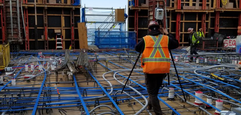
Image at top: With the ability to maintain continuous cloud registration as the RTC360 is moved between scan locations, workflows for as-built surveys and BIM (even in complex environments) can be greatly streamlined. Credit: Robert Lyche, Kuker-Rankin.