April 2020 Archives
Another Curveball: Coronavirus and Geospatial
Out of the blue, we’re facing another curveball. The current global concern (COVID-19, aka the Coronavirus) was generally not anticipated, and the situation changes daily. It was hoped that, by the time this is published, the situation would have calmed dramatically—but sadly it has taken a turn for the worse. Thus far disruptions have only […]
Datum Epochs, And How to Understand Them
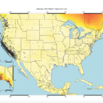
Understanding datum epochs for accurate measurements and locations in dynamic tectonic areas. What are datum epochs? Let’s start at the beginning. “Epoch” is a scientific term used to denote a specific moment or period in time. Land surveying and geodesy use a numerical “epoch” in decimal years to state the moment at which a given […]
GNSS for Curingue: Accessing Remote Water Resources
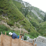
A surveyor volunteers his time and expertise to help supply fresh water to Curingue, an isolated village in the Andes. Featured image: As part of the water project, Curingue residents work on building a structure for water collection, storage, and pumping. High in the Andes Mountains of Ecuador, the village of Curingue has no centralized […]
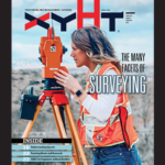
The Many Facets (and Faces) of Surveying
Surveyors have traditionally done a variety of essential and interesting work—and they continue to do so. We’ve asked surveyors from various work disciplines what inspires them. To get an idea of where we are going, it’s important to stop and take a look at where we have been. This rings especially true for those of […]
Teaching Roots and Research at the University of the Philippines
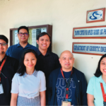
One of Southeast Asia’s oldest surveying schools is promoting the use of geospatial technologies and thriving in the digital age. When Louie Balicanta walks inside the high-ceilinged corridors of Malcolm Hall on his way to teach land surveying, he knows how much responsibility rests on his shoulders. Not only is he an assistant professor at […]