A surveyor volunteers his time and expertise to help supply fresh water to Curingue, an isolated village in the Andes.
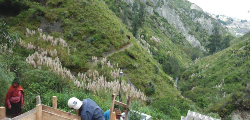
Featured image: As part of the water project, Curingue residents work on building a structure for water collection, storage, and pumping.
High in the Andes Mountains of Ecuador, the village of Curingue has no centralized water supply system. The lack of reliable water means villagers face hardship and increased risk of health problems.
In 2018, Engineers Without Borders (EWB) began work to install infrastructure that could deliver water to Curingue. The effort required accurate positioning to provide accurate data for design and construction.
At an elevation of roughly 11,800 feet, Curingue is an isolated rural community. There is no cellular phone service and only limited electricity for the roughly 210 people living there. When EWB proposed to provide a water supply system, they needed data about water sources and the area’s steep terrain.
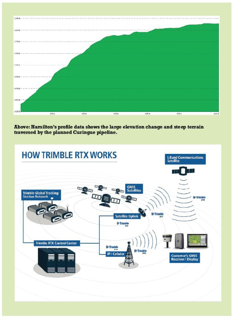
But they soon discovered that there were no existing large-scale maps or geographic information for the area. In order to plan the work, EWB needed to develop accurate maps and elevation information, but the remote location had no existing geodetic control points—a complication that could add time and uncertainty to the mapping effort.
Among the EWB volunteers in Curingue was John Hamilton, a U.S. surveyor who specializes in precise measurement and control over large areas. With three decades of experience on four continents, Hamilton has plenty of experience dealing with sparse control and remote locations. A long-time GNSS user, he examined possible approaches to gathering accurate data for the mapping effort.
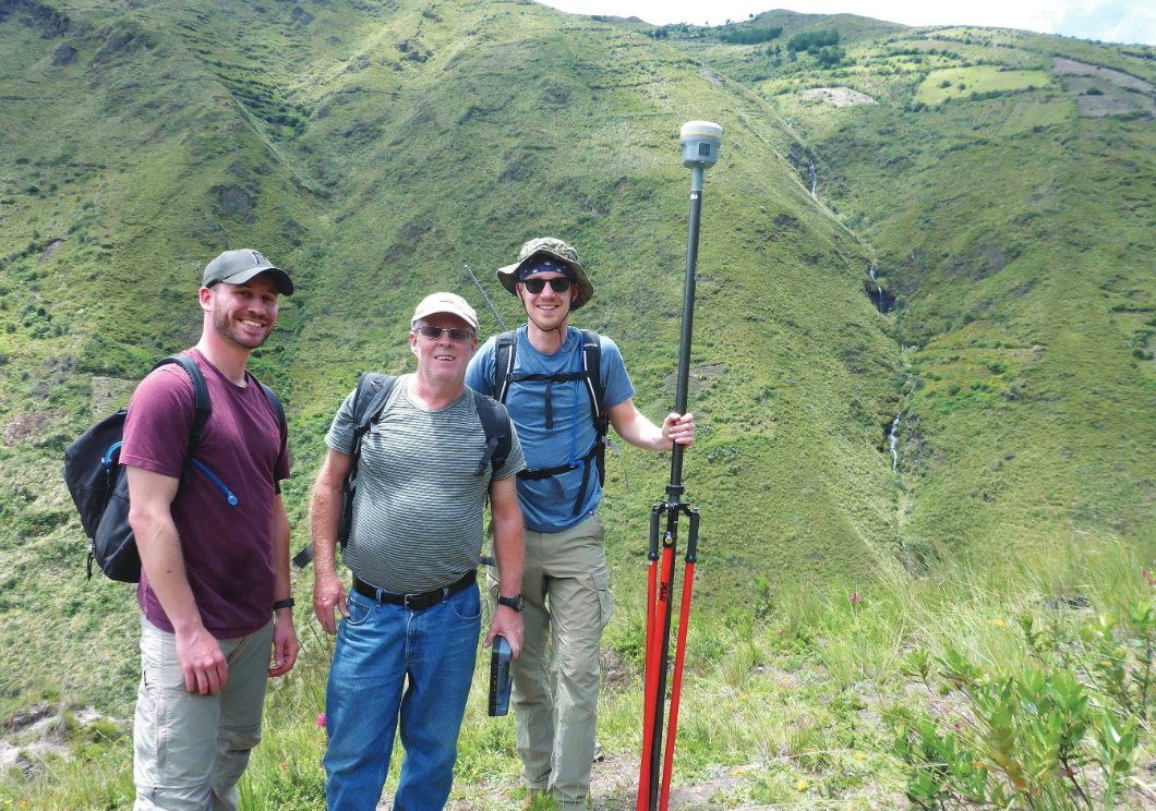
EWB volunteers (l to r) Ken Hendrick, John Hamilton, and James Kelly spent a week working in difficult terrain while on the project to provide water to Curingue.
His options included conducting long-observation GNSS sessions and then post-processing the data to establish reference stations for RTK. But accessing data from Ecuador’s network of continuously operating GNSS reference stations (CORS) proved problematic. In addition, Curingue’s mountainous landscape made using conventional RTK with UHF radios unfeasible.
The EWB teams captured the location of buildings in Curingue to support pipeline design efforts.
Precise GNSS in Difficult Terrain
To achieve accurate and reliable positioning, Hamilton turned to a position service, the Trimble CenterPoint RTX. The service enables users to achieve survey-grade GNSS positioning (better than 2cm horizontal and 5 cm vertical accuracy) anywhere on Earth.
Hamilton had gained experience using the system on projects in the U.S. and Canada and was confident that it could provide the needed accuracy even in the remote Ecuadorian mountains.
Using a single Trimble R10 GNSS receiver, Hamilton and his volunteer colleagues captured the 3D location of water sources that would supply the village.
He also collected measurements at sites selected for the water collection point and pump station, an intermediate pump station, and a water storage tank located above the village.
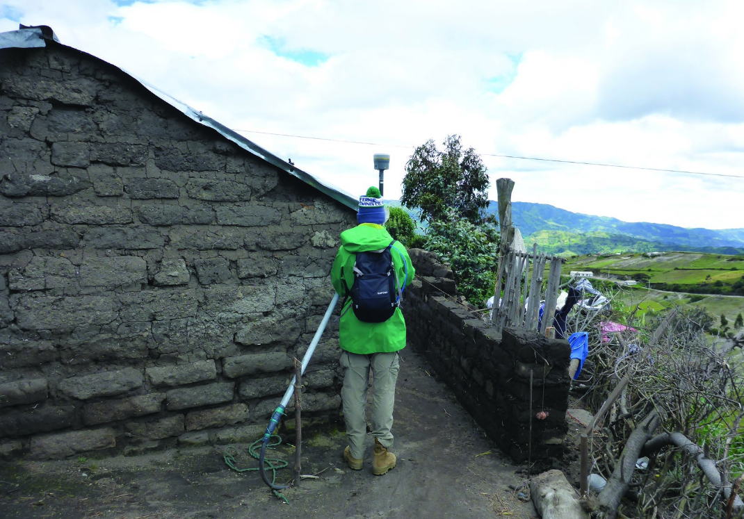
The team worked along the route of the proposed pipeline collecting GNSS data to compile critical vertical profile information for the pipe. They also located ravines and roads that would affect the construction. Finally, they visited each house in the village to collect position and elevation data.
Hamilton said they needed roughly one week to complete all the survey work.
EWB will use the information to establish a durable, sustainable water supply that will improve the lives of Curingue residents. Work is already underway on the collection point, which includes its own storage tank and pump station.
Hamilton is already planning a return visit to Ecuador, where he will work on a similar project in a different village.
(Listen to Hamilton talk about his fascinating work on our podcast, Measure This!)