December 2021 Archives
PPK or RTK: Which is Best?

Know your PPK from your RTK: How GPS correction systems are changing our understanding of landscapes Accuracy and precision are essential for any mapping or surveying task. When deploying a drone to do either, pinpoint location information can be enabled with GPS correction technology. There are two emerging and developing methods for doing this, namely […]
Policing the Profession

In my last column we touched on the idea of “unchecked incompetent practice” and how that is a problem for the land surveying profession. This time around we are going to dive a little deeper with that idea. In a 1969 article entitle “The Professional Status of Land Surveyors,” Curtis Brown wrote, “professional liability is […]
Digitizing for the Future

Street-level imagery and GIS technologies are turning Philadelphia into one smart city Major metropolises are racing to get ahead of technology that could bring driverless cars and delivery drones to their streets and skies. In Philadelphia, investments in new software and services are already paying dividends in other ways for many of its 1.6 million […]
An Awkward Angle
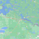
It’s a question that has bothered me since grade school geography. Why does Minnesota have that little protrusion popping out of its northern border? It’s like the state is wearing one of those little red clown hats held on by an elastic strap. I’m several decades past grade schools, but the other afternoon I was […]
Is Customer Education Worth It?

The most popular question I’ve been getting via phone and email recently comes in a few different formats, but the meaning is usually the same. “What is the average cost of a survey?” “How much does a survey cost?” And, my favorite incarnation: “I’ve been told by a trusted source that I spent too much […]
Affordable GNSS: Post-Processing Kinematic in the Cloud
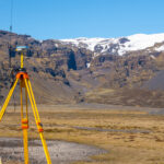
In 1990 I had the privilege to work with a group of pioneers in Canada in the early development of land surveying techniques using a revolutionary new technology known as global positioning system or GPS. Back then, there was only a handful of satellites and the availability of a workable constellation that would allow for […]