Heights 2020 Archives
Drone Surveying in the Ozarks
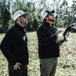
Crafton Tull, an engineering and surveying firm, was tasked with the daunting job of surveying up to 160 acres to collect data needed to design a new road through the heart of the Ozarks. Professional surveyors can face intense challenges—especially when they need to complete large, complicated jobs in dangerous terrain. That’s the situation that […]
Making Aerial Lidar Work for Small Businesses
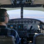
Aerial lidar’s growth has created challenges for small business in the aerial-data collection data; here’s how one company turned them into opportunities. Featured image: Midwest Aerial’s main lidar-flying aircraft. For several decades (1950s -1980s), the commercial mapping industry operated in a relatively stable technology environment. While numerous and important technological advances were made (most notably […]
MAPPS on Capitol Hill: A 2020 Update

By John Copple, Ed Kunz, and Stefan Bailey Wow, Washington, D.C. was an incredibly dynamic place this past year. Despite a complex and polarizing political environment, MAPPS made significant progress on many priority issues. The MAPPS Legislative Affairs Committee (LAC), along with many strategic association partners, made huge contributions to our profession in 2019. […]
Aerial Surveys Weathering Corporate Consolidations
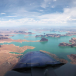
How Aerial Surveys, an independent aerial photogrammetry company, survived the wave of consolidations and continues to grow. Featured image: An Aerial Surveys International aircraft flies the Colorado River in Utah. Aerial Surveys International (ASI), based in Watkins, Colorado, provides aerial photogrammetry services using digital mapping cameras, film cameras, and lidar devices. It has remained independent […]
Fusing Data on Doomed Ash Trees
By using fused data gathered with lidar and hyperspectral imaging, a geospatial services company helped a large utility to identify 90% of ash trees with the potential to fall into their power lines—in a timeframe that wouldn’t have been possible without the use of remote sensing. By Ian Berdie, Zach Raymer, and Mia Chen Remote-sensing […]
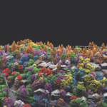
Lidar vs.Wildfires in Southern California

After the 2018 wildfires in Southern California, lidar data was collected to enable risk-mapping assessment and planning, to identify fuel-load reduction programs, and to escalate the emergency assessment of post-fire debris flow hazards. Featured image: This lidar image was taken over Lake Casitas, California. The data are clear: Natural disasters are on the rise, and […]