September 2019 Archives
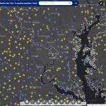
Mapping an Historic Internment Camp

Above: By using drone technology to digitally preserve and reconstruct sites like the Amache Internment Camp, researchers, survivors, and the general public gain a better understanding of an important part of history. UAVs help scholars digitally preserve and reconstruct (in AR) the Amache Internment Camp in Colorado. As national landmarks age, documenting their structures to […]
My 2019 Interview with Jack Dangermond

Above: Dangermond and Duggan at the Esri UC 2019. What’s changed in a year? Editor’s Note: At last year’s Esri User Conference, writer Nick Duggan interviewed Jack Dangermond, co-founder (with Laura Dangermond) of Esri. At this year’s UC Nick spent time with Jack again to delve deeper. Nicholas Duggan: First, I need to thank you. […]
The Science of Where to Build Anything

Above: Both Esri and Autodesk have shown this graphic at their individual presentations. Will the Esri/Autodesk partnership take BIM head-on? In August 2018, xyHt editor Gavin Schrock sat down with Jack Dangermond and Andrew Anagnost, of Esri and Autodesk respectively. They spoke of the natural industry links between the two companies and how they were […]
Fully BIM

Above: Jeffrey Truijens, BIM manager and information and process coordinator for one of the general contractors for the Pontsteiger building. Credit: Josine Voogt Fotografie. A new Amsterdam icon was developed completely with openBIM, proving that BIM can be a cornerstone for highly complex, multidisciplinary design and production coordination. Editor’s Introduction At the 2019 Geospatial World […]
The March toward 2022
Above: A screenshot of the GPS on Bench Marks web tool mobilized in 2018. NSRS modernization: What NGS is doing and what you can do. “The only thing that is constant is change.” – Heraclitus Although this quote pertains to all of life, its truth is especially painful for professional surveyors and geospatial professionals. But […]
Growing Airports with UAVs
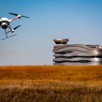
Above: AERIUM Analytics conducts Microdrones flights near the Edmonton International Airport control tower. A Canadian UAS provider uses a special UAV with lidar to transform their airport business into supportive infrastructure operations and runway-scanning projects across North America. The skies above Edmonton International Airport (EIA), Canada’s fifth-busiest airport in terms of passengers, are filled with […]