
The commercial satellite remote-sensing industry has rapidly evolved over the past two decades, from both the technology and market perspectives, so that satellite imagery has become an integral part of many industries.
For example, national, high-resolution maps greatly benefit the civil government and mapping portal industry, especially with cities refreshed on an annual or more-frequent basis. There will be an increased adoption for these maps as fit-for-purpose land cadaster, especially in agricultural markets. In developing nations, these maps will be used by small-holder farmers to claim their land.
Global elevation datasets created with stereo satellite imagery can be updated periodically with fresh imagery. Watersheds and stream models mapped at 50cm resolution or better provide valuable information for city and state/local governments for planning infrastructure for managing surface runoff and planning for floods.
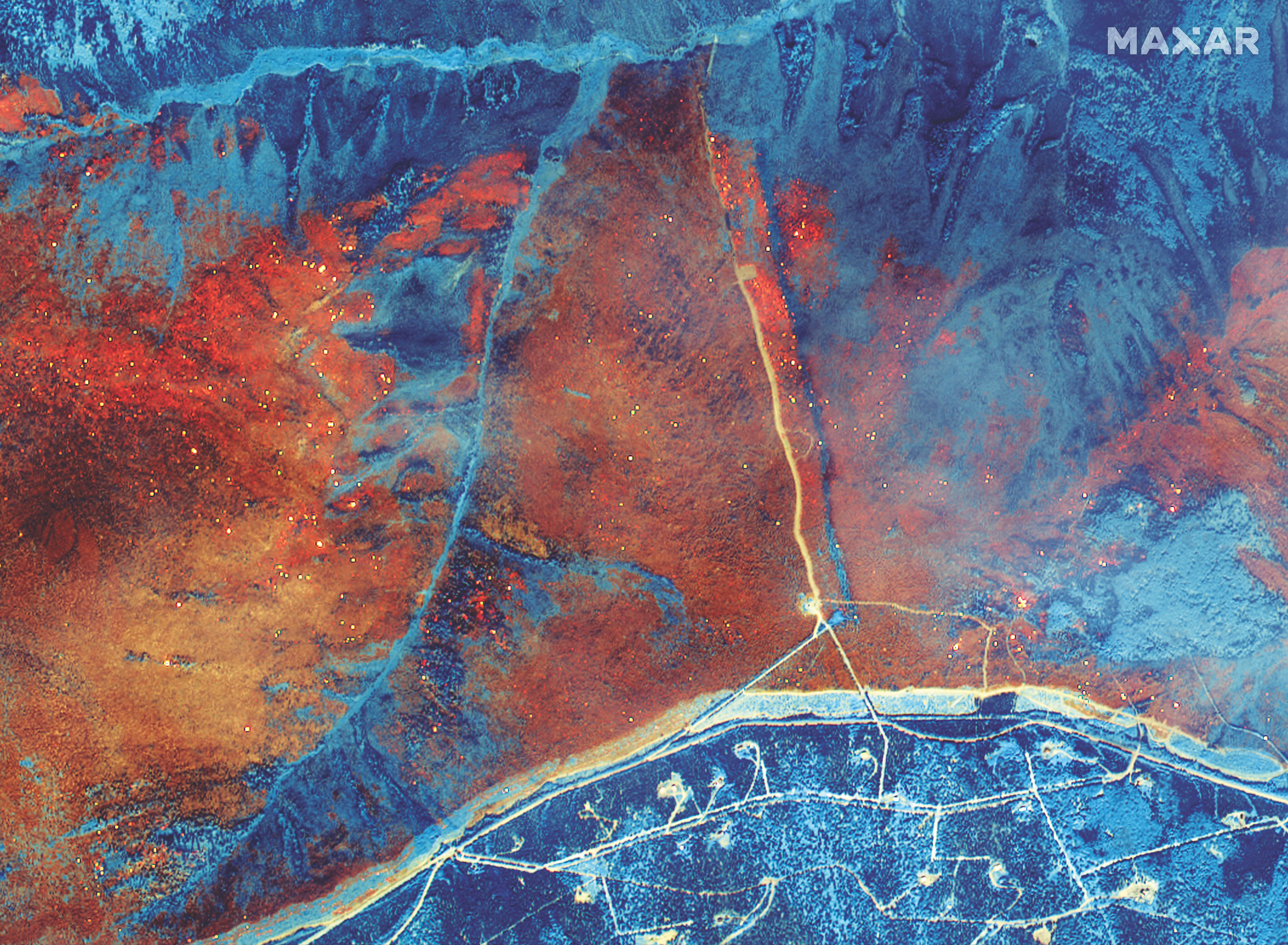
This WorldView-3 image from July 11, 2019, shows the Shovel Creek Wildfire burning 60 miles southeast of Fairbanks, Alaska. Credit: Maxar Technologies.
Using satellite imagery to map shallow-water bathymetry can enable people to rapidly update records in the wake of disasters like tsunamis that drastically change the benthic surfaces and depths. Updated maps are critical for safe ship navigation in shallow waters.
The following technological advances are having the greatest impact.
1) Spatial resolution: The first commercial imaging satellite, IKONOS, launched in 1999 with 80cm resolution. After 20 years of development, satellites now collect 30cm imagery. With more detail available, businesses can see more specifics about their area of interest, allowing them to more accurately create enterprise maps, monitor facilities and pipelines, and conduct land surveys.
2) Accuracy: Satellite pointing accuracy and image processing techniques have resulted in higher imagery accuracy in X, Y, and Z directions. For example, Maxar’s WorldView constellation achieves accuracies in the 2-3 meter range compared to 10-20 meter accuracy from the company’s first generation satellites, QuickBird and IKONOS.
I foresee one-meter image accuracy coming, ensuring location derived from satellites will be further adopted for navigation, logistics deliveries, and other applications. Accuracy is also crucial for feature extraction and the creation of information layers; derivative products from satellite imagery can only be as accurate as the imagery is.
3) Spectral resolution: the number of light bands a satellite collects, as well as the part of electro-magnetic spectrum where the images are captured. Over the past decade, the commercial industry expanded the number of bands in the visible-near infrared and added shortwave infrared bands.
These spectral bands allow end users to derive more information from satellite images, which provides additional context for decision-making. When the end user looks outside the normal red-blue-green color bands, they can learn about plant types and health, where heat is coming from, map soil moisture, etc.
4) Temporal resolution: the revisit for a given place on Earth. Historically, by using agile satellites, operators imaged anywhere in the world every two to three days. Now, companies are launching bigger constellations, resulting in intra-day revisit. This revisit frequency will enable the industry to expand from traditional mapping and monitoring missions to persistent surveillance.
The commercial satellite industry in the coming years will be an underlying technology to support applications including cartography, hydrology at a global scale, 3D mapping for 5G telecommunications, as well as backup technology for navigation and positioning in cases of GPS disruption. Overall trends point to a vibrant and growing commercial industry that becomes central to informing decisions made in a wide variety of industries.
Top: High-resolution, high-revisit constellations will enable persistent monitoring use cases, such as changes at a construction site and the direction a wildfire is burning. Credit: Maxar Technologies.