Container 42 and digital twins: the answer to life, the universe and how the Port of Rotterdam is transforming infrastructure management and operations.
Editor’s Note: If you think the term “digital twin” is yet another high concept being foisted on surveyors and geospatial professionals in AEC, then you are not alone. But you are hearing this term for good reason: it is a key concept and approach that is already bringing long-needed efficiencies to AEC (and may other disciplines). Dynamic digital models of infrastructure, plants, utilities, buildings, transportation systems, and perhaps someday whole cities may be used in 4D construction (3D models with the fourth D as scheduling/time management). In projects where these models are implemented, 4D has reduced downtime, rework, materials losses, and more.
Also consider what happens after something is built and commissioned. If a “twin” is kept up to date and tied into sensor systems that provide real-time feedback, a large piece of infrastructure or system could be operated via the twin, with various operational decisions being tested digitally before anyone starts fiddling with actual controls.
Imagine, say, a doctor being able to work with an accurate and live digital twin of a patient before opening them (c’mon, we’ve all seen this in sci-fi films). That might be a stretch right now, but infrastructure digital twins are already here, and the good news for surveyors and geospatial professionals is that they require (I love this term) “continuous surveying” to keep them current and accurate, plus a lot of immediate feedback, like sensors.
The following example provides a view into the downstream benefits of these digital twins you help create. Some of the largest (and most important) infrastructure systems are port facilities and operations.
The Port of Rotterdam in The Netherlands. Credit: Eric Bakker.
The Netherlands’ Port of Rotterdam has been in use since the 14th century. It’s a huge, 105-sq-km expanse which, from 1962 to 2004, was the world’s busiest port, with approximately 30,000 vessels coming and going through it each year. It’s still the largest port in Europe, and it’s a monumental task to maintain it efficiently and safely.
Within the next 10 years, autonomous vessels will travel through the port, and that creates the need for a digital transformation involving digital communication—in other words, a digital twin.
It came as a surprise to, for instance, operators of large infrastructure systems, that Industry 4.0 was missing the “context” from the digital twin model. (A common definition of Industry 4.0 is “the subset of the fourth industrial revolution that concerns industry. The fourth industrial revolution encompasses areas which are not normally classified as industry, such as smart cities and GIS, for instance.”
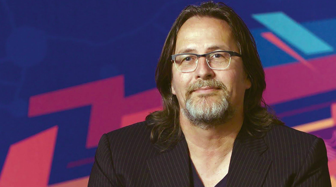
Erwin Rademaker at the Esri UC 2018. Credit: Esri.
Erwin Rademaker is a program manager with the Port of Rotterdam, currently responsible for smart Infrastructure and enabling the internet of things (IoT) for the digital twin of the port. In his keynote talk at the 2018 Esri Business Summit, he describes the issue of context by using a glass of water.
“If we consider a glass of water, the object is glass, the dimensions are 10cm x 10cm x 5cm, and its conditions are that it is 50% full [and] at a temperature of 12¡C.
“We know its geographic location. It is set on a table, but if we pick it up and move it to teetering on the edge of the table, its context changes. This doesn’t fit with business 4.0.”
He explains, “If I put my digital twin of my precious netbook under that table where the water might fall, the context of the netbook should change, but doesn’t.”
An example of context for the port, says Rademaker, is cranes. They’re moving around the port always, and if one is sitting in a parking lot it isn’t an issue, but, if it sits on an underground pipeline, that suddenly changes everything. Not only will you see people running out of the port, but also the condition and context of that crane changes.
His solution is to consider that the Port of Rotterdam has four dimensions: x, y, z, and t whereby the t represents time in three ways: real-time, predicted, and historic. In building the digital transformation for the Port of Rotterdam, Rademaker is working with CISCO, IBM, and Esri to create a smart port to allow the port managers to be able to cope with the increasing demand and future changes, all digitally.
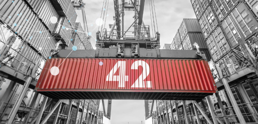
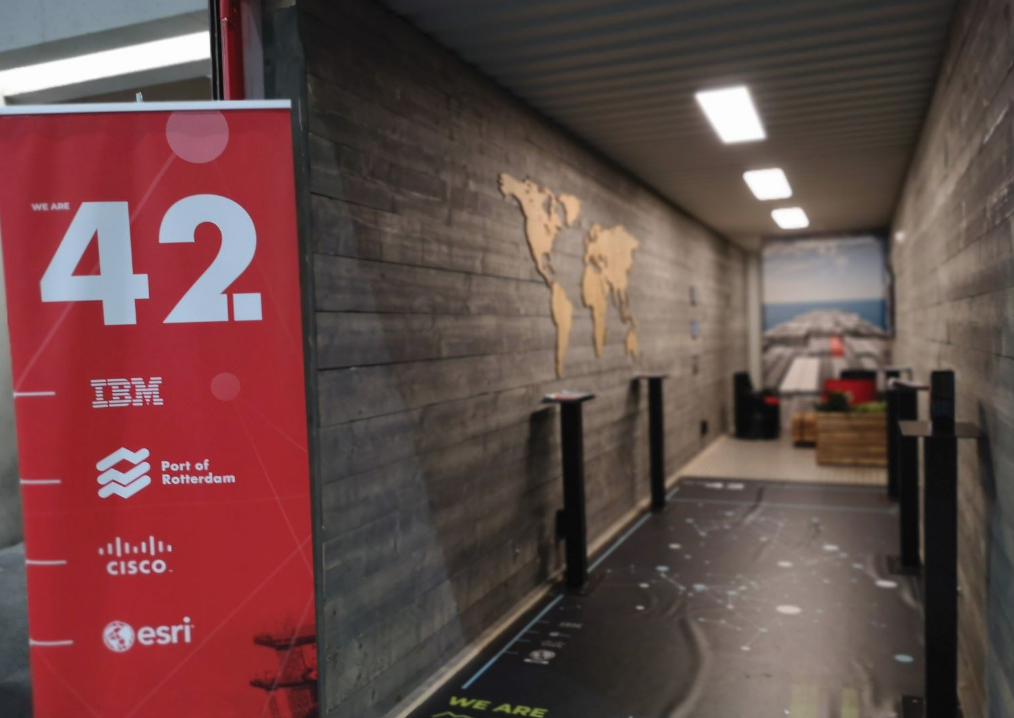
This concept is so progressive that a smart shipping container called “Container 42” has been created. With a plethora of sensors attached, this container will be able to better inform some of the digital questions that need answering to ensure there are no gaps in the port model.
I spoke with Rademaker at the Esri UC this year to discuss why this shipping container is so important.
Where’s My Stuff?
Vessels have had AIS (automatic identification systems) for many years, so they’re easy to track. But a container itself is its own separate entity. Tracking a container and its contents, in real-time, can be more complex.
“A vessel tracker doesn’t tell you if the container is on board or not,” said Rademaker. “One of the biggest irritations of cargo owners is that their container is left at the port of departure or is dropped off at a wrong port of arrival. Container lines follow a fixed route; they go to the same ports and routes around the world and then start all over again. If you go from port A to B to C to D and then you come into the port of your destination, that can take you like 40 days to make all the stopovers and then arrive at the point of destination.
“If a container has been forgotten on the quay wall, you will know in 40 days, plus a few more, that your container wasn’t on the ship. This is just an example: it might be 60 days, it might be 20 days, but you know it’s not arriving only when the ship finally arrives at the port of destination.”
Rademaker gave a more familiar example: “Take your luggage. You step on a plane, you leave your luggage to be picked up, you come to your destination, and you say, ‘Where the hell is my suitcase?’ and no one knows. Six weeks later, it’s delivered back to your home and your vacation was ruined.”
For big companies like Nike with multi-country marketing campaigns to launch their new products, that could be multi-millions of dollars lost. It is very important that the container arrives on time because otherwise the campaign is over before the container arrives.
The simple answer seems to put more trackers on individual containers, such as LoRa: long range radios, which are low-power wide-area network (LPWAN) technologies.
Rademaker said this is coming to the market right now. “There’s a company called TRAXENS that has a contract with Maersk, CMA, and MSC (the big shipping lines). They’re going to build smart containers now with track and trace.
“This is just the beginning of where we are heading to. To be honest, when the container is on the ship, nothing happens. The container might fall off; it might get shaken, but nothing big happens on the ship. Most events happen in ports or on the journey to another location on land.
“Another big issue is counterfeits, so I’m going to use a big global fashion company. They have their Brand A stuff to be shipped from China. The container ship is going via India to Europe to sell this stuff. Then in India, the container gets offloaded where 50% of Brand A is removed and fake stuff is popped in—this is another big issue for cargo owners: they don’t have any notification if a container has been compromised in another port.
“The port is working on a container that has smart lock on the inside, for instance, a door sensor that’s similar to what’s in your house. The port is using technology from other industries and putting as much technology on the container as possible to satisfy the people who are saying, “Why didn’t they put a little iOS tracker on top to get this industry moving?'”
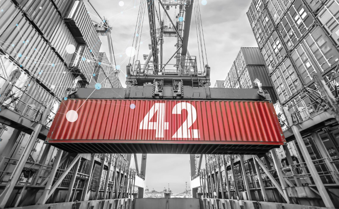
Container 42, with its plethora of sensors, will help people transform the Port of Rotterdam into a digital, smart port. Credit: We Are 42.
Rademaker painted scenarios that would benefit from additional sensors and event tracking: “If something happens inside the container regarding the cargo—let’s say the container has been flipped over and there is a Tesla inside—when it arrives at the port and insurance companies are involved, everybody will be pointing at one another. ‘It wasn’t me!’ You know, the container terminal operator, the shipping agent, the truck driver, the forklift operator, etc.”
The port seeks to demonstrate that with cheap and simple technology, they can measure everything. “I think that within 5 to 10 years,” said Rademaker, “all the sensors we will have installed will be all the size of SIM cards, and every container with a SIM card will be tracked.”
Getting people on board might be difficult unless it is relatively cheap and simple, but enterprises are taking loses because of the uncertainties that such systems could provide.
“Cargo owners are having big issues,” said Rademaker. “They will destroy the contents of a container with Chanel perfume if they know that the cargo has been compromised because they can’t track down which bottle is fake. (You know you’ve bought the fake bottle only after two months when it stinks.) Because they don’t want to destroy a whole container, they will invest in security: data security, cyber security, and physical security.”
I wondered where the investments would need to be made, and by whom. Rademaker responded: “A cargo transporter or freight transporter will arrange it all. Imagine you have a container and you want to ship it from the UK to Asia. The cargo guy who will do the work to ship it will ask you when you want it to arrive. Depending on that, he will plan the journey.
“If you say, ‘I don’t mind as long as it’s before Christmas,’ I bet your container is going to go to four or five ports first. You won’t get a cheap route because of all the stopovers, and he will calculate for himself the most profit. And if your container arrives in four or five ports, there are a lot of things that are going to go wrong. And with a small delay in every port, your container will be late.
“When the container leaves, it becomes a black box. You don’t know where it is, and the whole industry will shield off the information; they’ll say it’s ‘in transit.’ Customs is another party that’s interested in this kind of technology. They want to know what ports the container went to before the final destination.”
Such technologies could answer a lot of questions in real-time. “Did it get off the ship? Were the doors opened? What happened when a wave hit the ship?” Presently, often such things are not measured. A customer drops a container off and can only wait to see when it arrives. As for actionable data, there’s little to none.
As we are all getting more exposed to the world of IoT, one could imagine a lot of familiar digital tracking methods, like a security camera. Rademaker said, “We do [use those]! And we have like 40 sensors. If the door is being opened, due to the cameras we’ll know who opened it. The door opening turns on the camera and an RFID unit to see whether things are moving out of the container. One sensor triggers another sensor.”
Project Details
The Port of Rotterdam’s first logical step after implementing Esri software and creating PortMaps, the dynamic geographic data interface, was enriching the sensor data fed into it. Watson IoT, which is IBM, was implemented; the port replaced its hydro-meteo sensor network (water level, water streaming, salinity, visibility, and wind) with the IBM Watson technology and integrated that with the PortMap system.
Rademaker said, “We have spatial dimensions in Esri with all the assets in drawings and documents, etc. Our asset management system is also connected, and then we put the sensors that are attached to the same assets and we put the real-time measurements into this geographical context. That set up the idea to create a digital twin for ports.
Inside a Container 42 iteration on display at the Esri UC.
“We want the Port of Rotterdam to become the smartest port in the world because we want to be able to connect with autonomous shipping in the future. It will be the first port, actually. So, we have to make our ports smarter and make all the objects and assets smarter by attaching sensors, the same sensors as we have in the container.”
Why concentrate on containers? Rademaker said, “I chose the container because the container is in essence a very stupid object; it doesn’t have any intelligence. It’s six pieces of metal welded together, and that’s it. If you look at it, it’s a moving box of the global economy. 85% of all consumer goods you see around here have been shipped from the container.
“Every container crane in the world can lift this container because the container’s measurements are standardized. If you look at the software we need for autonomous ports around the world, the software in its essence is very smart. But it’s stupid in that it’s also standardized.”
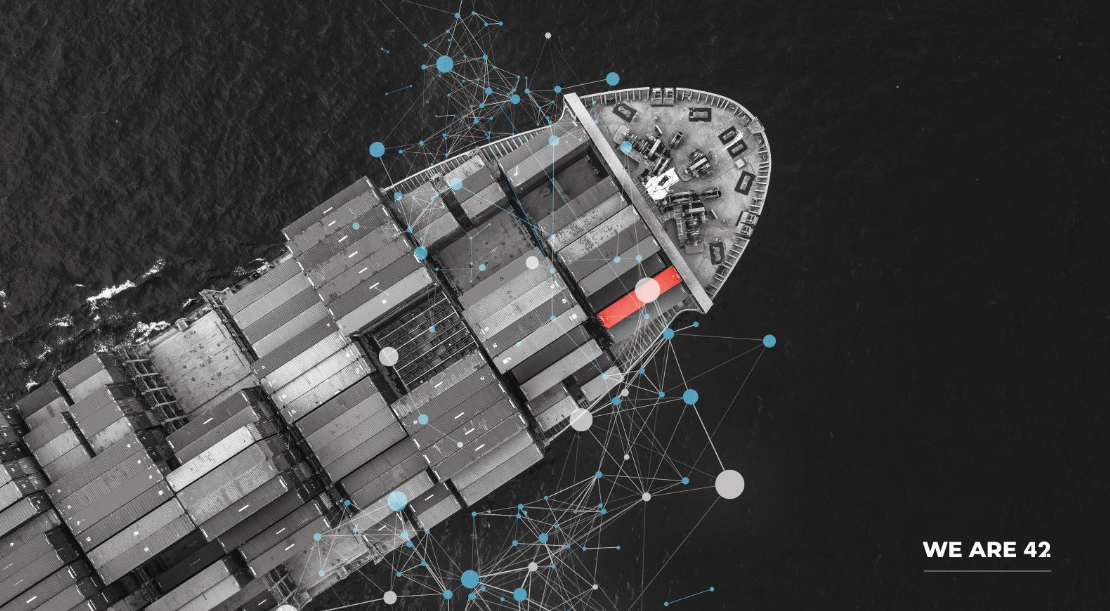
A mock-up of a Container 42 on a vessel. Credit: We Are 42.
Rademaker explained that there is an imperative to implementing digital twin elements to ports and shipping, and the sooner the better. “Consider a ship that could sail autonomously from Singapore to Rotterdam. If we don’t make other ports aware of the fact that these autonomous ships are coming within the next decade, they’ll build their own solution, and then when the ship comes and there’s a change in Windows or in Apple, we have a problem. So, we have to make sure that we’re standardized for autonomous from the start.
“This is why Container 42 is a metaphor for something stupid that can become very smart; we’re making it smart by putting sensors in it. The same technology we use at the port is used in Container 42. Cisco is collecting the data from the sensors, securing the communication. IBM Watson IoT is doing all the calculations and analyzing it, and Esri puts everything on a map. The map is all we need to show you. So, we’re going to soon travel around the world, visiting 25 ports, to create this awareness.”
If you’re wondering about the “42” reference, anyone familiar with The Hitchhiker’s Guide to the Galaxy will smile at this. In the sci-fi-comedy classic, when the most powerful computer in the universe was asked for the answer to “life, the universe, and everything,” the answer it gave was simply “42.” This is the joke in that 42 is the answer to the shipping question.
Additional Benefits
The efficiencies that Container 42 exemplifies include that shippers could avoid a lot of losses and missed deliveries, and smart containers can create certainty in scheduling and save fuel, with a potentially large environmental dividend. I asked Rademaker what inefficiencies their live sensors are revealing and what they anticipate could be positive environmental gains. After all, won’t it take more energy to power all of these sensors?
“As a test we sent a container to Munich and already found out that on a nine-day journey, it was idle for eight days. There’s a lot to improve. I don’t know if the whole industry will move to that next level. We as a corporation want to show where we can improve and benchmark one shipping line against the other.
“The shipping industry is one of the biggest polluters in the world. I wanted the chance to say this is why this is happening. The Container has solar panels on the roof. Imagine your ship coming to Southampton (UK) with all these Container 42s with solar panels, generating 400m-x-60m solar fields, powering and charging container batteries, and then going electric.
“The roof is actually the reason why this particular container [on display at the user conference] is here; there have been one or two iterations. For the first one we got into discussions with customs, and they asked what kind of wood it is on the roof because it’s not going to be allowed to ship to other ports due to warrants. So, I decided we need to remove the wood. But this container is made from reclaimed wood.”
The work the Port of Rotterdam has been doing has begun to influence operations at other ports. “Our port is not that difficult because we have two strategic goals and focal points,” said Rademaker, “One is the energy transition. That’s a mission to go to renewable resources.” While Rotterdam and the Netherlands are leaders in heading towards self-sufficiency through renewables, Rademaker says that’s “within the next 15 years, not tomorrow. We all have to move faster—it’s a long-term vision.
“I think one of the key factors is that the profit margins in logistics are very low. For example, FedEx is the fourth-biggest airplane-owning company in the world. If the price of fuel goes up there, the profit margin drops from 2% to 0.5%. So, they count as first for this new technology.”
The Port wants to involve the biggest players in the world—like IBM, Cisco, and Esri that have marketing power and are active in other industries—to bring in best practices from other industries that can be applied within their standard software. “That’s one of the key things to success, you know, to get partnerships instead of doing it alone,” Rademaker said.
Digital Twins
Rademaker says that what they are building at the Port of Rotterdam is essentially a smart city, and he defines a digital twin as “a digital representation of a physical object in a geo space-time cube.” I asked if it would be each individual component of each individual component that makes the digital twin.
“You have to define, say, a minimum size of an object. If you look at the ship, the ship has a digital twin, and it will have cargo as a digital twin. The cargo can be split up into 25,000 containers, each being a digital twin of a container, then the container goes on the truck and is delivered at a warehouse, and then 20 palettes move out. It’s become a digital twin for the warehouse.”
But would something qualify as a digital twin even if had no detailed data attached? Rademaker responded that it begins with only the minimal four dimensions and place on the Earth.
“Big industry says the object being tracked is just an object with dimensions and status. And I said no, it’s the geographical context—you have to add that to it. This is why I’m working together with Esri and IBM Research in Dublin on this concept of a digital twin of a port. A container is not just X meters long; we have to know where every object is. If it’s a ship and the water it’s in isn’t deep enough for its route, I will reroute it to shallow parts. That is geographic information.
“For us, a digital twin is the port in this space-time cube on the planet Earth with objects that are fixed to the Earth like a keyboard and objects that move. Foreign moving objects like vessels can move around with the port or they come from outside the port, go through the port, and go out again.”
The super-wired Container 42 is part of groundbreaking work the Port of Rotterdam is doing in large-scale, practical—and critical—digital twinning. Digital twins are being developed in manufacturing, medicine, buildings, and more. The spatially accurate and current data, whether it comes from a scanner, thermal camera, total station, LoRa, MEM—is all part of the whole. Some of your data is probably already contributing to digital twinning.