Helping firms meet the challenges of the global uptick in infrastructure development.
Editor’s note: What is spatial IT? This umbrella term for the spatial component of the new wave of digital wizardry that’s transforming our geospatial and geomatics professions and industries can seem nebulous. xyHt has adopted the following working definition (as the term applies to the AEC disciplines our publications serve).
“The digital elements that support and enable geospatial sciences, data-capture technologies, data management and analysis, and the utilization thereof in planning, designing, building, and managing physical infrastructure and location-based applications.”
Okay fine, but more and more we hear folks in the construction sector ask, “What can spatial IT do for us right now?” The current conundrum is that even with all the new high-tech developments, some in the construction sector still struggle to improve overall performance.
We put this question to Boris Skopljak, who has penned several insightful columns for xyHt on digital data and geomatics subjects. And we said it was okay to mention products as examples where relevant.
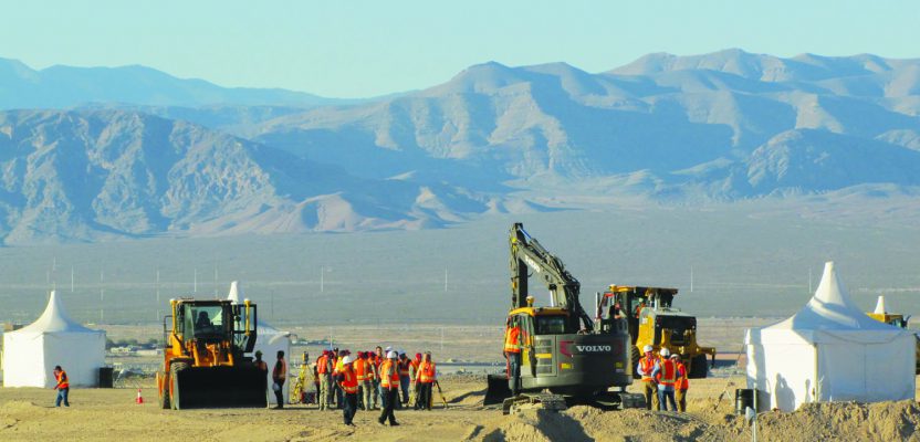
Spatial IT has tremendous potential to drive efficiencies in infrastructure construction and development. Benefits will be transformative across the entire design, build, and operate project lifecycle by increasing productivity, reducing construction cost, minimizing errors and rework, and accelerating project time to completion.
To get further along the spatial IT continuum, surveyors need to demonstrate the value of spatial IT and building information modeling (BIM).
This shift in thinking requires moving the customers’ conversation beyond sensors. Infrastructure project owners are hungry for streamlined data workflows and integrated work processes. By embracing spatial IT technological and workflow advances, surveyors can play an extremely important role in construction lifecycle and BIM. Let’s look at how spatial IT will contribute an integrated data workflow to affect infrastructure development and construction in the short term and beyond.
Secure information exchange and data flow across the project lifecycle.
One of the biggest obstacles to an integrated data workflow is that owners, architects, contractors, and engineers leverage different software and hardware solutions. This makes for challenging collaboration on deliverables like drawings, specifications, or 3D models.
Fortunately, new developments around connectivity, cloud computing, and APIs are empowering more seamless information and data exchange between these disparate groups. With full access to project documentation and 3D constructible models, stakeholders can better link real-time operations directly to the model, supporting 5D BIM (i.e., scheduling and cost).
Adapting these elements can have immediate positive impacts and ROI throughout the infrastructure lifecycle in surveying, design, construction, and operations.
Sensor fusion, mass-data collection, and simplified visualization.
Today’s advanced mobile mapping and scanning solutions collect massive amounts of data very quickly, e.g., the Trimble MX9 mobile mapping system is capable of collecting 2-million points per second along with imaging and positioning information.
Spatial IT is driving sensor fusion where surveying, imaging, and high-speed 3D scanning come together, often from a single piece of equipment. New spatial IT tools make it possible to work with information from different data sources in a seamless software environment, allowing surveyors to choose the best tool for the job.
Together, these capabilities provide non-geospatial professionals with easy access to accurate 3D digital representations of the real-world environment. The 3D information provides greater insight and visibility to enable all project stakeholders to make more-informed decisions.
They achieve great short-term ROI for pre-design and as-built surveying, and in more accessible visualizations for design teams and stakeholders. The rich 3D environments have long-term benefits for operations, as well.
Augmented, virtual, and mixed reality.
Remember when augmented reality (AR) was used only in conference rooms to demonstrate project models? Today’s AR spatial IT solutions are also used outdoors to accurately align design models to the real world.
Mixed-reality solutions like Trimble’s SiteVision can also be used for project coordination by enabling the constructible model to be visualized on the job site prior to construction. This is a leapfrog moment in 3D technology because it provides much-needed context to structural data and geo-referenced assets by overlaying them onto the real world. An integrated data workflow made possible by the connected job site will go further to enhance 3D design review, coordination, and collaboration.
Design teams evaluating design alternatives and resolving design and existing element conflicts would benefit immediately and reduce change orders in construction. Integrating AR and VR into all phases of the lifecycle may take longer but would yield substantial long-term benefits.
Deep learning and artificial intelligence.
These will play a significant role in the development of spatial technologies that can add contextual and scalable insights from large data sets. Again, cloud-based platforms are making it possible to access and analyze these massive geospatial big-data sets in ways once unfathomable.
Deep learning is powering image and object recognition and providing the foundation for extracting actionable information from geospatial data. For example, Trimble eCognition can extract corridor infrastructure such as traffic signs from point-cloud and imaging data to support asset management and natural resource applications. These might seem futuristic, with perhaps only long-term benefits, but there are elements of each in current solutions, yielding immediate benefits.
As geospatial professionals (and I emphasize professionals), we are often the first on the site providing geospatial framework for any design and construction work, and we are often the last to leave the site, ensuring the as-built environment corresponds to what was designed in the office.
We have a great opportunity to embrace this technical evolution and position ourselves as key contributors in the processes involving geospatial technologies, providing the integrity and confidence behind the construction process, resulting in safety and productivity increases.