Tag Archives: GIS
Let’s Be Colleagues: New Settings for GIS Mentoring
Mentoring is a key aspect in any career; otherwise how do we learn what we need to do and how we need to work in a particular environment? Mentoring is even more important for an SME (small- to medium-sized enterprise) or freelancer. Working on your own is increasingly common in the geospatial field, with the...

Weekly xyHt News Links: 12/27/2019
GIS Surveyor app now includes ED-50 zone
Integrating Location & Design: There must be a better way
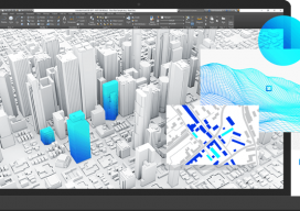
Autodesk & Esri Sponsored Content Engineers using building information modeling (BIM) software and geographic information systems (GIS) specialists constitute overlapping segments of the infrastructure project community. Sometimes, they work for the same company or public agency, but often they don’t: for example, the engineers might work for a design firm and the GIS specialists for...
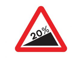
Using Real Road Signs in GIS
At the moment, I am doing a little work with the construction industry that requires road signs and markings placed on a map to show where signs need to move as the site(s) moves through different phases. Now, a real cartographer nerd would say that good graphics and symbolization would negate the need for placing...

What Is PostGIS Day?
For the last 20 years, we have celebrated GIS day along with Esri. It is a great opportunity to get people who haven’t used GIS or mapping before in your office to have a look at what you do and maybe share a map cake (Note: It is traditional for GIS professionals to make a...

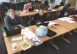
Esri UK Conference 2019 Recap
Every year towards the end of May, Esri UK, the UK distributer for Esri software, holds a user conference across the road from Westminster, the home of the UK parliament (when I was there I even got to see Jacob Reese Mogg). It’s held at the QE2 centre, and there are amazing views from the fifth floor which allow...