Tag Archives: GIS
Critical Issues for GIS/Survey Cooperation
State Plane Coordinates in Legal Descriptions The time is now to have State Plane Coordinates (SPC) attached to key monuments that should be part of just about any legal description, in the proper context.* This has been discussed since the early 1980s and has been accomplished only on a piecemeal basis. With coordinate inclusion, a...

Google Glass
The box a Glass arrives in is pretty impressive in and of itself—it reminded me more of Apple packaging for iPads than of typical Android products (top right). A little card underneath the Glass holder tells you that you are special for spending so much money (middle right). There are really very few operating instructions...
Growing GIS
Many people view Jack Dangermond as the face of commercial GIS, if not the face of GIS as a whole. As the internationally recognized and celebrated leader of Esri, he has led the company from humble beginnings to a leadership role in the GIS industry and community. xyHt recently asked Jack for his views on...
USACE GIS Cadre Mapping Team’s Future
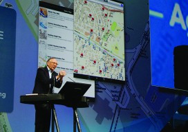
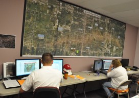
The cadre is a team of Army Corps employees from throughout the nation who are GIS subject-matter experts. When a federally declared disaster occurs the team gets ready to deploy and can be on the ground in just hours, setting up their own equipment even before other agencies are on the scene.

NC PLS Grandfathering Provision for GIS Professionals
In order to adapt to a whole new contingent (GIS), NCBELS formalized GIS Inclusion/Exclusion Guidelines for what GIS work fits under the definition of surveying in 2008 and created the Mapping Sciences Exam in 2009 as an alternative exam that focuses on areas of the surveying profession that GIS professionals would work with.
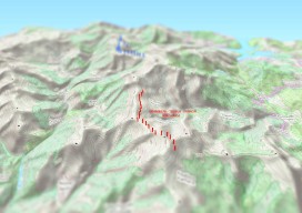
Create an Awesome 3D Map in Minutes in #QGIS
Until recently, 3D has been a bit of a gimmick to the everyday GIS user, by this I mean that it has been quite time consuming to create a GOOD 3D representation (easily) until now. I’ve used some great 3D software whilst working on survey data and also visualisation of environmental impacts, Fledermaus, ArcScene, Sketchup,...