Tag Archives: mapping

xyHt Weekly News Links: 03/27/2020
Phase One Industrial Redefines Large Format Aerial Imaging — Launches 280MP Aerial Solution iXblue launches new cost-effective range of FOG-based INS dedicated to land and air mobile mapping Woolpert Senior Vice President Jeff Lovin Named President of ASPRS Hyper Realistic Mapping Getting Ready for Disaster Events with Remote Sensing Topcon’s Real Time Construction Verification International Photogrammetry...

New Products, Training Highlight Drones’ Increased Role in Mapping and Surveying
Drones are taking on an increased role in the world of mapping and surveying, with some companies specifically tailoring their products to appeal to this market. For instance, the companies UAVOS and Polynesian Navigation Inc. have collaborated to develop a long-distance autonomous UAS for 3-D mapping. Powered by UAVOS’s autopilot, the UVH -25EL unmanned helicopter...
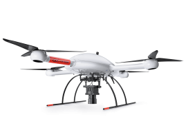
Sponsored: Microdrones goes to new ultra heights
Sponsored by Microdrones The new mdMapper3000DuoG VHR takes ultra-high resolution Photogrammetry from higher altitudes. Microdrones is releasing three new Integrated UAV Systems based on the heavy lifting power, resilience and efficiency of the Microdrones md4-3000 aircraft: the mdMapper3000DuoG VHR, the mdMapper3000DuoG and the mdMapper3000 PPK. The company has also updated the mdTector1000CH4 LR with a...

Esri UK Conference 2019 Recap
Every year towards the end of May, Esri UK, the UK distributer for Esri software, holds a user conference across the road from Westminster, the home of the UK parliament (when I was there I even got to see Jacob Reese Mogg). It’s held at the QE2 centre, and there are amazing views from the fifth floor which allow...

In The News: A Geospatial Year at Woolpert 2017-2018
Woolpert has been in business for 107 years, building a strong, broad-based foundation through engineering, surveying, mapping, photogrammetry, lidar collection, GIS, etc., to provide the most comprehensive geospatial support in the industry. In the past year alone our work in each of these sites, represented by these red dots, were spotlighted in the press. They...

My First Trip to the Esri UC
No matter what flavor of GIS you roll, there is no ignoring the annual Esri user conference in San Diego. The highlight is the opening plenary session which is always given by the (co) founder of Esri, none other than Jack Dangermond. To discuss this fully, we have to start at the beginning, which was...