Tag Archives: uas
UAS Crystal Ball 2017
Four things to watch for in the UAS space next year. Regulation: I just made up an acronym—“GBVLOS”—Getting beyond visual line of sight. With the rollout of the FAA’s Rule 107 allowing sUAS into the NAS for commercial work, the profession breathed a sigh of relief. Issues still remain, though: namely exemptions for BVLOS. So...

xyHt Magazine November 2016 Issue
Click here to view the November 2016 issue of xyHt magazine.
Drone design: What Goes into Designing a Drone?
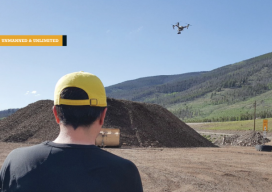
A UAS firm tackles a topographic mission at 10,000 feet above sea level with their own system. (Above: IST Aerial’s Bo LeRoy uses the firm’s DJI Inspire One to collect data for volumetric calculations for compost piles located on a landfill in Colorado.) IST Aerial is a division of Integrated Science and Technology (IST), founded 25...

Don’t Drone On: Drone Talk & Geospatial Professionals
How to explain the value of UAS to geospatial professionals. I’m the business development director at microdrones, where one of my goals is to help customers–who sell services like aerial mapping, surveying, infrastructure inspection, and monitoring precision agriculture–communicate to their potential clients the value of using UAS. This can be tricky in such a high-tech...
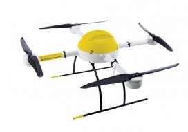
Rosalie Bartlett: Marketing Manager at Kespry
Women in Unmanned Systems Editor’s Note: In our ongoing effort to promote geospatial professions, we’re asking dynamic leaders what attracted them to UAS and other geospatial fields as well as advice they might have for young people considering choosing related career paths. I’ve been fascinated by flight ever since I was little. If I were...
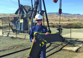
Dyan Gibbens: Founder and CEO of Trumbull Unmanned
Women in Unmanned Systems Editor’s Note: In our ongoing effort to promote geospatial professions, we’re asking dynamic leaders what attracted them to UAS and other geospatial fields as well as advice they might have for young people considering choosing related career paths. From an early age, I knew I would pursue some sort of career...