
Has Autodesk become too large? Too diverse? Did the software get too complex? Or are those concerns missing the point?
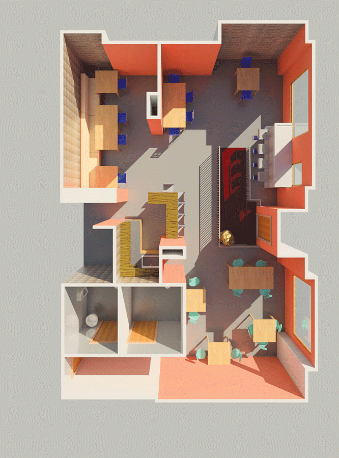
A designer can imagine, sketch, engineer, design, and create models for construction completely in a CAD environment. (Graphic: Autodesk Online Gallery)
We’re far from the day when we can think of something we’d like and it simply materializes: there’s still a long path between ideation and realization. But, for more than three decades the path between our brains and actionable designs has been steadily shortening, and we’re now on the cusp of shortening that path all the way to construction/fabrication.
Many fine digital design tools are available for all disciplines—civil infrastructure, manufacturing, entertainment—but it would be intellectually dishonest not to acknowledge Autodesk Inc.’s leadership and global impact in the world of design and visualization. It is hard to overlook the steps that Autodesk, its developer network, partners, and especially its user base have taken to shorten the path between imagination and reality.
Too … ?
A company with at least $2.5 billion annual revenue, around 8,000 employees worldwide, an installed base in the millions, and a user group of over 300,000 gets there—and stays there—by producing products that improve the user’s productivity. But how many times have you heard the following? “The software is too sophisticated.” “I could never use all of this.” “This is a monopoly.” “The company has lost its way.” Are any of these charges true?
To examine these questions, we’re focusing on the civil/survey aspects of the Autodesk’s AEC products and services reflecting the predominant disciplines currently represented by the readership of xyHt. The other markets served by Autodesk—industrial design, visualization, entertainment, and GIS construction and manufacturing—have grown to service much larger segments than civil/survey and infrastructure, but AEC is a substantial market segment in its own right.
To examine specific concerns that Autodesk has lost its way or strayed from what made its products an international standard, we look back at how it all got started. In the first five years of the company, when it rose from $0 to its first $.5 billion, many of the product lines and elements of business philosophy began; most endure to this day, and some of the founders’ dreams are fully coming to fruition.
Extending Further into the Void
Autodesk CEO Carl Bass has often said, “When people design something, they typically do it with the intention of building something.” If the efficiencies of digital design are to extend into construction or manufacturing, then the path must be shortened.
In our September issue we profiled “The Digital Site,” an example of the connectivity and automation that have transformed heavy civil construction. However, one element of a complete plan-design-build-commission cycle has, for the most part, been conducted as a separate operation: design.
The manufacturers of the instrumentation, automation, and software for construction and manufacturing generally have not tried to break into the design software markets; there is a realization from both segments that each is best at what it does. It has always been mostly “design over here, and build over here.”
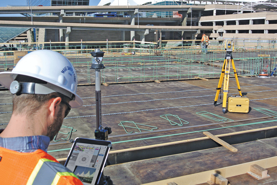
The collaboration is growing between Topcon Positioning Solutions and Autodesk for construction/BIM.
But that is changing. It was inevitable that seamless workflows would be sought, and both Autodesk and the positioning and measurement entities have done so, not so much by direct encroachment but through collaboration.
The growing collaboration between Topcon Positioning Systems and Autodesk for construction/BIM layout and data/image capture is an example. Working together for several years, apps like the Autodesk BIM 360 (for the Apple iPad) can drive the layout operation of the Topcon LN-100 (Layout Navigator). The LN-100 is essentially a total station, optimized for construction layout; it does not have an optical eyepiece for manual layout but instead is driven via internal camera and either Topcon’s own software or now Autodesk’s app. Geometry is taken directly from the design files to instruct (via wireless LAN) the robotic instrument with angle/distance for the layout points.
Just announced is the implementation of BIM 360 Layout for a second Topcon total station, the DS-200i. This is also an imaging station, with a built-in 5MP camera for real-time video imaging, but it is the long-range capabilities that extend the design-layout handshake further. The total station can work without a prism (reflectorless) up to 1,000m or with a prism up to 5,000m. We asked both companies for what is next, and both are mum but assured us that there is much more of such collaboration in the works.
More Hands
In 1982 when Autodesk first grew out of limited partnership of 16 techies (with day jobs) who wanted to develop desktop applications for a boom in personal computers, the world of CAD had been dominated by large mainframe systems, amazing yet expensive. The world’s population was about 4.6 billion, but only a relative few people had access to design software, and most of those who had heard of CAD thought it stood for “computer aided drafting.”
Certainly there must be multi-millions of people in the world with profound ideas that simply lacked ready access to the mechanisms and software to translate these ideas to actionable designs. Some of the founders of Autodesk held the idealistic belief that everyone has ideas worth considering and that ubiquitous access to the tools of design could truly result in world betterment.
The ubiquity of personal computers and the companion flood of application software was seen by the founders of Autodesk as inevitable. An internal memo from co-founder John Walker in January 1982 stated, “Look at any office tower and look at how many desks have computers on them. Say less than 1%. In five years or so, 80% to 100% of those desks are going to have computers on them, and those computers will be running programs that have not been written yet.” Further, “I cannot imagine any scenario other than total collapse of society in which the sales of microcomputer application software will not grow by a factor of 10 over the next five years.”
Though eventually named after a digital card file application for the desktop, Autodesk originally offered other desktop office applications. Another floated company name was “RHT” for “real hot techies”; a sense of humor helped the founders through tough times. It was the breakthrough demonstration at COMDEX of a simple pre-CAD program developed by Mike Riddle (from the original team of 16) called INTERACT that drew (pardon the pun) the most attention. By the next appearance at COMDEX, the product that would eventually be named AutoCAD was being shown off in demos by four different microcomputer manufacturers.

Models of entire infrastructure systems can be mapped and modeled—and preliminary engineering of new infrastructure can be worked through stages of design alternatives.
The founders foresaw the benefits, both monetary and societal, of offering this level of CAD to a mass market at roughly 5% of the cost of the mainframe systems, thus unleashing a much broader pool of design-inspired minds. But has Autodesk back-tracked on accessibility and affordability since then? The relative cost of the software is much what it was (in adjusted dollars) from the early years, and other scalable offerings are still available. The entry level AutoCAD LT (Lite) and AutoSketch are now far more sophisticated than the full versions of the early years.
More Disciplines
Some of the first “drafting” applications people saw during the personal computer boom of the early 1980s were not much more than rudimentary line-drawing tools. Even AutoCAD was not immediately taken seriously, especially by the established (mainframe) CAD community. In a famous letter from July 1986, Walker addressed skeptics on the key point that the core of AutoCAD’s processing made it suitable for all manner of uses: scientific, industrial, precision manufacturing, and more, maybe even astrophysics:
“AutoCAD maintains all of its coordinates in 64 bit floating point, adhering to the IEEE standard for double precision floating point (IEEE Std 754-1985). This delivers more than 14 decimal places of accuracy. No physical constant is known to an accuracy of 14 decimal places. That accuracy is more than adequate to position objects anywhere in the solar system (encompassing the orbit of Pluto) to within one centimeter.”
A popular sample drawing (drafted by Walker in 1983) of the solar system demonstrated the resolution of AutoCAD by allowing the user to zoom in from the full solar system scaling down to surprise tiny-scale items (like text on a plaque on the lunar lander in the Sea of Tranquility on the CAD moon). The letter explained that there was a dynamic range available from 0 to 4.5 quadrillion. Enabled by this floating point database would be designs of manufactured components to tens of thousandths of an inch to entire countries mapping their transportation infrastructure.
3D was an early priority, proposed first as a kind of “low-rent 3D” in internal memos in 1983 (some users nicknamed it “2-and-a-half D”) that would later lead to solid modeling and offshoots for manufacturing, mapping, rendering, and civil and structural design. This dynamic range of precision also meant that the AutoCAD platform could easily accommodate surveying and geodesy needs and utilities for geodetic transformations and least-squares adjustments. Autodesk has even moved into 3D for manufacturing, working to establish standards for 3D printing. See more in “Creating the Futuristic Worlds of 3D” in our December 2014 issue.
More Models
Describing all of the suites and add-ons for structural, mechanical, manufacturing, visualization, etc. would fill several volumes, but in the arena of AEC—civil/survey in particular—the utility of digital elements of a drawing and models opened doors not yet dreamed of by many practitioners. Simply having intelligent geometry, even in 2D, meant that points lines, curves, and even spirals could be brought from field observations into the CAD environment for design and later sent back to field instruments for layout, without hand-transcription errors.
These capabilities have grown all the way up to 3D terrain and finished grade models that can drive machine-guided heavy civil equipment, just like CNC manufacturing robots and 3D printers can. (Hey, a machine-controlled grader is a 3D printer, too!)
A large-scale, third-party developer community begat add-ons and companion packages. One example is the DCA-to-Civil-3D story. In the mid-80s engineer David C. Arnold, in Henniker, NH, developed a civil add-on suite that accommodated the import of surveying data from text files, shot-stringing, terrain modeling, and civil design alignments and templates. This rapidly gained popularity, then became Softdesk, which was acquired by Autodesk and initially offered civil software under the name AdCADD. With a larger team, the civil package was first called LDD (Land Development Desktop), and later “development” was dropped for it to become Land Desktop.
Around 1999, flagship software lines within Autodesk began to move more towards object-based design and more sophisticated software-database structures. LDD would take this path and become Civil 3D—a giant leap—but not without hiccups. This change surprised many legacy users and took some getting used to.
As the packages became more complex and relied on the setting of numerous styles to enable object- and rules-based engineering, additional overhead was required to set things up. But once set up it was hoped new levels of productivity would follow. A standalone survey product was soon absorbed by Civil 3D; functionally it made little sense to keep it separate. There were certainly growing pains, but in the 15 years since, Civil 3D has become a standard from solo engineering to large multidiscipline firms (although a segment of transportation and utility markets have continued to utilize the workstation versions of some of the previously mainframe CAD systems).
An addition to Autodesk’s civil family is Infraworks, wherein models of entire infrastructure systems can be mapped and modeled and preliminary engineering of new infrastructure can be worked through design alternative stages. This level of large-scale mapping had been difficult to do with the legacy engineering software, but Autodesk had many years of experience in wide-area mapping (yes, GIS) with Autodesk Map, and input for users hungry for infrastructure planning tools drove the development of Infraworks. For AEC project management there is a Navisworks product that can, among other functions, allow multiple designers, construction managers, and stakeholders on a large infrastructure project view and estimate progress.
More Data
In 1985 the idea of a CAD/camera was outlined in an internal memo (which also discussed an initial public offering). The “camera” referred to an interface to bring in legacy hard-copy drawings from scans and translate these to vectors. Scanning technology at the time was expensive, and a premium was placed on processing, but the tools would be developed, and this begat tools like Raster Design.
Now, with several decades of digital design and with many essential drawings already converted, Autodesk’s attention has turned towards the mass data capture of existing features (rather than them being measured and drawn into 2D or 3D first). They’ve dubbed this “reality capture,” shortened to “ReCap” as used in a suite of related products.
Several years ago, Pete Kelsey, a strategic projects executive at Autodesk (and long-time evangelist for the civil/survey product line) related to xyHt his excitement that Autodesk was “finally getting into the measurement business.” He clarified this to mean that Autodesk was not going to build surveying equipment and scanners, but that they would provide software and cloud-based services to combine mass data capture output from “the big four: photogrammetry, scanning, hydrography, and ground-penetrating radar.”
ReCap is a family of standalone softwares, cloud-processing services, and plug-ins (e.g. for Civil 3D) to develop 3D models of existing conditions. ReCap is very much what co-founder Walker had in mind with what he characterized in 1988 as “putting the real world inside the computer.”
Expert Insights for Civil 3D
We sought insights from two noted experts in the teaching and use of AutoCAD and Civil 3D:
Oswaldo Andrés Sequera is the senior Civil3D processor Murphy Surveys (Ireland) who has a substantial education and experience in geodesy, survey processing, civil engineering, and teaching CAD and civil software.
Rick Ellis is president of Cadapult Software Solutions Inc (Oregon). He is a nationally recognized CAD/Civil/GIS consultant, trainer and author.
Q. Did AutoCAD and Civil3D get too big and complex?
Oswaldo Andrés Sequera:
Oswaldo Andrés Sequera
I’ve noticed that instead of changes, C3D developers add more features and options on each release, increasing the software capabilities and ease of use. I really admire the work C3D developers have done to make such powerful software, so user friendly at the same time. I remember the first time I used Civil3D, it was v2006, and as a Land Desktop user, I noticed instantly how powerful it was and how my daily work was going to be more efficient, and was able to use it in a few hours – DTM creation, Volumes, Horizontal Alignments, Longitudinal Profiles. It took a while to get my head around the Civil3D object styles but once you dig it, you’ll notice how easy it is and the amount of things you can do.
It’s very important to understand that C3D is used to build models out of design data (e.g. Roads, rail, terraces), that later can be used to create plans for construction purposes. A model is assumed to not be 100% accurate, because that’s what it is, a model. So far, I haven’t found any client making any complaints regarding miscalculations on any delivered projects on the past 9 years (11 if I include my use of Land Desktop). I always suggest that if you doubt the results, check it manually, maybe you’re using the wrong design parameter model, and triple check if, especially if you’re working on railway projects.
Rick Ellis:
Rick Ellis
Any time you are going to increase flexibility there is going to have to be some corresponding increase in complexity – that is the nature of more choices – but I don’t think the software has gotten “too big.”
I think that the mistake that some people who want to say it had gotten too big make is they think that everyone has to be an expert in every part of the program. That might have been the case when it was a much simpler drafting tool, but now as an engineering tool you might be a civil engineer or technician and might have specific niche where you do a lot of certain types of projects. Like road designs – you might not be dealing with a lot of pipe networks.
We talk about the engineer type users, vs tech or drafter; engineer does not have to become an expert in every aspect of the software. Everybody complains about the complexity of setting up styles and templates or settings for rules based engineering, but if I had a firm I would invest the time in setting those up proactively and most engineers would never have to know or understand all of the intricacies. They have to know how to apply them to objects, but that is not hard.
Q. Does AutoCAD/Civil 3D meet your surveying and geodesy needs?
Oswaldo Andrés Sequera:
Yes, for surveying, and there are very few geodesy functions I cannot perform in the software. I only need other software packages when I need to adjust a levelling run, to perform Vertical Datum Transformations using a Geoid model, or to estimate transformation parameters (Helmert Conformal and Affine models) between local grids and official grids.
I find it very useful the fact that you can create your own transformations as well. For example, Venezuela uses the Badekas-Molodenski model to transform between the old geodetic Datum (PSAD-56) and the new geocentric datum (REGVEN). The software also supports the Grid Transformation models (e.g. WGS84-OSGB36) and it’s even possible to display two sets of coordinates, in local grid and National Grid, at the same time, on the same drawing. It also has astronomy tools, and the survey module is superb. One of the highlights of the survey module is that you can perform datum and grid transformations on the fly while you’re importing field observations (Total Station, GPS and Integrated) into a C3D model.
Q. Should civil software suites like Civil 3D be taught as part of college and university civil engineering standard curricula?
Rick Ellis:
It would be great if engineers who are new to a firm have some hands on experience. Hopefully more and more engineering programs at colleges and universities give an opportunity to use the software. Not enough do; I run into recent grads who somehow feel they were done a disservice; they’ve invested years of their lives and lord knows how many dollars and they have not been exposed to CAD or civil software packages that their employers expect them to be able to use at entry level.
The software needs to be taught differently now, both in degree programs, tech schools, or commercial classes – different than when it was just drafting. The user base is very diverse … those who are successful used to be drafters and tech expanded into engineers as it is an engineering tool. There were offices where the drafters were seen as sort of the office assistants of the design field like decades before that where there were typists transcribing reports from notes or dictation. The successful companies now are using that engineering capability – it is not just an electronic pencil – and the engineer uses the tools built-in, instead of going into some other program, or calculator … or like using a slide rule and making a sketch on paper to hand off to the drafter to make presentable. Now the design can be engineered and mostly laid out at the same time.
Oswaldo Andrés Sequera:
There are certain civil software functions every civil engineer should understand. Civil 3D has user friendly interface, like for its volume calculation tool (I personally think is the best on the market). Outputs of the traverse adjustment are very thorough, and interoperability with other similar software packages by using LandXML files makes it a good choice for [civil engineering degree programs]. Integrating point clouds from ReCap to a C3D model is a great plus now, as they are much easier to handle, and very useful with the current boom of UAV related outputs. Raster design is an important tool as it’s, in my opinion, the software to go if a raster-to-vector conversion from scanned maps is required as the output; (lines and 2D-3D polylines) can be used to create DTMs and/or to transform to different coordinate systems if needed. C3D capabilities are broad and there’s always a way of getting the results you want; there many options to complete a task, pick the one that works for you and you satisfy the client.


More Collaboration
In August 1982, the Autodesk general meeting was held at the house of one of the founders (prior to email and adoption of a teleconferencing system). Minutes from that meeting included the statement, “It’s clear that getting copies into the field and getting information back from the users will be invaluable in developing the product.”
In another memo, “No vendor in any market knows as much about their product, how it is being applied, where its shortcomings are, and what is needed to make it better as the customers using it.”
Autodesk Users Group International (AUGI) began forming chapters (at first in the Bay area) in 1990 and rapidly grew worldwide. Users share tips, tricks … and complaints. Autodesk has relied on AUGI as the preeminent mechanism for user feedback to inform development. Long-time ambassador for Autodesk to the AUGI community, Lynn Allen, has also been one of Autodesk’s “Tech Evangelists,” who like other Autodesk tech evangelists reach out directly to the user community, not only to teach and preach, but to beseech the users for feedback.
The choice of Lisp (later as AutoLisp) as an AutoCAD programming language in 1995 was met with puzzlement. Lisp was, as founders noted, “an arcane, obscure, and hopelessly stuck-in-the-computer-science-department language” but had some advantages as an early programming interface for the end users as it lent itself well to debugging for non-programmers. Many an Autodesk user got their first taste of programming with AutoLisp. Users were not limited to simple scripts and batching; they could develop, share, and adapt code for added functionality.
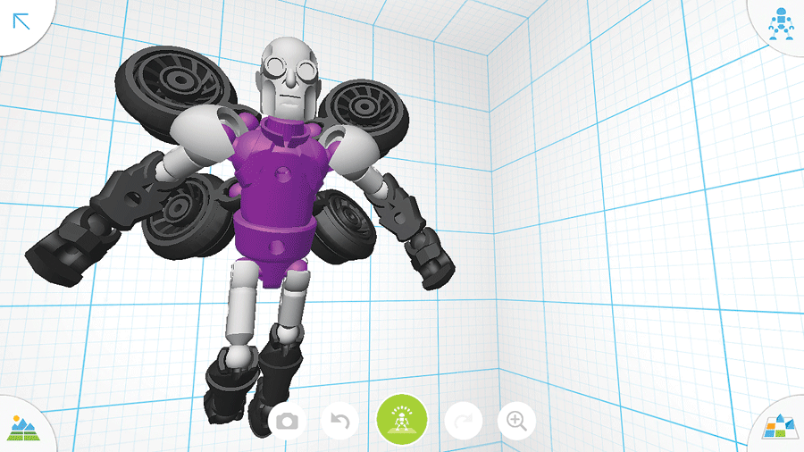
People of all ages and levels of education can access free rudimentary
3D design tools like Tinkerplay. (Graphic: Business Wire)
The Autodesk Developer Network (ADN) opens up the structure of the products to software developers who wish to extend the functionality of the core products to end users whom the company might not have thought of or otherwise pursued. This often involves more than just standard application programming interfaces and can lead to direct collaboration. While very active with regards to packages like Revit, Maya, Navisworks, et al., there is healthy ADN participation in Civil 3D.
360: You will see the term “360” attached to nearly every product line within Autodesk (e.g. 360 cloud, viewer, field, glue, rendering, mobile). The term applies mostly to added cloud capability, either software-as-service options as with ReCap, but also for cloud collaboration tools: multiple parties being able to work on the same designs online. Expect to see much more along these lines (we’ll be running more 360-related content in the near future).
Still More?
It would take a decade after the inception of Autodesk for many users to embrace the concept that CAD was not simply a drafting tool, and even longer to realize that Autodesk was not just writing drafting programs. The realization that the geometry could carry intelligence and could help automate design and engineering is not lost on the new generations. A memo from 1987 touting a new golden age of engineering stated, “Anybody who draws a limit on what our children can achieve is a fool.” The legacy days of CAD were like buying a new shovel, and nowadays CAD can be like buying a robot to do the shoveling for you.
Sure, there were times in the history of Autodesk that seemed like an army of MBAs got a hold of the helm and nearly squelched the controlled chaos that turned an unlikely startup into a world leader. (How many times have we seen that in the tech world?) But misgivings about individual business decisions aside, the offerings are now broader and deeper than ever before.