Comparing systems for real-property management in the Netherlands and the United States
Editor’s Note: the most valuable fiscal investment for many in their lifetime is in real-property; and quite understandably matters of legal and spatial certainty is of utmost importance to property owners, financial institutions, and public entities (for taxation, planning, and land management purposes). Entire industries have been created to address and ensure legal certainty, like title insurance, and the surveying profession serves to ensure both legal and spatial certainty.
Globally there are many varied systems and conventions for ensuring legal and spatial certainty for real property – to protect the bona fide rights of the induvial and corporate land owners, and stewards of public properties. Some employ a formal, centralized form of land registration, and often (especially since the advent of geographic information systems) pair this with a cadastre (or cadaster) – a spatially accurate representation of property boundaries and land information. Such registration/cadastre systems, common in Europe, are growing worldwide.
By contrast real-property management in the U.S. is handled via the recording of real-property records, instruments of conveyance, and of property surveys. Such recording-centric systems are typically handled at the state, or more commonly county level. While many counties have developed parcel-base mapping in GIS, these are used mainly for assessment and land use planning purposes and not as a formal instrument of registration – except in the relative few places that have Torrens systems (which we will cover in subsequent articles). Legal and spatial assurance for properties by a combination of land surveys and land title searches – but not expressly by the public entity.
xyHt is beginning a series of content focused on examining the varied systems, the pros and cons, and how systems were transitioned form one to the other. Would registration/cadastre systems be unthinkable for U.S. states? Perhaps an open dialogue on the subject could answer that question, but first, let’s look at two representative examples of systems from Europe and the U.S.
An accurate and up-to-date record of property boundaries is essential for administering property taxes, enforcing environmental and zoning regulations, enabling owners to use their real estate property as collateral for loans, and resolving boundary disputes. There are several cadastral systems in use around the world. For example, the single national system in The Netherlands differs significantly from the typical system in the United States, where cadastres differ from state to state and, within states, from county to county.
The Dutch System: Kadaster
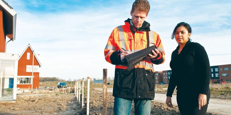
Since 2006, all of The Netherlands has had a single cadastre, land registry, and mapping agency, called Kadaster. Previously, there were 15 separate offices. Ruben Roes is Kadaster’s Chief Registrar. He studied law and worked at a notary office before joining the land registry and becoming a registrar. “My role is to register the deeds that come in and to update their Kadaster registration. It is an object-based registration; we pull into it essentials from the deeds. Kadaster’s base register also includes a cadastral map. My duty is to update the registrations and the map and make decisions if there are complaints.” Parties who do not agree with his decisions or argue that boundaries were not registered correctly can appeal them to a court.
In The Netherlands, all the plots are parcels; therefore, Kadaster does not have to register new parcels. Sometimes, however, parcels are split, or must be changed. There are about ten million parcels and about one million transactions a year—such as conveyances, deeds of ownership transfer, and mortgages. The transactions affect about five percent of the parcels, because usually transfers and mortgages are done at the same time.
Kadaster’s data provides support to the public in making land choices.
“It all starts with the agreement between the seller and the buyer,” Roes explains. “Most of the time, the seller has a real estate agent, who makes up a contract of sale. It is a legal requirement to run every transaction—every deed of transfer or every establishment of real estate rights—through a notary. So, the real estate agent sends the contract to the notary.” Most of the time, the buyer needs a mortgage, so the bank also sends mortgage papers to the notary. The notary then prepares a deed to convey the property and another one to establish the mortgage—and queries Kadaster Online, Kadaster’s online object-based registration. He reviews the map, checks who the owners are, and whether there are any servitudes, attachments, or seizures. Once all of this is done, the parties agree on a date of transfer and make an appointment with the notary. Just before signing the deed, the notary checks whether there have been any changes. Then the notary and the parties sign the two deeds and the notary sends them electronically to Kadaster, with a digital certificate of his signature.
“We flag all the deeds that come in daily, before 9:00am the next [business] day,” says Roes. “So, within just a few hours, everyone knows which deeds are in effect on an object. This guarantees that every deed that came on in this day on the plot is flagged. The notaries can check after 9:00am and pay out purchase sums.” The notary does this only after checking one last time to make sure that no seizures [or liens and other encumbrances] have been put on the property and receiving an electronic message that the registrar has approved the deed. This message of approval (or denial, in one percent of the cases) is sent within 24 hours after the registrar received the deed. “It’s pretty fast, if you compare it to other countries. Our employees then update the registration within six days and alert the owner that the registration has been updated.”

Because the Netherlands is already divided into parcels, new lines are drawn most- ly to split parcels.
Given that the whole country is already divided into parcels, new lines are mostly drawn to split parcels. “There is little space in our cities. So, if you want to sell just a small few square meters, you have to draw a line.” An owner can also transfer part of a parcel. In the Dutch system, transferring a parcel does not require having a definite boundary. “You can draw a line on the map yourself, indicating that this is going to be the new border, and that line is verified after the transaction,” Roes explains. “We send the deed of transfer to our surveyors, saying that there is a transaction transfer of a plot with a line that is drawn as a preliminary boundary. Then they go to the field and measure it and we have a definite boundary in our registration.”
An owner has the option to split his property by creating a new boundary before the deed of transfer is created. A surveyor will then measure the new boundary and write up a description in the field notes. If the owner wants to split his property in two parts and sell one to a neighbor, he can hire a surveyor. If a seller and a buyer have agreed to transfer a part of a parcel, the notary draws the preliminary boundary, creating two parcels with preliminary boundaries, writes up the deed of transfer, and a Kadaster surveyor verifies it, measures it exactly, and describes it. Then Kadaster updates the registration. In Kadaster Online an application called Splits allows users to draw some points on the parcel and split it. It then shows you the square meters on each side of that new boundary. Clicking the “Agreed” button creates two parcels with those preliminary boundaries. Preliminary boundaries require more checks, because there are more parties involved and a description already exists in the deed. “So that’s more about our legal task to verify this boundary, not only to measure it, but also to compare it to the deed and determine whether it is correct. If it’s not correct, our surveyor asks the notary to review the deed and figure out what the parties meant to do.”
In the United States, property purchases require title insurance, in case a problem arises later about ownership of the property. In The Netherlands, that is neither required nor needed. “In our system, registration started as only an index for a collection of deeds and every time a property was conveyed people investigated the chain of titles,” says Roes. “Then, however, it became mandatory to go to a notary, who updates the registration each time. So, the registration became pretty reliable. Politicians decided to add some third-party protection into the system so that people could rely on the public register. Nowadays, the notary guarantees that someone is really the owner of a parcel and that there are no other real estate rights on it. If something goes wrong and the property right doesn’t come into effect, the notary’s insurance has to pay.”
Kadaster does not function like a Torrens system, Roes explains, because in a Torrens system, typically, the state guarantees the registration and The Netherlands does not do that. “The system, however, is pretty reliable, because you also don’t have the problems that sometimes Torrens systems have, that the administrative truth is always the legal proof. That probably sounds a bit lawyerly! Sometimes it is practical to look at what has happened and decide what the legal proof is, and the administration does not always have the last word.” Additionally, he points out, Torrens systems require inheritances to be registered. “In our system, that is a possibility, but not an obligation.”
Kadaster stores all the information about objects, persons, and rights. The object information includes the area, the purchase sum (which is public), and governmental decisions with third party effects. For example, if the land is polluted and the government orders the owner to clean it up, that decision can also be entered into the land register so that a new buyer can see that obligation. “Nowadays, our cadastral objects are linked with other data, such as the addresses of plots for which municipality are responsible,” says Roes. “They have their own databases with addresses and we link them to our objects, so that we have the actual address of each object. We also have a taxation database, which shows the actual value of each plot for taxation purposes. It is open, so that if people want to buy a plot, they can know its fiscal value.”
In The Netherlands, municipalities and big companies hire surveyors if they want to build a new large structure, such as a road. Data from surveyors is also used to reconstruct boundaries. Municipalities use Kadaster’s data to tax owners and The Dutch government uses it to manage policy issues. For example, it may want to know who would be affected by construction of a new road and the value of their properties. “It’s always about connecting several types of data so that the government has an idea of how the problem can be solved,” Roes says. The statistics bureau uses it to write reports for the government. Private companies use Kadaster’s data for a variety of purposes, such as to produce navigation tools using the topographic data it includes. “Our data is open, so anyone can look at it online and use it for their own purposes.”
“We work with the land registrars in all of Europe, so we see different systems,” say Roes. “When you compare our system to others, the most striking difference most of the time is that we are faster in updating the registration. That’s because of the checks that notaries do. When we need to update the register, we only have to do a few checks, but we can already flag the deeds to an object, so that purchase sums can be paid out fast. In other countries, it often takes days, weeks, or even months before purchase sums can be paid out.”

Ruben Roes is Kadaster’s chief registrar.
Notaries are aware that the plot descriptions they see in the registration were probably written years before and may not reflect current reality, but regular citizens may not realize this. “For this reason,” Roes says, “we want to be more specific about metadata, so that people can know what to expect from our data. People are not all legal or geographical experts, so you have to be more specific about what you deliver to them.”
Kadaster has exported their expertise around the globe. Dozens of countries, especially those in the developing world who may not have had any formal systems before, are adopting some or all of the Dutch model. Some countries with existing variations of registration and cadastres have sent specialists to Kadaster on exchanges and for training. Roes colleague Paula Dijkstra, Regional Manager at Kadaster has been a strong proponent of cadastral system development worldwide, co-founded the FIG Young Surveyors Network, and incidentally was honored as one of xyHt’s 40 outstanding geospatial professions under 40 in 2017.
Multnomah County, Oregon: DART
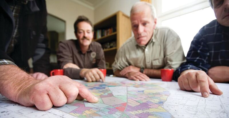
Tim Mercer is the GIS/Cartography/Parcel Management Supervisor for the Department of Assessment, Recording & Taxation (DART) of Multnomah County, Oregon, with Portland as the county seat. Portland rank 18 in the U.S. by combined statistical area (CSA) and is the largest in Oregon. He supervises four GIS technicians and three assessment and taxation technicians. He has been a cadastral cartographer for about 16 years, working for three different Oregon counties as well as the state’s Department of Revenue.
In rural counties, the majority of development consists of individual large parcels, or large subdivisions, often with a dozen or more lots. By contrast, in Multnomah County, which has little undeveloped land, there are few large tracts, and subdivisions may contain a great number of parcels, and many more condominiums, including very large ones—far more than in all other counties in Oregon. “The bulk of the city of Portland was subdivided in the early 1900s,” Mercer explains and over the years many lots were combined and traded as single units of land. In recent years, the trend has reversed: “A lot of the development nowadays consists of taking that one piece of land and turning it back into two or three. Much of the development we see is small scale like that. We process a lot of partition plats. In Oregon, a partition plat is a type of plat formalized in statute. It can only be up to three lots.”

Before the County converted maps to CAD in the late 1990s, paper maps were living docu- ments that were main- tained for decades.
Multnomah County’s cadastre consists of two separate databases: a GIS database and a CAMA (Computer-Aided Maps Appraisal) system, which is the assessor’s database. “For many reasons, we’ll do merges of those data to create GIS data that has a lot of the assessor’s data in it. We do that on a weekly basis to create a product that people can use in GIS applications, including Web-based applications.” One example is the City of Portland’s Portland Maps product, which uses the value-added tax lots that the county creates on a weekly basis.
Unlike in many of the state’s 36 counties, in Multnomah County the assessor’s office and the recording office are combined. The process of updating the cadastre varies, depending the type of update. Simple conveyances that do not involve changes to property boundaries are primarily handled by a different group. At the front counter, citizens and title companies record deeds to transfer property. “That document then goes to an ownership group who will look at the legal description and compare it to the legal description in our cadastre,” Mercer explains. “They’re not looking at the map; they’re looking at the legal description within our database. If the two matches, they process that ownership transfer.”
However, there are plenty of reasons why the two records might not match. Most often, it is due to human errors, such as typos. Consolidations—a type of action in which an owner of two contiguous lots combines them into one—can also create problems. “A consolidation is not a recorded document so it doesn’t show up in the public record, often it doesn’t make it to a title company and into their title plant,” Mercer says. “So, when they go to do the conveyance, maybe they only convey one of the two legal descriptions.” Similarly, property line adjustments create problems when they don’t make it into a title plant. “When the title plant goes to pull the description, they pull the old description previous to the lot line adjustment and that produces an error.” The county’s owner group reviews and resolves these discrepancies, often after consulting with Mercer’s GIS techs, who are cadastral cartographers and thus experts in how to read legal descriptions and reference maps.
Simple conveyances rarely require a new survey. However, property line adjustments and lot segs—short for segregation, the process through which two or three old lots that have been trading as one economic unit are re-formalized as two or three lots—often require the involvement of a surveyor and we’ll get new descriptions that match the new survey. Likewise, whenever a new plat is surveyed and recorded, it becomes part of the public record.
Disputes between owners on the exact location of a property line often also require a survey. “Frankly,” says Mercer, “we’re a pretty urban area, so we don’t deal with the volume of those that you might see in more rural counties around Oregon, where a fence could be off by few, to dozens, or even hundreds of feet. Don’t get me wrong; we field phone calls and customers at the counter very regularly who say, ‘I don’t think our fence is in the right location’ or ‘I need a map to prove where my fence is.’” In those cases, Mercer and his staff have to explain the purpose and limits of the maps they make. “We don’t proclaim that our maps are good for other purposes. Likewise, it is the job of a surveyor to take our maps or other surveys or deed documents and figure out where that stuff is on the ground.”
The legal descriptions are based on measurements from survey markers, which are part of a network. “The network, in Oregon as well as in most states in the country, is based on the public land survey system (PLSS),” says Mercer. “You start with that, then you start laying other known things on top of it,” such as corners from recorded plats. “It’s part of the public record, it’s a physical thing on the ground that we can go locate, and we know its relation to other points that are part of the public record.” Corners in a surveying sense are usually markers in the ground, set by surveyors, such as pieces of rebar, iron pins, or nails and caps set in concrete, which hopefully will stay there forever. “We have corners that are part of the [original] Public Lands Survey System (PLSS), and then we have corners that come off recorded plats, and you start building this framework of known points that we can see in recorded documents and locate on the ground. To properly write a legal description, you should reference at least one of those kinds of points.” [Ed: preferably at least two to establish a basis of bearing]
Since at least the 1950s, Mercer points out, every tax map that Multnomah County has produced has had this disclaimer at the top: “For assessment purposes only.” State statutes require them to produce maps for assessment purposes that show property boundaries and tie them to owner names. “We do that through a tax lot number.” Those statutes do not specify such parameters as scale or other mapping specifics. “However, we have other statutes that speak to our other business processes. The statutory requirements for assessors’ maps are minimal, so we’re trying to create a map that really drives our business internally. The duty of the assessor is to produce an accurate tax bill every fall. We’re trying to produce maps to do that. Our maps are good for engineering purposes. They’re not for trying to figure out where to locate your fence, although plenty of people try to use them for that.”
DART publishes PDF versions of its maps, which get very little use, and polygons for use in GIS, which are used a lot. “Anybody who does GIS within Multnomah County is using our polygons.” For example, they constitute a layer in the Regional Land Information System (RLIS) created and administered by the regional government, Metro.
People often will try to use GIS applications that use DART’s data for purposes for which that data is not suited, such as determining whether a crime that occurred close to a property line took place on one property or the other. “We didn’t build that data to answer that question,” says Mercer. “We used to have hand-drawn maps and now our product is used by all kinds of people in GIS applications to make decisions. We don’t proclaim it to be survey grade. It doesn’t need to be survey grade to meet our business needs or our statutory requirements or even the ORMAP requirements.” ORMAP is a statewide effort begun by state legislation passed in the late 1990s that gives grants to assessors’ offices to improve their GIS data. It is funded by a one-dollar fee on every document that’s recorded in every county in Oregon and requires national accuracy standards for tax lots
About a third of Oregon’s 36 counties don’t have a cartographer in their assessor’s office and contract out the job of maintaining tax maps, in many cases to the state’s Department of Revenue. About another third of the state has only one cartographer per county and often that person wears other hats, such as being the lead appraiser. In Oregon, Washington, and California the assessment function is at the county level and the county assessor administers the property tax system. In a few states, such as Kansas, some of those duties are at the state level. “On the Eastern seaboard, many systems are at a smaller level,” Mercer says. “For instance, in Massachusetts, the cities carry many of the functions that we would see here at the county level.”
Multnomah County’s Surveyor and Assessor Image Locator application (sail.multco.us), is a GIS interface that catalogs all the recorded surveys and plats in the history of Multnomah County as well as all of its assessors’ maps. There is also a mobile version of this. “The next frontier of cadastral cartography is all about sub-parcel mapping,” Mercer opines. “We’ve made a business decision not to map the details of condominiums. We make sure that there’s a placeholder polygon in our GIS data set so that we have a one-to-one relationship between the tax lots in a condo and the polygons, but we don’t take the time to actually map their true footprint or of the individual units.” It would be extremely time consuming to do, he explains, and would yield only very minimal value from a business perspective.

Tim Mercer is the GIS/cartography/parcel management supervisor for DART in Multnomah County, OR.
A lot of DART’s business is sub-parcel, Mercer points out. “For instance, you might have a large office building. In Oregon, we tax personal property, which is all the stuff that a business owns that is not for sale, such as office furniture, computers, and art on the wall. It’s depreciated, the way you would do if you had a business income tax. We don’t have good ways to audit, to find out which businesses have filed and which have not, especially when new businesses start up. We don’t always know geographically where that business is at other than an address.”
“The future of our work is 3D sub-parcel mapping,” says Mercer. “The tools aren’t quite there yet to make it time-efficient to do that. We would know that particular personal property is on floor 12 and in this corner of the building, and maybe we’d even have a 3D GIS application where we could see it and pull up some pictures. In our current application, we can turn on some aerial photos and lay the text outlines over the top.” You can read more about the subject of 3D cadastre in the xyHt article.
A few small areas of in the United States use a Torrens system, in which a county registrar keeps a register and property owners who want to update a deed go there and change the registration to the new name. In Oregon and much of the United States, however, the deed is the transfer document. It is recorded and made part of the public record, so that everybody can see it. “So, there is no updating the registration or updating the deed; you’re simply recording a new deed that completes that transfer,” Mercer says.
Contrasts
Both systems work, may work well, or in some instances not-so-well; but success may be more of a function of how well a system is run that the type of system. Formal cadastres have grown in their appeal globally, and the subject has been finding its way into dialogues on land systems in the U.S. and other countries with similar transactional recording systems. The systems share more similarities than differences concerning the role of surveyors.
Are existing local-level systems, developed under the limitations of analog solutions, to big and complex to adapt to the modern era of rapid and efficient surveying and digital registration systems and mapping? Would the cost savings of a registration system (e.g. less need for title insurance and transactional research) outweigh the cost of system administration or be a wash? These are the kind of questions to be considered; but first we will provide more examples of various systems (e.g. Torrens) and how the varied systems work in future issues of xyHt.
To read the rest of the articles in this print issue, click on the issue cover, below.