All posts by Nicholas Duggan FRGS Cgeog (GIS)
Robots
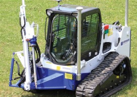
Above: GPS-controlled robots can measure a site fully automatically and precisely anchor screws for the foundation of a solar plant. Measuring and Anchoring As a child I used to watch a program on BBC television called Tomorrow’s World. Once in 1981, I sat in awe as it showed a snooker-playing robot. My dreams were filled with...
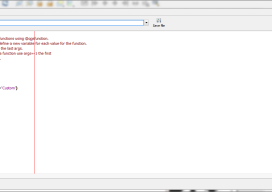
Dynamic Text with QGIS Layouts
It’s not until you need it that you realize how much you miss it: such is the case with the Esri ArcGIS dynamic text functionality. On the surface it seemed easy to put a little reference into a text box, and then every time I opened a template or new map it would automatically show...
Esri UK User Conference
May 22, QEII Building, London UK With a venue overlooking Westminster Cathedral and a stone’s throw from the Houses of Parliament, Esri couldn’t have picked a more British location for the UK annual conference. Last year (2014), there were a little more than 1,000 delegates; this year Esri UK played host to over 2,000, and...
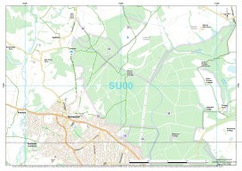
Should We Be Reading Maps or Moving Forward?
There has been a lot of press recently about an announcement from the Royal Institute of Navigation (RIN) declaring that “Society is being sedated by software,” and it would appear that most of the media have jumped on board, like the BBC, The Guardian, even the Western Morning News. I have to agree with them...
How to Add Transparent Text to ArcGIS in 4 Easy Steps
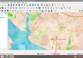
ArcGIS is a great piece of software but has some small functionality missing which, to a cartographer or perfectionist (like myself), can be a little frustrating. So I was really pleased when I discovered a way to create transparent text, something which has eluded me for a long time in ArcGIS. Lets consider this map:...
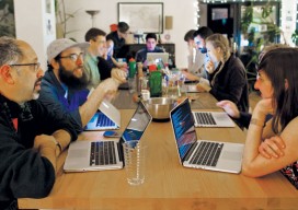
Maptime
A new source of support for mapmakers is spreading internationally. With so many sectors and niches, the spatial/IT industry was falling into silos. Then, seemingly from out of nowhere groups started appearing, first in the United States and then in Europe, under the label “Maptime,” in a similar fashion to the hackathons a decade ago. ...