
Blog

The Rise of Value-packed RTK
Barriers are being removed for adaptable and inexpensive, high-precision GNSS. Many of you may be familiar with traditional base-rover applications for RTK such as surveying and mapping—with precision that typically comes with a large price tag. However, Swift Navigation provides a multi-frequency, multi-constellation, fully RTK-capable GNSS receiver called the Piksi Multi with a smaller price...
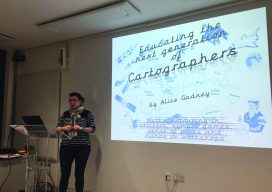
Mini Map-Makers
Cartographer “Captain Alice” teaches children to read and use maps as a communication tool. Alice Gadney believes her cartography business, Silver7 Mapping, is designed “to help people understand the world around them and their need for a great communications tool—the map.” And when she says “people,” she’s also including youngsters, starting with her five-year-old son,...
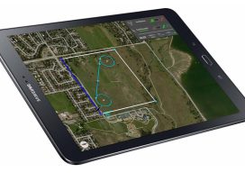
More Than Just Autopilot
Your UAS flight management system affects accuracy in photogrammetry, so get to know what you need. Unmanned aircraft systems (UAS) are arguably the most disruptive technology introduced to the geospatial profession since GPS. Advances in UAS capabilities and in photogrammetry software have significantly reduced the barrier to generating digital surface models (DSM) and orthomosaics from...
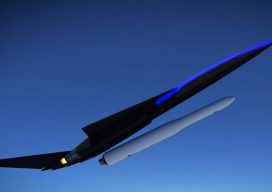
Revolution #3: Drone-launched Rockets
Think of it as a revolution inside a revolution tucked inside yet another revolution. Revolution #1: ground-based reusable rockets as exemplified by rocket billionaires Elon Musk’s SpaceX and Jeff Bezos’ Blue Origin. The reuse of launch vehicles is lowering barriers to space flight. Great stuff! Revolution #2: air-launched rockets. A shining example is Paul Allen...
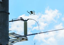
Cooperative Effort Takes Off
Tapping into UAS technology creates possibilities for a northern Arizona utility. Sometimes, the most effective, revelatory, progressive solutions to a problem can be found in the unlikeliest of places. Case in point: three and a half hours north of Phoenix in the city of Lakeside, Arizona, an electric cooperative that serves more than 33,000 member...

Weekly xyHt News Links: 09/7/2018
Digital Twinning and the Complexity of Reality Leica Microsystems Opens First Ever Imaging Center in San Francisco Radiant Earth Foundation Releases First Earth Imagery Platform for Global Development Trimble launches new model of R10 GNSS system for land surveyors Laser Technology offers improved rangefinder with compass EOMAP launches online shallow-water bathymetry store Phase One Industrial...
Advertisement