
Blog
LiDAR for Forestry
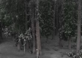
Sponsored by Green Valley Finding DBH Values from Handheld Mobile LiDAR GreenValley International’s (GVI) LiBackpack provides mobile terrestrial and handheld LiDAR solutions that allow users to efficiently capture 3D data. As part of our LiDAR in Forestry applications series we investigated the accuracy of diameter at breast height (DBH) measurements extracted from LiBackpack data using...
Geomatics STEM Outreach – NM State Prep Academy
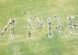
Editor’s note: With all the talk among surveying and geospatial practitioners and the professional associations and societies about outreach, succession planning, and recruitment, it is great to see examples of action from across the country. Here is a great model for other state societies to emulate from New Mexico, courtesy of David Acosta, PS, president...
Founder of QGIS: Gary Sherman
An Interview with Gary Sherman If Roger Tomlinson is considered the father of GIS, then Gary Sherman is one of the godfathers. He started building a GIS to solve a particular problem, and it has since grown into the world’s most-popular free GIS: QGIS. Gary doesn’t often give interviews, so when he agreed to do...
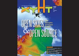
xyHt Magazine September 2018 Issue
Click on the cover below to view the September 2018 issue of xyHt magazine. Articles in the issue include (links will turn live throughout September): QGIS: What Is It and How Does It Work? – An introduction to QGIS by Nick Bearman, noted GIS trainer and consultant at Geospatial Training Solutions and teaching fellow. QGIS...
QGIS: What Is It and How Does It Work?
Editor’s Note: Nowadays everything costs, whether you are a solo practitioner, in a small business, or part of a large firm seeking to expand. You buy a new laptop, you need an operating system, then office software, then a broadband subscription; the cost keeps escalating. Are you bound to this legacy progression of costs? Not...

Weekly xyHt News Links: 08/31/2018
Hexagon Partners with Clevest to Improve Utility Field Operations Topcon announces acquisition of ThunderBuild Topcon introduces new software for UAV inspection applications Trimble Launches New Model of its R10 GNSS System for Land Surveyors The Spry: The First Waterproof Drone That Submerges, Floats Like a Boat, and Flies in the Air Geneq Inc. Announces F90...
Advertisement