
Blog
BVLOS
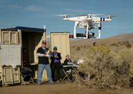
Beyond visual line of sight is the next frontier for UAVs. The FFA’s Part 107 rule allows for routine civil operation of small unmanned aircraft vehicles (UAV) in the National Airspace System (NAS) and provides safety rules for those operations. Since this implementation almost two years ago, more than 70,000 drone pilot applications have been...

Weekly xyHt News Links: 05/04/2018
Insitu Integrates Customized TK-5 Firewatch Smart Mapping Payload on ScanEagle UAS Insitu Debuts ScanEagle3 Unmanned Aerial System at Xponential 2018 Vista LiDAR Sensor Unveiled for Autonomous Vehicles Fortress UAV Announces New Drone Fleet Services for Enterprise and Public Safety Markets DroneDeploy Releases New Construction Solution to Put a Drone on Every Construction Site CEE News...
Open Source for Enterprise Solutions
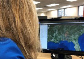
A geospatial firm integrates open-source GIS and cloud services for the DoD’s IT security, a giant energy co-op managing 2,500 miles of transmission lines, and the USACE as they monitor dredging vessels. Too often, clients maintain outdated and inefficient workflows because they fear that building applications to improve processes would be too time-consuming and expensive....

An innovative approach to service. A growing need for robust, relevant data.
With Trimble Catalyst Mobile Data Capture, City of Centennial Efficiently Proves GIS Accuracy Sponsored content by Trimble Since 2008, the City of Centennial, Colorado has partnered with global engineering company CH2M to manage its public works. The successful public-private partnership, often cited as a model of small government, has allowed the city and CH2M...
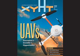
xyHt Magazine May 2018 Issue
Click on the cover below to view the May 2018 issue of xyHt magazine. Articles in the issue include (links will turn live throughout May): Open Source for Enterprise Solutions – A geospatial firm integrates open-source GIS and cloud services for the DoD’s IT security, a giant energy co-op managing 2,500 miles of transmission lines,...
Weekly xyHt News Links: 04/27/2018
TerraGo Adds Time-Series Visualization to GeoPDF® Hemisphere GNSS Announces Family of Rugged Handheld Devices for Mobile Applications DT Research’s new military-grade tablet has RTK GNSS Topcon acquires outstanding Viasys VDC holdings Bentley Systems Acquires Plaxis, and Complementary SoilVision, to Integrate Geotechnical Engineering within Digital Workflows for Infrastructure Projects
Advertisement