
Blog
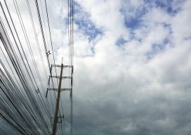
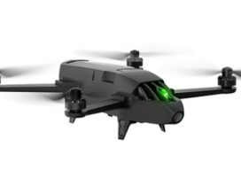
Powerline Inspection
Drone? Ground? Helicopter? For years now drones, UAVs, UASs or whatever you wish to call them have been the revolution that promises to change the way we live. Five+ years into the drone revolution we are seeing some change—but it has certainly been a slower progression than expected. Linewise Aerial specializes in transmission line inspection...
Low-cost Tech for Aerial Archeology, Part One
Last February we took a look at how airborne lidar is revolutionizing the science of archeology in Lidar and The Lost City of the Monkey God. Lidar is nothing less than a godsend for the search for lost cities and civilizations. But it comes at a price, one that cash-strapped archeologists can’t always afford. I’d...
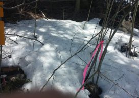
Law & Order
The sunlight had magically poked through the winter aspen forest in such a way as to warm through two areas in the snow, both of them survey monuments lying about four feet apart. One was a 3 and 1/4-inch aluminum cap, stamped with the surveyor’s state license number, posted with a government-issued, yellow “Forest Service...

Weekly xyHt News Links: 04/20/2018
SimActive Automates Drone Data Processing Exact Metrology Introduces Artec Ray Laser Scanner Teledyne Optech to showcase its Airborne and Terrestrial survey systems at GEOINT 2018 ENGINEERSUPPLY ANNOUNCES NEW PRODUCTS FROM SCHONSTEDT SPAR 3D Expo & Conference 2018 Keynote Speakers Announced Trimble Announces New Field Solutions for Land and Construction Surveying New Indoor Mobile Mapping System...
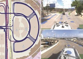
Huge Airport, One Vehicle
Inventory of roadway and airfield assets, including pavement surfaces, using the “One Vehicle” collection approach. Dallas Fort Worth International Airport (DFWIA) is the second-largest airport by land mass (27 square miles) in the United States and the third-busiest airport in the world by aircraft movement.It can easily be considered a city of its own. With...
Improving GNSS in the Urban Canyon
To prepare you for the this blog post, I wish to point out that I am a geospatial expert and can hold my own around the ins and outs of survey, so going to an event at the Ordnance Survey on “3D mapping for the improvement of GNSS in urban areas” was an eye-opener. You...
Advertisement