
Blog
The Practice of UAS
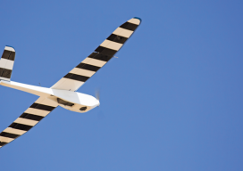
Above: An Altanvian employee tries out their newly redesigned Nova 7200. Advice from a pro on introducing UAS into your practice. UAS are quickly transforming from cutting-edge to standard tools for geospatial mapping and surveying. How will your firm be competitive and turn this technology into a profitable business? Get Smart about Regulations The greatest challenge...

xyHt News Links: 5/6/16
Global Aerospace Announces Insurance Program for AUVSI Members FLIR Announces Vue Pro R Radiometric Thermal Camera for Commercial Drones Stampede Debuts Industry’s Most Complete UAV Product Line And Support Programs At XPONENTIAL 2016 AeryonLive: Drone Fleet Management Platform for UAVs Top Gear USA Captures Rubicon Trail in 360 Degrees INTERGEO Preview 2016 SelectTech GeoSpatial, LLC Launches...
Distinguishing Features
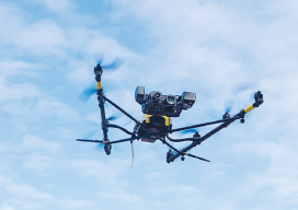
Inside the unique design of the Falcon 8 I must confess a little bit of UAS fatigue. Among the flood of new UAS, it takes a bit of research to find distinguishing features. It does make sense at one level that a basic form might evolve from so many parallel development efforts, but it makes...
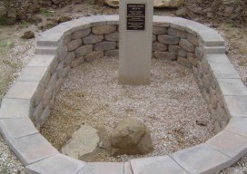
Crown Stone Dedication – 250th Anniversary of the Mason and Dixon Line Survey
The Mason and Dixon Line Preservation Partnership (MDLPP) will unveil a CrownStone set on the border of Maryland and Pennsylvania by Charles Mason and JeremiahDixon, 250 years ago. The Crown Stone was lost and had not been seen for over 110years. A replica Crown Stone, showing how the original stone looked when it was set,...
What Is a Professional Land Surveyor?
As I was recently completing the comprehensive NSPS questionnaire developed as a follow-up to the Forum on the Future of Surveying (see Multiple Choices by Gavin Schrock, PLS), I found myself contemplating the many descriptions of land surveyors included along the way. After completing the questionnaire and providing some personal feedback, I couldn’t help but...
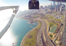
Closer Than It Looks
Above: High-definition mapping sensors (lidar, digital, and oblique imagery, here mounted on a helicopter during collection of an autonomous vehicle mapping project) provide an accurate, cost-effective approach to limit the interference and potential delays related to collecting extensive control on a right of way. A hybrid of geospatial technologies could help autonomous vehicle mapping drive...
Advertisement