Category Archives: Aerial/UAS
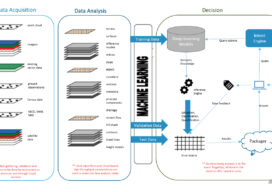
How Deep Learning For Remote Sensing Produces Quicker, Higher-Quality Results
As the volume, velocity, and variety of the data generated to address worldwide geospatial needs has steadily grown, advances in the systems and algorithms needed to produce spatial and temporal resolution data have not kept pace.
Thinking Ahead
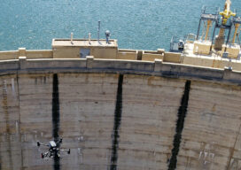
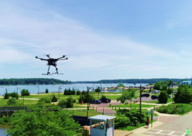
From mapping catchments to inspecting dams, there’s a solid future for UAS technology at public utility companies like the Salt River Project in Arizona
Walden Environmental Engineering Captures New Insights and Revenue
Emesent Hovermap was used by Harkin Aerial to conduct internal and external scans of assets for Walden Environmental Engineering. This resulted in simplified and streamlined projects with improved efficiency.

The State of MAPPS
Rapidly moving forward in a pandemic and beyond It has been an exciting year in the MAPPS community! While much of the nation was somewhat idle, our MAPPS members were actively supporting our nation’s needs from our offices, at job sites, and remotely at our homes, fulfilling needs emanating from federal, state, and local government...

Seeing the Trees and the Forest
How airborne lidar and hyperspectral imaging helps improve America’s green space and, ultimately, our quality of life
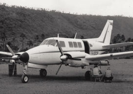
Looking Back
Using a single-beam laser to create a mapping profile in the Amazon jungle was a hint at aerial technologies to come