xyHt in print, April 2016 Archives
Reality Capture in 2016

An overview of criteria for obtaining and processing 3D data today. Above: Reality Capture has always played a role in the safety factor for surveyors and data collectors. Image courtesy of Olsson Associates. Ten years on, 3D and BIM are the de facto standards for design. It took firms a long time to recognize the […]
3D Cadastre
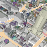
How to promote 3D land administration for a 3D world. We live in a 3D world, so shouldn’t we be basing decisions on 3D data? When people think about the word “cadastre,” they might envision a two-dimensional map of boundaries, but there is more to the concept of a cadastre than who owns what. There […]
Virtual Desktop Infrastructure

VDI allows you to scale your computer performance based on your current needs, with each project administered and managed through central management consoles. The geospatial industry has seen an incredible jump in the use of technology over the last 20 years; however, the way that we interact with technology at our offices and in our […]
(Nearly) Symbiotic

Above: A 3D laser scan inside a facility, which will be processed into a BIM 3D model. Credit: 3CON, LLC BIM is quickly advancing for construction and survey. As long as humans have built environments, they have been surveying. And as the human imagination has spurred increasingly complex constructions, land survey tools and techniques have […]
Multiple Choices

Forum on the Future of Surveying enters its initial feedback phase. This new column provides monthly coverage of the Forum on the Future of Surveying (FFOS)—a national initiative with representatives from 15 key surveying-related associations—to examine paths forward for the profession. See the first installment in our March issue. Now the initial report of the […]
BIM: Scaling the Challenges of a Curtain Wall

Layout for a high-rise curtain wall in Hawaii is dramatically streamlined with a 3D scanner paired with BIM software. It’s difficult for a structure to stand out on the Honolulu waterfront—the area is one of the busiest, yet most beautiful, on the island of Oahu. Home to Waikiki Beach, exclusive marinas, a breathtaking view of Diamond […]