Tag Archives: gnss
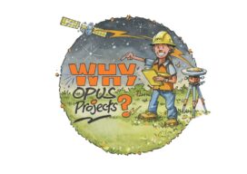
Why Opus Projects? Part 1 of 2
Part 1 of 2The new version of the NGS suite of Online Position User Service tools simplifies many tasks By Philippe HenselWith Dan Gillins, Dan Martin and Julie Prusky NOAA’s National Geodetic Survey (NGS) continues to improve its suite of Online Position User Service (OPUS) tools. In addition to single-point processing, OPUS offers a web-based...

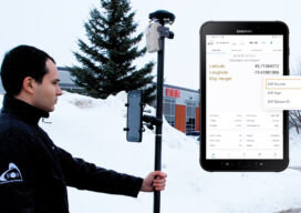
What’s Inside Your GNSS Rover? Part 1
The venerable GNSS rover, has evolved into an essential part of a surveyor’s toolkit, although some mystery remains as to what that magic box does and how it does it. To demystify this, we engaged GNSS engineers to help craft this three-part “explainer” series. Part one The work of a surveyor requires a lot of...
Is It Really Impossible?
Looking Forward As the saying goes, it’s only impossible until it’s not. In the past when I’ve heard, or used, this bon mot I would think of the moon landing in 1969. I think of all the early astronomers who gazed at and intensely studied heavenly bodies, using them for navigation and location while knowing...

xyHt Digital Magazine: September 2023
xyHt magazine’s September issue goes inside the GNSS rover to see exactly what’s in it and reveal how the technology works its magic. As always, if you don’t have a subscription to our print edition, or if someone else in the office has snaffled your copy, don’t fret, here is the digital edition. Click here or...
xyHt Digital Magazine: July/August 2023
xyHt magazine’s combined July/August issue focuses on geographic information systems and and how the science has made its way into many aspects of our existence—how it is helping now and how it will help in the future. As always, if you don’t have a subscription to our print edition, or if someone else in the...
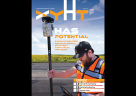
HAS Potential
Free and Global: The new high accuracy positioning service (HAS) of the Galileo constellation and its advantages for GIS and asset mapping If you consider field mapping applications, such as for GIS, asset inventory and management, and field operations for utilities, how wonderful would it be to have sub-foot positioning in real time, with no...