The last time I visited the AUVSI conference was about 10 years ago. I remember walking into the show and thinking, “Did I just accidentally walk onto a military base?” The exhibits were populated with Predators, Reapers, and at least one Global Hawk. Every other attendee was dressed in their best camo BDUs. Not judging, just observing.
This year, although there were plenty of uniforms, not a Predator was in sight. Boeing, Lockheed Martin, and Northrup Grumman were all in attendance; however, their offerings demonstrated their collective pivot to the commercial market: swords into plowshares, if you will.
Let’s back up. What is AUVSI? Direct from the website: “The Association for Unmanned Vehicle Systems International is the world’s largest nonprofit organization devoted exclusively to advancing the unmanned systems and robotics community.” Every year they hold a giant conference called XPONENTIAL. This year the conference was held in Denver, Colorado, and featured more than 750 exhibitors displaying their products and services to more than 8,500 industry professionals. What’s more, the event offered more than 200 sessions on a wide variety of unmanned subjects.
I’ll focus on the surveying and mapping subset; here’s a small sample of what I saw.
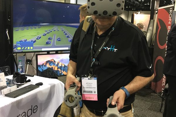
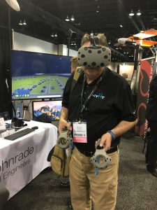 Virtual reality with BIM, CAD, and UAS-derived imagery. Wohnrade Civil Engineers is a Colorado civil engineering consulting firm that incorporates UAS in its workflow. The big news is that they are taking the next step by combining UAS-derived ground data with 3D CAD images, including BIM data, into eye-popping VR. Here I’m taking the system for a test drive. One-word reaction? Wow! There are a number of great applications for this technology, ranging from land-use entitlement review to marketing subdivisions and homes. I’ll stop right here; I want to talk about this at greater length in xyHt’s Unmanned and Unlimited later this year.
Black Swift Technologies’ new Black Swift S2 UAS. Wohnrade’s go-to UAS is the Black Swift S1. The team at Black Swift has just introduced its Black Swift S2 UAS, specifically designed for atmospheric and Earth-observing scientific field campaigns. This advanced aerial platform was developed and refined in partnership with NASA and University of Colorado – Boulder Integrated Remote and In Situ Sensing (IRISS) and consists of the airframe, avionics, and sensors specifically designed to measure atmospheric parameters (e.g., temperature, pressure, humidity, and 3D winds) as well as carrying up to 2.3kg (5lbs) of additional payload.
UAS tethering moves forward. We’ve talked previously about the advantages that UAS tethering offer. More proof is to be found in the work being done by CyPhy Works. The firm specializes in tethered drones for the defense, public safety, and commercial sectors. CyPhy’s leading product, the Persistent Aerial Reconnaissance and Communications platform, or PARC, combines a patented tethered design with unique capabilities that help industries such as defense, security, agriculture, construction, law enforcement, and mining achieve their goals. Here’s how PARC is used in construction and mining applications.
Watch for the June issue of xyHt for still more coverage.
This article appeared in xyHt‘s e-newsletter, Pangaea. We email it twice a month, and it covers a variety of unusual geospatial topics in a conversational tone. You’re welcome to subscribe to the e-newsletter here. (You’ll also receive the once-monthly Field Notes newsletter with your subscription.)