
Blog
Atlas Obscura
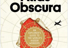
Fall is a great time for travel: the weather’s cooled off, the youngsters are back in school (and not clogging up the national and state parks), and, as a bonus, there’s the fall foliage to enjoy. Back in the day (you know, before the advent of smartphones and digital maps), I used to rely on...

Weekly xyHt News Links: 09/21/2018
Women’s Geospatial Forum Now On GeoNet Mapping indoors with a smart phone Aceinna launches open-source GNSS+IMU development kit for drones, robots University research uses smartphones for precision GNSS Trimble Adds Galileo and BeiDou to its VRS Now Service in North America INTERGEO report 2018 3DR Launches Site Scan Esri Edition

In The News: A Geospatial Year at Woolpert 2017-2018
Woolpert has been in business for 107 years, building a strong, broad-based foundation through engineering, surveying, mapping, photogrammetry, lidar collection, GIS, etc., to provide the most comprehensive geospatial support in the industry. In the past year alone our work in each of these sites, represented by these red dots, were spotlighted in the press. They...
Weekly xyHt News Links: 09/14/2018
3 geospatial events combine to form Geo Week Jan 25-31, 2019 LTI Partners with Eos and Esri to Develop World’s First Laser Offset Solution That Transforms How Field Crews Collect Data National Geodetic Survey 2018 Webinars senseFly launches the eBee X fixed-wing drone, allowing operators to map without limits

Continuing Ed Outside Your Comfort Zone
Learn new skills by taking continuing education seriously. Since its inception in the geomatics arena in the 1990s, the requirement for continuing education (also called continuing competency) has had the aura of a penalty rather than an opportunity. Obtaining legislative approval in many states for the continuing education requirement was difficult. Getting courses approved for...

The Rise of Value-packed RTK
Barriers are being removed for adaptable and inexpensive, high-precision GNSS. Many of you may be familiar with traditional base-rover applications for RTK such as surveying and mapping—with precision that typically comes with a large price tag. However, Swift Navigation provides a multi-frequency, multi-constellation, fully RTK-capable GNSS receiver called the Piksi Multi with a smaller price...
Advertisement