
Blog
Above the Mud
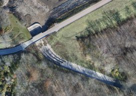
An orthographic image of the exposed spillway at Geode State Park in Iowa at 1″ ground sample distance. To improve water quality in a 500-acre state park, drones are key for surveying drained lakes and the surrounding watershed. Improving water quality is a key part of the Iowa Department of Natural Resources’ (DNR) mission. Planning...
3D Cities from a Single System
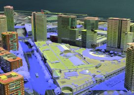
Above: This screenshot is of CityMapper output. A look at the hybrid airborne system that combines lidar with oblique and nadir imagery. Over the last five years I’ve built and used a lot of 3D GIS and BIM models. Almost all of this has required the capture of stereo imagery and oblique imagery and a...
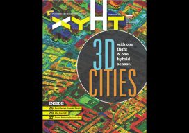
xyHt Magazine December 2018 Issue
Click on the cover below to view the December 2018 issue of xyHt magazine. Articles in the issue include (links will turn live throughout December): 3D Cities from a Single System – a look at a unique hybrid airborne system that combines lidar with oblique and nadir imagery. Who Does SUE? – Subsurface utility engineering isn’t really engineering;...

Weekly xyHt News Links: 11/30/2018
Topcon Introduces ‘Infrastructure and Technology’ Documentary Series Septentrio boosts its portfolio with mosaic GNSS module Federal Geographic Data as a Strategic Resource Topcon introduces ‘Infrastructure and Technology’ documentary series LiDARUSA Announces Z+F Mobile Systems Leica Geosystems offers new Utility Surveyor Course GeoSLAM Adds Indoor and Outdoor Handheld Scanner to Product Range Bentley Acquires Machine...
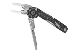
Gift Ideas for Geospatial Pros: Nifty, Thrifty, and under $50
Once again we offer up some gift-giving ideas for the geospatial professional in your family or circle of friends, or just to treat yourself—you deserve it, right? The links for each item below all go to Amazon, but choose your own vendor. Prices are accurate at the time of writing. Also, check out the Located...
Weekly xyHt News Links: 11/23/2018
vHive Releases Autonomous Drone Solution for Complex Cell Tower Inspection Avineon Completes Acquisition of InfoGeographics, Inc. Sonardyne leads ocean autonomous systems collaboration project AMW Solutions Announces Availability of PIPE and DITCH Machine Control Products
Advertisement