
Blog
Geodetic Control over Time and Space in California
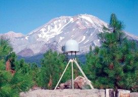
Interview with Scott Martin, Chief of Geodetic Control and GNSS Surveys, California DoT Above: UNAVCO/PBO station P655 with Mt. Shasta in the background. Matteo Luccio: Scott, what is your relevant background and what is your current role? Scott Martin: I’m a state employee with the California Department of Transportation (Caltrans), in the Office of Land...
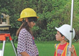
Certifications or Licensing? The Future of Surveying
Part 1 Editor’s note: What will regulation, certification, and licensing of the surveying profession look like in the near and distant future? Surveying is and always has been molded by external influences: markets, technologies, economic conditions, demographics, and competition from outside of the profession. Other professionals, consumers, and prosumers have found that the legacy mysteries...
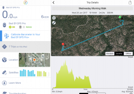
A Good Day with a Bad Elf
It was a beautiful early summer day, ideal weather to take a road trip to the Pike National Forest about an hour from my Eastern Colorado home. Pike National Forest comprises 1,106,604 acres southwest of Denver and is a frequent haunt of mine for camping, off-roading, and in past years dirt biking and ATV-ing. This...

xyHt Weekly News Recap: 7/14/17
From the International Cartography Conference (ICC 2017) ‘Maps Are Alive’: Highlights from the Esri UC plenary
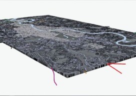
Multipurpose GIS with ArcGIS Pro
You can now use point clouds and massive geospatial data with GIS through the web and your desktop with new software. Above: London rendered in 3D with London Underground data. For years, point clouds (lidar, laserscan, and multibeam) have been pretty useless to GIS users. When a GIS user had to analyze the data, often...
xyHt Weekly News Recap: 7/7/17
Tersus launches a ‘new generation’ NeoRTK system senseFly announces worry-free service package to keep professional drone operators flying Surveying the World of Tomorrow CompassCom to Release CompassTracker App for iOS & Windows Mobile Smart Phones at Esri User Conference Trimble Catalyst high-accuracy, on-demand geolocation service now available worldwide Quorum Launches myQuorum Land On Demand, Bringing Speed...
Advertisement