
Blog

xyHt Magazine February 2017 Issue
Click here to view the February 2017 issue of xyHt magazine.

xyHt News Links: 1/27/17
TerraGo Partners with CompassTools to Deliver Advanced GIS & GPS Data Collection Solutions New CT5 Rugged Smartphone Launched from Cedar by Juniper Systems Orbit GT releases Indoor Mapping solution with Floor Plan Builder 3rd Annual National Surveying, Mapping and Geospatial Conference Topcon announces new ES series total station with advanced data transfer functionality DOF, Sonardyne,...

MAPPS, NSPS Announce 2017 National Surveying, Mapping & Geospatial Conference
Not your typical exhibit hall! TECH TIME SESSIONS Meet More People – Schedule Follow-up Discussions The 2017 MAPPS-NSPS National Surveying, Mapping & Geospatial Conference will feature “Tech Time”, a speed dating/speed mentoring concept which offers to those whose role is typically that of “exhibitor” the opportunity to be a “participant”, and to meet more people. Your...

Markets for Geospatial 2017: Part 2, Infrastructure
President Trump’s plan for investing in America’s infrastructure calls for $1 trillion in spending over the next ten years. The specifics of the plan are still a work-in-progress, but with largely bipartisan support, chances are that there will be a big push on infrastructure projects in the coming years, and that should translate into significant...
Methods of Analyzing Data Part 3: Data Snooping & the tau Criterion
In previous articles, I discuss two rudimentary techniques that can be used to identify blunders in data. However, anyone who has used an advanced least squares adjustment package knows that such software often uses a post-adjustment statistic known as the tau criterion. The tau criterion is a modification of a method known as data snooping,...
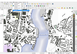
Webmapping 3.5: A Recommendation for your First Step Into Web Mapping
It’s been almost a year since the web mapping series I did. Hopefully, by now, you’ve had a chance to have a little play with some of the options. If not, don’t worry, I have a sneaky confession to make… I held back on one option, QGIS2WEB, which is a wysiwyg plugin for QGIS. Why...
Advertisement