All posts by Matteo Luccio
Mapping the Damage from Superstorm Sandy
In the wake of the devastation wreaked along the East Coast by Superstorm Sandy, government agencies and private companies partnered to quickly and efficiently collect and analyze aerial data for emergency responders, relief and reconstruction workers, and the public in need. When it hit the United States as a post-tropical cyclone, Sandy had a diameter...
The Oregon Lidar Consortium
A statewide, airborne, lidar-collection effort achieves wide area coverage and high data quality on a low budget. Images courtesy of Oregon Department of Geology and Mineral Industries and created by Daniel E. Coe In less than six years since it was formed, the Oregon Lidar Consortium (OLC) has collected 16 million acres of high-resolution data, which is...
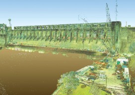
Capturing the Bluestone Dam
Above: Bluestone Dam is a concrete gravity dam located just upstream of the confluence of the New and Greenbrier Rivers near Hinton, West Virginia. Editor’s note: Because the Bluestone Dam is critical infrastructure, the Corps cannot display images of its insides. In fact, security is one of the key reasons it didn’t contract out the...
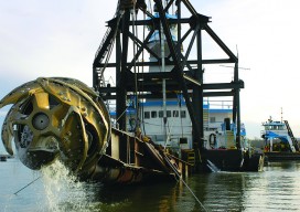
Survey. Dredge. Repeat: Keeping the Columbia River Navigable
As the skipper of Galileo 3, a 30-foot sailboat on the Columbia River, I tell my crew that I am comfortable with 15 feet of water under the keel, get nervous when it drops below 10 feet, and take immediate action if it drops below 6 feet. That’s because I cannot constantly monitor my chart...
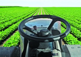
Satellite Signals Steer Farmers Straight
Precision agriculture combines GPS, remote sensing, and GIS to capture large amounts of georeferenced data on spatial variations in soil types, moisture content, nutrient availability, and crop yields and then create and follow prescription maps. Until recently, it was difficult for growers to correlate soil and crop information with production techniques, so they generally treated...
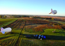
Tethered Aerostats Provide Another Option in the Sky
Geospatial professionals are able to choose from an increasingly wide array of platforms on which to deploy ever more accurate and smaller sensors. Lately, unmanned aerial vehicles (UAVs) have been getting most of the buzz (pun intended). However, in many situations, high-tech versions of one of the earliest flying devices, tethered aerostats, are a better...