All posts by Matteo Luccio

Mapping the Appalachian Trail, Part 2
How the AT was brought into GIS via a collaboration among ATC staff, NSP professionals, and dedicated volunteers. Part 1 of this article (May 2015) reveals the history of the trail, particularly how the land that comprises it was surveyed. Read here about how the trail was brought into GIS. In 1998, the Appalachian Trail...
Comparing Maps a New Way
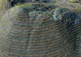
Above: The new standards are independent of map scale or contour interval and provide a way to deal with lidar data. ASPRS releases new positional accuracy standards. The positional accuracy of geospatial technologies has improved dramatically in the past few decades, and digital maps have replaced paper maps, making old ways of comparing maps obsolete. Satellite...

A Global Geodetic Roadmap
Above: Ambassador Peter Thomson, Fiji’s permanent representative to the United Nations, presents to the General Assembly the resolution titled, “A global geodetic reference frame for sustainable development.” The United Nations takes up the call to develop a global geodetic reference frame for sustainable international relief and development. Geospatial technologies that have quickly become commonplace and essential in industrialized...
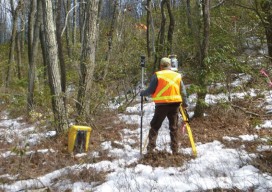
Mapping the Appalachian Trail
How the AT was created and surveyed, from Avery’s wheel to GPS The Appalachian Trail (AT) is very old, very long, and iconic. Completed in 1937, it stretches 2,189 miles through 14 states, 88 counties, 168 townships, eight national forests, six national parks, two national wildlife refuges, and more than 65 state game lands, wildlife...

Tracking Aircraft in Flight
From surveillance methods using ground-based radar to space-based systems, it’s more complex to track aircraft than you might think. The disappearance of Malaysia Airlines Flight 370 on March 8, 2014, with 239 people on board, was both tragic and stunning. The loss of a modern commercial aircraft operating in government-controlled airspace, which remains unexplained, represents...

Maximizing the Sun
Solar energy grows in part due to aerial imaging and surveying. Solar power is booming in the United States. “Every three weeks,” President Obama said in his 2015 State of the Union address, “we bring online as much solar power as we did in all of 2008.” Geospatial technologies—especially remote sensing and surveying—play an important...