
Blog
Improving GNSS in the Urban Canyon
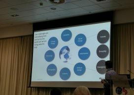
To prepare you for the this blog post, I wish to point out that I am a geospatial expert and can hold my own around the ins and outs of survey, so going to an event at the Ordnance Survey on “3D mapping for the improvement of GNSS in urban areas” was an eye-opener. You...
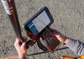
Data Collector and Tablet Mashup – TSC7
Can’t decide between a tablet and a data collector? The TSC7 is a bit of a “mashup” between the two. A new DC (data collector/controller) was announced today by Trimble: the TSC7. The big tablet-style screen on a handheld data collector is the most visible attribute of the TSC7, but of course there is a...

Taxi!
Major work on JFK airport’s system of taxiways gets a boost from a contractor’s 3D milling capability. Ranked #16 on the list of the world’s busiest airports, New York’s JFK airport handles nearly 59 million passengers and 1.4 million tons of cargo annually. The area designated for warehouse and storage facilities to accommodate all that...
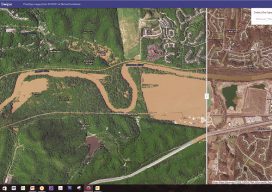
The 2017 Flooding of Missouri’s Meramec River
Missouri’s Meramec River is one of the largest free-flowing waterways in the state. With a source southwest of St. Louis, in Dent County, and the mouth at the Mississippi River in Arnold, some 20 miles south of St. Louis, its meandering 220 miles drain nearly 4,000 square miles in a watershed covering six Missouri counties....
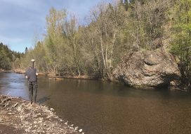
Assessing the Potential
UAS-based Topobathymetric Lidar Surveys Understanding stream channel and floodplain morphology is critical for a number of efforts—from hydraulic modeling and stream-restoration design to aquatic habitat assessment. These applications require description of conditions both inside the channels and in the adjacent riparian zones. Gathering these data has typically relied on individuals on the ground or in...

Weekly xyHt News Links: 04/13/2018
Trimble Launches Marine Positioning GNSS Receiver Sky Power and 3W-International are Introducing Engine Construction Kits for the First Time at Xponential 2018 Latest YellowScan Lidar System Designed for UAV Surveys Trimble’s Forensics Solution Enables Efficient Data Collection for Crash and Crime Scene Investigators Topcon Announces New Features Added to Web-based Service for Mass Data Processing...
Advertisement