
Blog
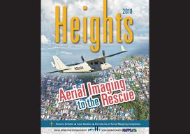
xyHt Magazine Heights 2018 Issue
Click on the cover below to view the Heights 2018 issue of xyHt magazine. Articles in the issue include (links will turn live throughout April): Powerline Inspection – Recommendations for those debating whether to complete their next project by drone, ground or helicopter. Aerial Imagery to the Rescue – Events in 2017 demonstrated without any...

Weekly xyHt News Links: 3/30/2018
EdgeTech Introduces the 6205s Next Generation Swath Bathymetry & Side Scan Sonar System senseFly takes drone flight planning & management to next level with release of eMotion 3.5 CANSEL TO DISTRIBUTE MICRODRONES FULLY INTEGRATED DRONE SYSTEMS THROUGHOUT CANADA NASA completes third phase of UAS airspace testing Intergeo 2018 to focus on geoinformation, digitalization SBG Systems...

Big Bird + Black Ice = Space 2.1
First off, let’s decipher that headline, starting at the end. Space 2.0 (AKA “NewSpace”) is the catch-all phrase that describes the privatization of space and the companies, platforms, and technologies that come with it. We’ll get to the “2.1” in a minute. Big Bird is the nickname given the world’s largest aircraft (by wingspan, 385’)...
UK Geospatial Apprenticeships Are a Go!
Editor’s note: Great news from the UK … a new program of apprenticeships specifically for geospatial disciplines. This program is expected to help meet challenges of meeting the demand for skilled surveyors and geospatial workers, especially in these times of rapid growth in commercial development and public infrastructure. While apprenticeships have always played an important...
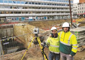
A New Line
Midway through a large and complex transportation project, a team of Belgian surveyors successfully adopted a new class of instrument. Hardware and software modernization doesn’t always yield immediate benefits for enterprises, and sometimes taking a particularly big leap or risk comes at a premium in time and labor. But sometimes everything goes smoothly. Our July...
Weekly xyHt News Links: 3/23/2018
SimActive Launches Free Data Processing Service New SR3 underground laser scanner from Maptek Teledyne CARIS and Teledyne Optech bring bathymetric solutions to the Joint Canadian Hydrographic and National Surveyor’s Conference (CHC-NSC 2018) Aspen Avionics and Sensurion Aerospace team to Co-develop Commercial UAV Avionics Phase One Industrial and Aerialtronics Sign Partnership Agreement DJI’s Metric Camera for Aerial...
Advertisement