
Blog

Leveraging Point Clouds
Above: This image illustrates the transition from point clouds to modeled deliverables. These non-BIM solids were later used for com-putational fluid dynamics analysis to ensure proper airflow throughout the room. Three ways you can derive value from point clouds past the pre-design phase. By Daniel Chapek Reality capture is a powerful way to digitize the...
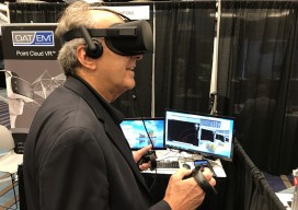
Three Trends at SPAR International 2017
I’ve attended SPAR every year since its inception in 2004, always while working for a vendor for 3D laser scanning products. This year, sporting my new xyHt shirt, I viewed the event from a different perspective. Let me preface this “review” by noting that I did not do a complete walk-around of each vendor’s booth;...

15 Years of Growth at AXIS GeoSpatial
AXIS GeoSpatial provides more applications from one mapping effort. Easton, Maryland-based AXIS GeoSpatial LLC provides geospatial data and solutions to federal, state, and local government agencies and private sector firms, especially aerial mapping services. Heights talked with Erica Insley, marketing director for the firm. Heights: How did AXIS GeoSpatial get its start? Erica Insley: Founded in...

Neutrino Beam! Scanning a Ring Tunnel
The surveying challenges for construction related to a particle accelerator are exacting—but surprisingly familiar. By Matteo Luccio Trillions of neutrinos from the sun and other celestial objects pass harmlessly and unnoticed through our bodies each second. These tiny particles are among the most abundant in the universe–a billion times more abundant than those that make...

Ocean Business 2017
Last week, April 4th – 6th, one of the largest gatherings for the offshore industry took place, Ocean Business, in Southampton, UK. The bi-annual event is a large deal for the maritime industry. When I say large, I actually mean huge; there are over 350 exhibitors from 26 countries and 166 training and demonstration workshops...

UAS Regulations Update
A look at recent and near-future legislation affecting UAVs for geospatial business use. By Jeff Salmon BVLOS Update The ability to fly beyond line of sight (BVLOS) is paramount to a wide range of UAS operations, including utility and pipeline inspections and monitoring, open pit mining, precision agriculture, corridor mapping, large-area mapping and surveying, and...
Advertisement