Category Archives: Cartography
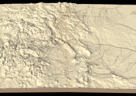
Hayden’s Survey in 3D
Above image: Hayden’s triangulation survey map is overlaid on a digital elevation model. A GIS project visualizes the fascinating triangulation network created for the historic Hayden survey of Colorado. One of the great surveyors in the American West is undoubtedly Ferdinand Vandeveer Hayden. A physician during the Civil war, he rose to be chief medical...

Who are the “Geo6” and why will this change UK geospatial?
Around the middle of 2017, there was a mumble in the geospatial industry about how the UK government was going to open up more of its geospatial data. There was even an outrageous rumor that Ordnance Survey was going to have to release its multimillion-pound product, Mastermap. Everyone sniggered but watched the news like hawks....
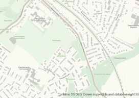
OS Zoomstack – the Gift that Keeps On Giving
On July 17 2018, Ordnance Survey (OS), the United Kingdom’s national mapping agency, released a trial of a product called “OS Zoomstack.” At the time many overlooked it, as Ordnance Survey makes lots of their data over 1:5000 available for free. I have to admit I was one of them. In August of last year,...
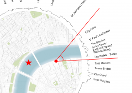
What’s within a 30-minute Walk – Revisited
I recently had reason to be in London for a short meeting and walked past London Bridge, looked at the sky around me, and thought, “I wonder how accurate that map I made last year is?” I was fortunate to have my camera phone with me so that I could take a few pictures. The...
Alice Gadney
Founder & President, Silver7 Mapping & Mini Map-Makers Bedford, England “Captain Alice” Gadney’s mission underscores much of the geospatial work done globally: “To help people understand the world around them and their need for a great communications tool—the map.” She applies this mission to her work with industries and organizations through her cartography company, Silver7...
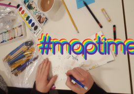
Maptime – Grassroots Geo-learning
From beginners to experts: #maptime chapters worldwide provide opportunities for cartographers, mappers, geospatial practitioners—and anyone with an interest in maps—to learn from each other. The concept and impetus behind #maptime are very simple: people who create (or have an affinity for) maps and mapping getting together to share common interests, tips, tricks, and techniques. If...